 |
|
| Monument Municipal Airport |
| IATA: none – ICAO: none – FAA LID: 12S |
| Summary |
| Airport type |
Public |
| Operator |
City of Monument |
| Location |
Monument, Oregon |
| Elevation AMSL |
2323 ft / 708.1 m |
| Coordinates |
44°49′54.5290″N 119°25′48.9670″W / 44.83181361°N 119.43026861°W / 44.83181361; -119.43026861Coordinates: 44°49′54.5290″N 119°25′48.9670″W / 44.83181361°N 119.43026861°W / 44.83181361; -119.43026861 |
| Runways |
| Direction |
Length |
Surface |
| ft |
m |
| 14/32 |
2104 |
641 |
Gravel |
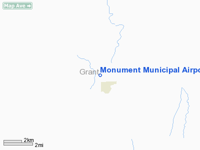
Monument Municipal Airport (FAA LID: 12S), is a public airport located 1 mile (1.6 km) northwest of Monument, in Grant County, Oregon, USA.
The above content comes from Wikipedia and is published under free licenses – click here to read more.
Location & QuickFacts
| FAA Information Effective: | 2008-09-25 |
| Airport Identifier: | 12S |
| Airport Status: | Operational |
| Longitude/Latitude: | 119-25-48.9670W/44-49-54.5290N
-119.430269/44.831814 (Estimated) |
| Elevation: | 2323 ft / 708.05 m (Surveyed) |
| Land: | 18 acres |
| From nearest city: | 1 nautical miles NW of Monument, OR |
| Location: | Grant County, OR |
| Magnetic Variation: | 18E (1985) |
Owner & Manager
| Ownership: | Publicly owned |
| Owner: | City Of Monument |
| Address: | Po Box 426
Monument, OR 97864 |
| Phone number: | 541-934-2025 |
| Manager: | Shannon Bravos-city Mgr |
| Address: | Po Box 426
Monument, OR 97864 |
| Phone number: | 541-934-2025 |
Airport Operations and Facilities
| Airport Use: | Open to public |
| Wind indicator: | Yes |
| Segmented Circle: | Yes
TIRES PAINTED WHITE. |
| Control Tower: | No |
| Landing fee charge: | No |
| Sectional chart: | Seattle |
| Region: | ANM - Northwest Mountain |
| Traffic Pattern Alt: | 1000 ft |
| Boundary ARTCC: | ZSE - Seattle |
| Tie-in FSS: | MMV - Mc Minnville |
| FSS on Airport: | No |
| FSS Toll Free: | 1-800-WX-BRIEF |
| NOTAMs Facility: | MMV (NOTAM-d service avaliable) |
Airport Communications
Airport Services
| Airframe Repair: | NONE |
| Power Plant Repair: | NONE |
| Bottled Oxygen: | NONE |
| Bulk Oxygen: | NONE |
Runway Information
Runway 14/32
| Dimension: | 2104 x 29 ft / 641.3 x 8.8 m |
| Surface: | GRVL-TRTD, Fair Condition |
| |
Runway 14 |
Runway 32 |
| Traffic Pattern: | Left | Left |
| Obstruction: | 550 ft hill, 4000.0 ft from runway, 6:1 slope to clear | , 50:1 slope to clear |
|
Radio Navigation Aids
| ID |
Type |
Name |
Ch |
Freq |
Var |
Dist |
| IMB | VORTAC | Kimberly | 103X | 115.60 | 20E | 16.3 nm |
Remarks
- INTMTLY CLSD WINTERS DUE TO SNOW.
- RY 32 TERRAIN SLOPES UP 3.7%.
- RY 14 HAS +6 FT UNMKD FENCE AT 95 FT.
- HAS +15 FT BY 25 FT CONCRETE PAD AT NORTH END RY 14/32.
- ESTABD PRIOR TO 15 MAY 1959.
Images and information placed above are from
http://www.airport-data.com/airport/12S/
We thank them for the data!
| General Info
|
| Country |
United States
|
| State |
OREGON
|
| FAA ID |
12S
|
| Latitude |
44-49-54.529N
|
| Longitude |
119-25-48.967W
|
| Elevation |
2323 feet
|
| Near City |
MONUMENT
|
We don't guarantee the information is fresh and accurate. The data may
be wrong or outdated.
For more up-to-date information please refer to other sources.
|
|


