|
|
Mc Minnville Muni Airport |
| McMinnville Municipal Airport |
 |
| IATA: none – ICAO: KMMV – FAA LID: MMV |
| Summary |
| Airport type |
Public |
| Owner |
City of McMinnville |
| Serves |
McMinnville, Oregon |
| Elevation AMSL |
163 ft / 50 m |
| Coordinates |
45°11′40″N 123°08′10″W / 45.19444°N 123.13611°W / 45.19444; -123.13611 |
| Runways |
| Direction |
Length |
Surface |
| ft |
m |
| 4/22 |
5,420 |
1,652 |
Asphalt |
| 17/35 |
4,340 |
1,323 |
Asphalt |
| Statistics (2009) |
| Aircraft operations |
63,500 |
| Based aircraft |
132 |
| Source: Federal Aviation Administration |
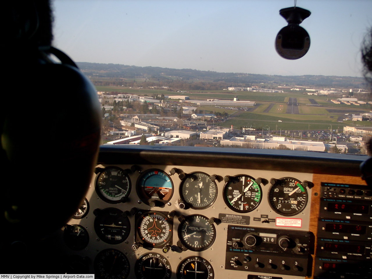
McMinnville Municipal Airport (ICAO: KMMV, FAA LID: MMV) is a city-owned public-use airport located three nautical miles (6 km) southeast of the central business district of McMinnville, a city in Yamhill County, Oregon, United States. According to the FAA's National Plan of Integrated Airport Systems for 2009–2013, it is categorized as a general aviation facility.
McMinnville serves as the home to Evergreen International Airlines, Evergreen Aviation Museum and their parent company Evergreen International Aviation. Oregon Route 18 separates the museum from the company operations. In addition located on the airfield is McMinnville Flight Service Station. Each year the field hosts the Northwest Antique Aircraft Club Fly-In. It is home to the Hughes H-4 Hercules or Spruce Goose.
Although many U.S. airports use the same three-letter location identifier for the FAA and IATA, this facility is assigned MMV by the FAA but has no designation from the IATA. Facilities and aircraft
McMinnville Municipal Airport covers an area of 650 acres (263 ha) at an elevation of 163 feet (50 m) above mean sea level. It has two asphalt paved runways: 4/22 is 5,420 by 150 feet (1,652 x 46 m) and 17/35 is 4,340 by 75 feet (1,323 x 23 m).
For the 12-month period ending January 16, 2009, the airport had 63,500 aircraft operations, an average of 173 per day: 98% general aviation and 2% military. At that time there were 132 aircraft based at this airport: 66.7% single-engine, 8.3% multi-engine, 3.8% jet, 8.3% helicopter and 12.9% glider.
The above content comes from Wikipedia and is published under free licenses – click here to read more.
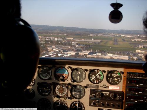 |
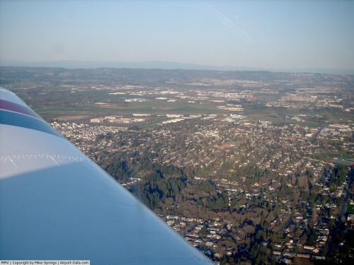
(Click on the photo to enlarge) |
 |
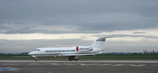
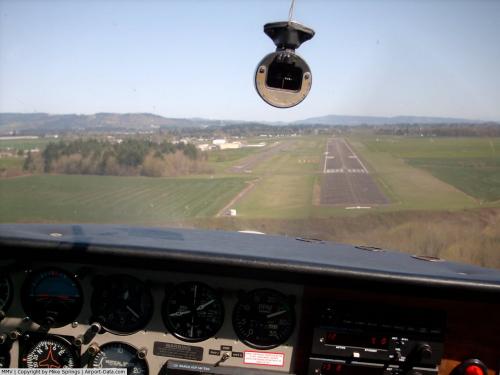
(Click on the photo to enlarge) |
 |
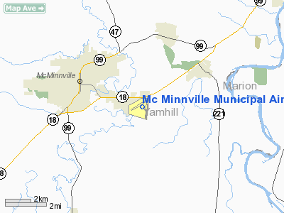
(Click on the photo to enlarge) |
Location & QuickFacts
| FAA Information Effective: | 2008-09-25 |
| Airport Identifier: | MMV |
| Airport Status: | Operational |
| Longitude/Latitude: | 123-08-09.4000W/45-11-40.0000N
-123.135944/45.194444 (Estimated) |
| Elevation: | 163 ft / 49.68 m (Surveyed) |
| Land: | 650 acres |
| From nearest city: | 3 nautical miles SE of Mc Minnville, OR |
| Location: | Yamhill County, OR |
| Magnetic Variation: | 19E (1990) |
Owner & Manager
| Ownership: | Publicly owned |
| Owner: | City Of Mc Minnville |
| Address: | City Hall- 230 North East Second St
Mc Minnville, OR 97128 |
| Phone number: | 503-434-7312 |
| Manager: | Judy Newman |
| Address: | 230 North East Second St
Mc Minnville, OR 97128 |
| Phone number: | 503-434-7411 |
Airport Operations and Facilities
| Airport Use: | Open to public |
| Wind indicator: | Yes |
| Segmented Circle: | Yes |
| Control Tower: | No |
| Lighting Schedule: | DUSK-DAWN
ACTVT MALSR RY 22; REIL RY 04; AND HIRL RY 04/22 - CTAF. |
| Beacon Color: | Clear-Green (lighted land airport) |
| Landing fee charge: | No |
| Sectional chart: | Seattle |
| Region: | ANM - Northwest Mountain |
| Boundary ARTCC: | ZSE - Seattle |
| Tie-in FSS: | MMV - Mc Minnville |
| FSS on Airport: | No |
| FSS Toll Free: | 1-800-WX-BRIEF
ADDNL PHONE NR. TO FSS LC434-5508. |
| NOTAMs Facility: | MMV (NOTAM-d service avaliable) |
| Federal Agreements: | NGY3 |
Airport Communications
| CTAF: | 123.000 |
| Unicom: | 123.000
EVERGREEN INTL AVIATION MAY BE CONTACTED ON FREQ 122.75. |
Airport Services
| Fuel available: | 100LLA |
| Airframe Repair: | MAJOR |
| Power Plant Repair: | MAJOR |
| Bottled Oxygen: | NONE |
| Bulk Oxygen: | HIGH
HIGH PRESSURE BULK OXYGEN AVBL MON-SAT. |
Runway Information
Runway 04/22
| Dimension: | 5420 x 150 ft / 1652.0 x 45.7 m |
| Surface: | ASPH, Good Condition
HAS EXTENSIVE CRACKING & SPALLING WITH HOLES. |
| Weight Limit: | Single wheel: 40000 lbs.
Dual wheel: 50000 lbs.
Dual tandem wheel: 80000 lbs. |
| Edge Lights: | High |
| |
Runway 04 |
Runway 22 |
| Longitude: | 123-08-53.4490W | 123-07-49.8350W |
| Latitude: | 45-11-30.3235N | 45-11-59.3106N |
| Elevation: | 161.00 ft | 160.00 ft |
| Alignment: | 57 | 127 |
| ILS Type: | | ILS
|
| Traffic Pattern: | Left | Left |
| Markings: | Basic, Good Condition | Precision instrument, Good Condition |
| Crossing Height: | 40.00 ft | 55.00 ft |
| VASI: | 4-light PAPI on left side | 4-light PAPI on left side |
| Visual Glide Angle: | 3.00° | 3.00° |
| Approach lights: | | MALSR |
| Runway End Identifier: | Yes | |
| Obstruction: | 25 ft trees, 1200.0 ft from runway, 40:1 slope to clear | 90 ft trees, 3116.0 ft from runway, 350 ft right of centerline, 32:1 slope to clear |
|
Runway 17/35
| Dimension: | 4676 x 150 ft / 1425.2 x 45.7 m |
| Surface: | ASPH, Fair Condition
HAS EXTENSIVE CRACKING & SPALLING WITH HOLES. |
| Weight Limit: | Single wheel: 40000 lbs.
Dual wheel: 50000 lbs.
Dual tandem wheel: 80000 lbs. |
| |
Runway 17 |
Runway 35 |
| Longitude: | 123-07-51.8143W | 123-07-58.5052W |
| Latitude: | 45-11-57.4583N | 45-11-11.5338N |
| Elevation: | 161.00 ft | 162.00 ft |
| Alignment: | 127 | 6 |
| Traffic Pattern: | Left | Left |
| Markings: | Basic, Fair Condition | Basic, Fair Condition |
| Obstruction: | 45 ft tree, 1278.0 ft from runway, 200 ft right of centerline, 23:1 slope to clear | , 50:1 slope to clear |
|
Radio Navigation Aids
| ID |
Type |
Name |
Ch |
Freq |
Var |
Dist |
| PND | NDB | Banks | | 356.00 | 21E | 26.5 nm |
| LBH | NDB | Laker | | 332.00 | 20E | 35.3 nm |
| LWG | NDB | Lewisburg | | 225.00 | 18E | 35.4 nm |
| CBU | TACAN | Columbia | 029X | | 20E | 32.4 nm |
| UBG | VOR/DME | Newberg | 121X | 117.40 | 21E | 11.6 nm |
| PDX | VOR/DME | Portland | 055X | 111.80 | 20E | 32.8 nm |
| CVO | VOR/DME | Corvallis | 101X | 115.40 | 18E | 42.3 nm |
| BTG | VORTAC | Battle Ground | 113X | 116.60 | 21E | 40.4 nm |
| HIO | VOT | Portland-hillsboro | | 115.20 | | 22.3 nm |
| PDX | VOT | Portland Intl | | 111.00 | | 33.2 nm |
Remarks
- GLIDER OPNS RY 17/35 & WITHIN 8 NM BELOW 8000 FT DURING DALGT HRS MAR - OCT.
- MIL HEL & PARACHUTE OPNS IN AREA. SCHEDULED BY NOTAM.
- TAXIWAY D CLOSED UNTIL FURTHER NOTICE.
- ESTABD PRIOR TO 1959.
Images and information placed above are from
http://www.airport-data.com/airport/MMV/
We thank them for the data!
| General Info
|
| Country |
United States
|
| State |
OREGON
|
| FAA ID |
MMV
|
| Latitude |
45-11-40.000N
|
| Longitude |
123-08-09.400W
|
| Elevation |
163 feet
|
| Near City |
MC MINNVILLE
|
We don't guarantee the information is fresh and accurate. The data may
be wrong or outdated.
For more up-to-date information please refer to other sources.
|
|