 |
|
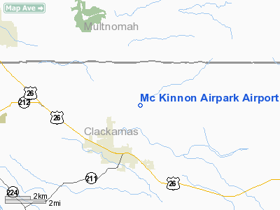
Mc Kinnon Airpark Airport |
Location & QuickFacts
| FAA Information Effective: | 2008-09-25 |
| Airport Identifier: | OG29 |
| Airport Status: | Operational |
| Longitude/Latitude: | 122-14-31.3150W/45-25-50.4330N
-122.242032/45.430676 (Estimated) |
| Elevation: | 658 ft / 200.56 m (Surveyed) |
| Land: | 80 acres |
| From nearest city: | 2 nautical miles NE of Sandy, OR |
| Location: | Clackamas County, OR |
| Magnetic Variation: | 19E (1985) |
Owner & Manager
| Ownership: | Privately owned |
| Owner: | Mc Kinnon Airpark |
| Address: | 12960 Se Teneyck Rd
Sandy, OR 97055 |
| Phone number: | 503-668-6003 |
| Manager: | Mc Kinnon Airpark |
| Address: | 12960 Se Teneyck Rd
Sandy, OR 97055 |
| Phone number: | 503-668-6003 |
Airport Operations and Facilities
| Airport Use: | Private |
| Wind indicator: | Yes |
| Segmented Circle: | No |
| Control Tower: | No |
| Landing fee charge: | No |
| Sectional chart: | Seattle |
| Region: | ANM - Northwest Mountain |
| Boundary ARTCC: | ZSE - Seattle |
| Tie-in FSS: | MMV - Mc Minnville |
| FSS on Airport: | No |
| FSS Toll Free: | 1-800-WX-BRIEF |
Airport Services
| Airframe Repair: | NONE |
| Power Plant Repair: | NONE |
| Bottled Oxygen: | NONE |
| Bulk Oxygen: | NONE |
Runway Information
Runway 07/25
| Dimension: | 3000 x 50 ft / 914.4 x 15.2 m |
| Surface: | TURF, |
| |
Runway 07 |
Runway 25 |
| Traffic Pattern: | Left | Left |
|
Radio Navigation Aids
| ID |
Type |
Name |
Ch |
Freq |
Var |
Dist |
| LBH | NDB | Laker | | 332.00 | 20E | 11.4 nm |
| PND | NDB | Banks | | 356.00 | 21E | 35.9 nm |
| CBU | TACAN | Columbia | 029X | | 20E | 18.2 nm |
| PDX | VOR/DME | Portland | 055X | 111.80 | 20E | 18.2 nm |
| UBG | VOR/DME | Newberg | 121X | 117.40 | 21E | 31.4 nm |
| BTG | VORTAC | Battle Ground | 113X | 116.60 | 21E | 24.1 nm |
| PDX | VOT | Portland Intl | | 111.00 | | 18.2 nm |
| HIO | VOT | Portland-hillsboro | | 115.20 | | 30.5 nm |
Remarks
- ROAD CROSSINGS BLIND FROM SOUTH NEAR EAST 1/3 POINT OF RWY.
- ESTABD PRIOR TO 1959.
Images and information placed above are from
http://www.airport-data.com/airport/OG29/
We thank them for the data!
| General Info
|
| Country |
United States
|
| State |
OREGON
|
| FAA ID |
OG29
|
| Latitude |
45-25-50.433N
|
| Longitude |
122-14-31.315W
|
| Elevation |
658 feet
|
| Near City |
SANDY
|
We don't guarantee the information is fresh and accurate. The data may
be wrong or outdated.
For more up-to-date information please refer to other sources.
|
|


