 |
|
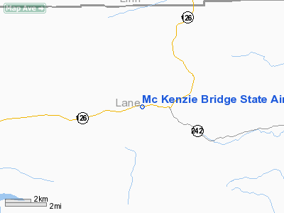
Mc Kenzie Bridge State Airport |
| McKenzie Bridge State Airport |
| IATA: none – ICAO: none – FAA LID: 00S |
| Summary |
| Airport type |
Public |
| Operator |
Oregon Department of Aviation |
| Location |
McKenzie Bridge, Oregon |
| Elevation AMSL |
1620 ft / 494 m |
| Coordinates |
44°10′59.4400″N 122°05′19.2000″W / 44.1831778°N 122.088667°W / 44.1831778; -122.088667Coordinates: 44°10′59.4400″N 122°05′19.2000″W / 44.1831778°N 122.088667°W / 44.1831778; -122.088667 |
| Runways |
| Direction |
Length |
Surface |
| ft |
m |
| 6/24 |
2600 |
792 |
Turf |
McKenzie Bridge State Airport (FAA LID: 00S), is a public airport located 3 miles (4.8 km) east of McKenzie Bridge, in Lane County, Oregon, USA.
Note: Because of the sloping runway, you must land to the East and take off to the West (RY 24)
The above content comes from Wikipedia and is published under free licenses – click here to read more.
Location & QuickFacts
| FAA Information Effective: | 2008-09-25 |
| Airport Identifier: | 00S |
| Airport Status: | Operational |
| Longitude/Latitude: | 122-05-19.2000W/44-10-59.4400N
-122.088667/44.183178 (Estimated) |
| Elevation: | 1620 ft / 493.78 m (Estimated) |
| Land: | 21 acres |
| From nearest city: | 3 nautical miles E of Mc Kenzie Bridge, OR |
| Location: | Lane County, OR |
| Magnetic Variation: | 19E (1985) |
Owner & Manager
| Ownership: | Publicly owned |
| Owner: | Oregon Dept Of Aviation |
| Address: | 3040 25th St, Se
Salem, OR 97302 |
| Phone number: | 503-378-4880 |
| Manager: | State Airports Mgr |
| Address: | 3040 25th St, Se
Salem, OR 97302 |
| Phone number: | 503-378-4880 |
Airport Operations and Facilities
| Airport Use: | Open to public |
| Wind indicator: | Yes |
| Segmented Circle: | Yes |
| Control Tower: | No |
| Landing fee charge: | No |
| Sectional chart: | Klamath Falls |
| Region: | ANM - Northwest Mountain |
| Traffic Pattern Alt: | 1000 ft |
| Boundary ARTCC: | ZSE - Seattle |
| Tie-in FSS: | MMV - Mc Minnville |
| FSS on Airport: | No |
| FSS Toll Free: | 1-800-WX-BRIEF |
| NOTAMs Facility: | MMV (NOTAM-d service avaliable) |
Airport Communications
Airport Services
| Airframe Repair: | NONE |
| Power Plant Repair: | NONE |
| Bottled Oxygen: | NONE |
| Bulk Oxygen: | NONE |
Runway Information
Runway 06/24
| Dimension: | 2600 x 90 ft / 792.5 x 27.4 m |
| Surface: | TURF, Poor Condition
ROUGH WITH NUMEROUS DIPS & RUTS PARTICULARLY ON THE EAST HALF. |
| |
Runway 06 |
Runway 24 |
| Traffic Pattern: | Left | Left |
| Runway End Identifier: | No | No |
| Centerline Lights: | No | No |
| Touchdown Lights: | No | No |
| Obstruction: | 120 ft trees, 1500.0 ft from runway, 12:1 slope to clear | 135 ft trees, 60.0 ft from runway |
|
Radio Navigation Aids
| ID |
Type |
Name |
Ch |
Freq |
Var |
Dist |
| RD | NDB | Bodey | | 411.00 | 18E | 46.7 nm |
| EU | NDB | Frakk | | 260.00 | 19E | 48.8 nm |
| DSD | VORTAC | Deschutes | 123X | 117.60 | 18E | 34.1 nm |
| EUG | VORTAC | Eugene | 076X | 112.90 | 20E | 49.1 nm |
Remarks
- OWNER ADVISES CONTACT WITH OR DEPT OF AVIATION (503-378-4880) PRIOR TO USE.
- WILDLIFE ON AND AROUND AIRPORT YEAR ROUND.
- LAND EAST - TAKEOFF WEST.
- RY 06/24 SLOPES UP TO THE EAST.
- +500 FT RIDGELINE PARALLEL TO RY 1000 FT SOUTH.
- IRREGULAR WINTER MAINTENANCE; ARPT MAY BE CLOSED DUE TO SNOW.
- ESTABD PRIOR TO 1959.
Images and information placed above are from
http://www.airport-data.com/airport/00S/
We thank them for the data!
| General Info
|
| Country |
United States
|
| State |
OREGON
|
| FAA ID |
00S
|
| Latitude |
44-10-59.440N
|
| Longitude |
122-05-19.200W
|
| Elevation |
1620 feet
|
| Near City |
MC KENZIE BRIDGE
|
We don't guarantee the information is fresh and accurate. The data may
be wrong or outdated.
For more up-to-date information please refer to other sources.
|
|


