 |
|
| Malin Airport |
| IATA: none – ICAO: FAA: 4S7 |
| Summary |
| Airport type |
Public |
| Operator |
City of Malin |
| Location |
Malin, Oregon |
| Elevation AMSL |
1634 ft / 498 m |
| Coordinates |
42°00′03.5600″N 121°23′46.9660″W / 42.0009889°N 121.39637944°W / 42.0009889; -121.39637944Coordinates: 42°00′03.5600″N 121°23′46.9660″W / 42.0009889°N 121.39637944°W / 42.0009889; -121.39637944 |
| Runways |
| Direction |
Length |
Surface |
| ft |
m |
| 14/32 |
2800 |
853 |
Asphalt/Gravel |
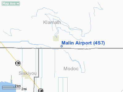
Malin Airport (FAA LID: 4S7), is a public airport located one mile (1.6 km) southeast of Malin in Klamath County, Oregon, USA.
The above content comes from Wikipedia and is published under free licenses – click here to read more.
Location & QuickFacts
| FAA Information Effective: | 2008-09-25 |
| Airport Identifier: | 4S7 |
| Airport Status: | Operational |
| Longitude/Latitude: | 121-23-46.9660W/42-00-03.5600N
-121.396379/42.000989 (Estimated) |
| Elevation: | 4052 ft / 1235.05 m (Estimated) |
| Land: | 97 acres |
| From nearest city: | 1 nautical miles SE of Malin, OR |
| Location: | Klamath County, OR |
| Magnetic Variation: | 18E (1985) |
Owner & Manager
| Ownership: | Publicly owned |
| Owner: | City Of Malin |
| Address: | City Hall, Box 61
Malin, OR 97632 |
| Phone number: | 541-723-2021 |
| Manager: | Kay Neumeyer |
| Address: | City Hall Box 61
Malin, OR 97632 |
| Phone number: | 541-723-2021 |
Airport Operations and Facilities
| Airport Use: | Open to public |
| Wind indicator: | Yes |
| Segmented Circle: | No |
| Control Tower: | No |
| Landing fee charge: | No |
| Sectional chart: | Klamath Falls |
| Region: | ANM - Northwest Mountain |
| Boundary ARTCC: | ZSE - Seattle |
| Tie-in FSS: | MMV - Mc Minnville |
| FSS on Airport: | No |
| FSS Toll Free: | 1-800-WX-BRIEF |
| NOTAMs Facility: | MMV (NOTAM-d service avaliable) |
| Federal Agreements: | S |
Airport Communications
Airport Services
| Airframe Repair: | NONE |
| Power Plant Repair: | NONE |
| Bottled Oxygen: | NONE |
| Bulk Oxygen: | NONE |
Runway Information
Runway 14/32
| Dimension: | 2800 x 30 ft / 853.4 x 9.1 m |
| Surface: | ASPH-GRVL, Fair Condition
SURFACE ROUGH & RUTTED; WEEDS GROWING ON RY WITH HEAVY WEED GROWTH ON SHOULDERS; ASPH PORTION CRACKED WITH WEEDS GROWING THROUGH. |
| |
Runway 14 |
Runway 32 |
| Traffic Pattern: | Left | Left |
| Obstruction: | 55 ft pline, 1850.0 ft from runway, 30:1 slope to clear
+4 FENCE ON CNTRLN AT 100 FT. | 17 ft road, 150.0 ft from runway, 8:1 slope to clear |
|
Radio Navigation Aids
| ID |
Type |
Name |
Ch |
Freq |
Var |
Dist |
| LFA | NDB | Merrill | | 347.00 | 17E | 11.0 nm |
| ARU | NDB | Alturas | | 215.00 | 18E | 49.3 nm |
| LMT | VORTAC | Klamath Falls | 106X | 115.90 | 17E | 17.4 nm |
| LKV | VORTAC | Lakeview | 57X | 112.00 | 19E | 49.4 nm |
Remarks
- RY 14 NW 305' ASPH.
- RY 14/32 HAS WEED GROWTH ALONG RY EDGES & AROUND NW END.
- RY 14/32 WEEDS GROWING ON RY; ASPH PORTION CRACKED WITH WEEDS GROWING THROUGH.
- ESTABD PRIOR TO 1959.
Images and information placed above are from
http://www.airport-data.com/airport/4S7/
We thank them for the data!
| General Info
|
| Country |
United States
|
| State |
OREGON
|
| FAA ID |
4S7
|
| Latitude |
42-00-03.560N
|
| Longitude |
121-23-46.966W
|
| Elevation |
4052 feet
|
| Near City |
MALIN
|
We don't guarantee the information is fresh and accurate. The data may
be wrong or outdated.
For more up-to-date information please refer to other sources.
|
|


