 |
|
Location & QuickFacts
| FAA Information Effective: | 2008-09-25 |
| Airport Identifier: | 98OR |
| Airport Status: | Operational |
| Longitude/Latitude: | 123-22-12.3880W/45-11-56.4090N
-123.370108/45.199003 (Estimated) |
| Elevation: | 435 ft / 132.59 m (Estimated) |
| Land: | 20 acres |
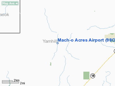
| From nearest city: | 7 nautical miles N of Sheridan, OR |
| Location: | Yamhill County, OR |
| Magnetic Variation: | 19E (1985) |
Owner & Manager
| Ownership: | Privately owned |
| Owner: | Loren H. Otto |
| Address: | 8250 Gopher Valley Road
Sheridan, OR 97378 |
| Phone number: | 206-266-5606 |
| Manager: | Loren H. Otto |
| Address: | 8250 Gopher Valley Road
Sheridan, OR 97378 |
| Phone number: | 206-652-7104 |
Airport Operations and Facilities
| Airport Use: | Private |
| Wind indicator: | Yes |
| Segmented Circle: | No |
| Control Tower: | No |
| Sectional chart: | Seattle |
| Region: | ANM - Northwest Mountain |
| Boundary ARTCC: | ZSE - Seattle |
| Tie-in FSS: | MMV - Mc Minnville |
| FSS Toll Free: | 1-800-WX-BRIEF |
Runway Information
Runway 17/35
| Dimension: | 1300 x 50 ft / 396.2 x 15.2 m |
| Surface: | TURF, |
| |
Runway 17 |
Runway 35 |
| Traffic Pattern: | Left | Left |
|
Radio Navigation Aids
| ID |
Type |
Name |
Ch |
Freq |
Var |
Dist |
| PND | NDB | Banks | | 356.00 | 21E | 29.3 nm |
| LWG | NDB | Lewisburg | | 225.00 | 18E | 35.4 nm |
| LBH | NDB | Laker | | 332.00 | 20E | 43.5 nm |
| CBU | TACAN | Columbia | 029X | | 20E | 39.7 nm |
| UBG | VOR/DME | Newberg | 121X | 117.40 | 21E | 19.0 nm |
| PDX | VOR/DME | Portland | 055X | 111.80 | 20E | 40.0 nm |
| CVO | VOR/DME | Corvallis | 101X | 115.40 | 18E | 42.2 nm |
| BTG | VORTAC | Battle Ground | 113X | 116.60 | 21E | 46.5 nm |
| ONP | VORTAC | Newport | 118X | 117.10 | 19E | 47.6 nm |
| HIO | VOT | Portland-hillsboro | | 115.20 | | 27.2 nm |
| PDX | VOT | Portland Intl | | 111.00 | | 40.4 nm |
Remarks
- RY 17/35 SOFT DURING RAINY SEASON.
- RWY BUMPY DUE TO GOPHER MOUNDS.
- LAND TO NORTH; TAKEOFF TO SOUTH.
- PROVIDED LANDINGS ARE TO THE NORTH & TAKEOFFS ARE TO THE SOUTH.
Images and information placed above are from
http://www.airport-data.com/airport/98OR/
We thank them for the data!
| General Info
|
| Country |
United States
|
| State |
OREGON
|
| FAA ID |
98OR
|
| Latitude |
45-11-56.409N
|
| Longitude |
123-22-12.388W
|
| Elevation |
435 feet
|
| Near City |
SHERIDAN
|
We don't guarantee the information is fresh and accurate. The data may
be wrong or outdated.
For more up-to-date information please refer to other sources.
|
|


