 |
|
| Lebanon State Airport |
| IATA: none – ICAO: none – FAA LID: 3S0 |
| Summary |
| Airport type |
Public |
| Operator |
Oregon Department of Aviation |
| Location |
Lebanon, Oregon |
| Elevation AMSL |
344 ft / 105 m |
| Coordinates |
44°31′47.4420″N 122°55′46.3210″W / 44.529845°N 122.92953361°W / 44.529845; -122.92953361Coordinates: 44°31′47.4420″N 122°55′46.3210″W / 44.529845°N 122.92953361°W / 44.529845; -122.92953361 |
| Runways |
| Direction |
Length |
Surface |
| ft |
m |
| 16/34 |
2877 |
877 |
Asphalt |
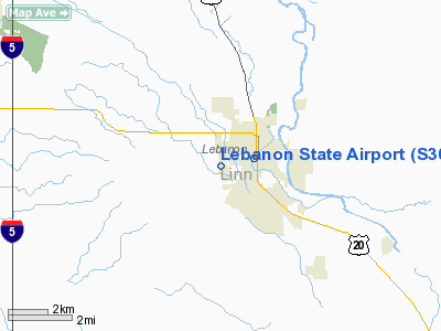
Lebanon State Airport (FAA LID: S30), is a public airport located one mile (1.6 km) west of Lebanon in Linn County, Oregon, USA.
The above content comes from Wikipedia and is published under free licenses – click here to read more.
Location & QuickFacts
| FAA Information Effective: | 2008-09-25 |
| Airport Identifier: | S30 |
| Airport Status: | Operational |
| Longitude/Latitude: | 122-55-46.3210W/44-31-47.4420N
-122.929534/44.529845 (Estimated) |
| Elevation: | 344 ft / 104.85 m (Estimated) |
| Land: | 77 acres |
| From nearest city: | 1 nautical miles SW of Lebanon, OR |
| Location: | Linn County, OR |
| Magnetic Variation: | 19E (1985) |
Owner & Manager
| Ownership: | Publicly owned |
| Owner: | Oregon Department Of Aviation |
| Address: | 3040 25th St Se
Salem, OR 97302-1125 |
| Phone number: | 503-378-4880 |
| Manager: | States Airports Manager |
| Address: | 3040 25th St Se
Salem, OR 97302-1125 |
| Phone number: | 503-378-4880 |
Airport Operations and Facilities
| Airport Use: | Open to public |
| Wind indicator: | Yes |
| Segmented Circle: | No |
| Control Tower: | No |
| Lighting Schedule: | DUSK-DAWN |
| Beacon Color: | Clear-Green (lighted land airport) |
| Landing fee charge: | No |
| Sectional chart: | Seattle |
| Region: | ANM - Northwest Mountain |
| Traffic Pattern Alt: | 1000 ft |
| Boundary ARTCC: | ZSE - Seattle |
| Tie-in FSS: | MMV - Mc Minnville |
| FSS on Airport: | No |
| FSS Toll Free: | 1-800-WX-BRIEF |
| NOTAMs Facility: | MMV (NOTAM-d service avaliable) |
| Federal Agreements: | NGY |
Airport Communications
| CTAF: | 122.800 |
| Unicom: | 122.800 |
Airport Services
| Fuel available: | 100LL |
| Airframe Repair: | NONE |
| Power Plant Repair: | NONE |
| Bottled Oxygen: | NONE |
| Bulk Oxygen: | NONE |
Runway Information
Runway 16/34
| Dimension: | 2877 x 50 ft / 876.9 x 15.2 m |
| Surface: | ASPH, Fair Condition |
| Edge Lights: | Medium |
| |
Runway 16 |
Runway 34 |
| Traffic Pattern: | Left | Left |
| Markings: | Basic, Fair Condition | Basic, Fair Condition |
| Crossing Height: | 36.00 ft | 33.00 ft |
| Displaced threshold: | 0.00 ft | 387.00 ft |
| VASI: | 2-box on left side | 2-box on left side |
| Visual Glide Angle: | 3.00° | 3.80° |
| Obstruction: | 35 ft tree, 785.0 ft from runway, 16:1 slope to clear | 56 ft brush, 693.0 ft from runway, 150 ft left of centerline, 8:1 slope to clear
+60FT TREE, DIST 1087FT,125FT L, 18:1 BASED ON DISP THR.
+15 FT ROAD AT 130 FT. |
|
Radio Navigation Aids
| ID |
Type |
Name |
Ch |
Freq |
Var |
Dist |
| LWG | NDB | Lewisburg | | 225.00 | 18E | 15.4 nm |
| EU | NDB | Frakk | | 260.00 | 19E | 22.8 nm |
| CVO | VOR/DME | Corvallis | 101X | 115.40 | 18E | 15.7 nm |
| UBG | VOR/DME | Newberg | 121X | 117.40 | 21E | 49.5 nm |
| EUG | VORTAC | Eugene | 076X | 112.90 | 20E | 27.6 nm |
| ONP | VORTAC | Newport | 118X | 117.10 | 19E | 48.5 nm |
Remarks
- ACFT DEPT RWY 34 MAKE 10 DEGS LEFT TURN AFTER TKOF AS SOON AS SAFETY PERMITS.
- TPA 1000 FT AGL.
- RY 16/34 TWY MKGS NSTD; MKD WITH REFLECTORS.
- ESTABD PRIOR TO 1959.
Images and information placed above are from
http://www.airport-data.com/airport/S30/
We thank them for the data!
| General Info
|
| Country |
United States
|
| State |
OREGON
|
| FAA ID |
S30
|
| Latitude |
44-31-47.442N
|
| Longitude |
122-55-46.321W
|
| Elevation |
344 feet
|
| Near City |
LEBANON
|
We don't guarantee the information is fresh and accurate. The data may
be wrong or outdated.
For more up-to-date information please refer to other sources.
|
|


