 |
|
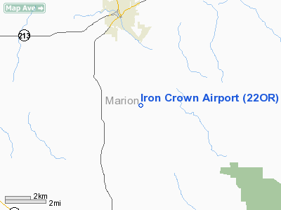
Location & QuickFacts
| FAA Information Effective: | 2008-09-25 |
| Airport Identifier: | 22OR |
| Airport Status: | Closed Indefinitely |
| Longitude/Latitude: | 122-45-45.3200W/44-56-30.4370N
-122.762589/44.941788 (Estimated) |
| Elevation: | 790 ft / 240.79 m (Estimated) |
| Land: | 0 acres |
| From nearest city: | 3 nautical miles SE of Silverton, OR |
| Location: | Marion County, OR |
| Magnetic Variation: | 19E (1985) |
Owner & Manager
| Ownership: | Privately owned |
| Owner: | Harold W Krueger Jr |
| Address: | 1187 Victor Point Road Ne
Silverton, OR 97381 |
| Phone number: | 503-873-2722 |
| Manager: | Harold W Krueger Jr |
| Address: | 1187 Victor Point Road Ne
Silverton, OR 97381 |
| Phone number: | 503-873-2722 |
Airport Operations and Facilities
| Airport Use: | Private |
| Wind indicator: | Yes |
| Segmented Circle: | No |
| Control Tower: | No |
| Landing fee charge: | No |
| Sectional chart: | Seattle |
| Region: | ANM - Northwest Mountain |
| Boundary ARTCC: | ZSE - Seattle |
| Tie-in FSS: | MMV - Mc Minnville |
| FSS on Airport: | No |
| FSS Toll Free: | 1-800-WX-BRIEF |
Runway Information
Runway 16/34
| Dimension: | 2000 x 50 ft / 609.6 x 15.2 m |
| Surface: | TURF, |
| |
Runway 16 |
Runway 34 |
| Traffic Pattern: | Right | Left |
| Obstruction: | 300 ft tower, 6076.0 ft from runway | 50 ft trees, 750.0 ft from runway |
|
Radio Navigation Aids
| ID |
Type |
Name |
Ch |
Freq |
Var |
Dist |
| LWG | NDB | Lewisburg | | 225.00 | 18E | 29.3 nm |
| LBH | NDB | Laker | | 332.00 | 20E | 38.2 nm |
| PND | NDB | Banks | | 356.00 | 21E | 43.1 nm |
| EU | NDB | Frakk | | 260.00 | 19E | 48.0 nm |
| CBU | TACAN | Columbia | 029X | | 20E | 39.4 nm |
| UBG | VOR/DME | Newberg | 121X | 117.40 | 21E | 26.4 nm |
| CVO | VOR/DME | Corvallis | 101X | 115.40 | 18E | 34.9 nm |
| PDX | VOR/DME | Portland | 055X | 111.80 | 20E | 39.7 nm |
| BTG | VORTAC | Battle Ground | 113X | 116.60 | 21E | 49.0 nm |
| HIO | VOT | Portland-hillsboro | | 115.20 | | 36.8 nm |
| PDX | VOT | Portland Intl | | 111.00 | | 40.0 nm |
Remarks
- (ARPT STATUS) ARPT CLSD INDEFLY.
Images and information placed above are from
http://www.airport-data.com/airport/22OR/
We thank them for the data!
| General Info
|
| Country |
United States
|
| State |
OREGON
|
| FAA ID |
22OR
|
| Latitude |
44-56-30.437N
|
| Longitude |
122-45-45.320W
|
| Elevation |
790 feet
|
| Near City |
SILVERTON
|
We don't guarantee the information is fresh and accurate. The data may
be wrong or outdated.
For more up-to-date information please refer to other sources.
|
|


