|
|
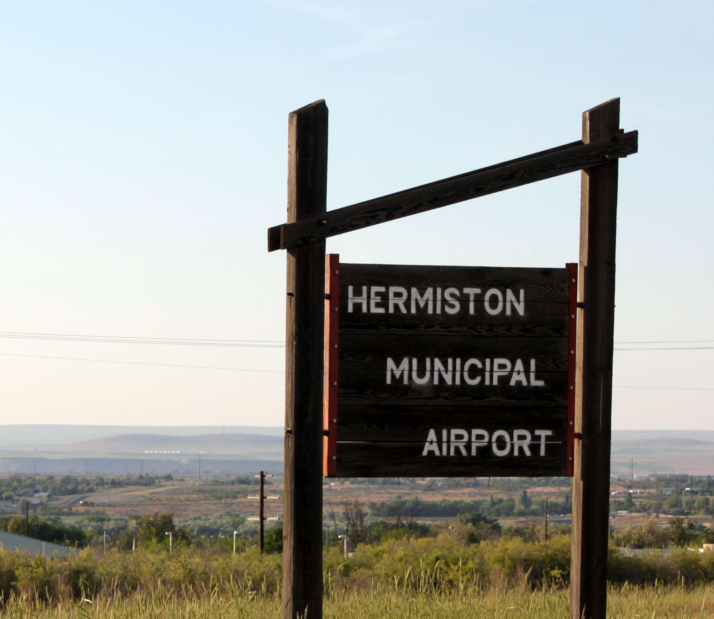
| Hermiston Municipal Airport |
 |
| IATA: HES – ICAO: KHRI – FAA LID: HRI |
| Summary |
| Airport type |
Public |
| Owner |
City of Hermiston |
| Serves |
Hermiston, Oregon |
| Elevation AMSL |
644 ft / 196 m |
| Coordinates |
45°49′42″N 119°15′33″W / 45.82833°N 119.25917°W / 45.82833; -119.25917 |
| Runways |
| Direction |
Length |
Surface |
| ft |
m |
| 4/22 |
4,500 |
1,372 |
Asphalt |
| Statistics (2004) |
| Aircraft operations |
24,850 |
| Based aircraft |
42 |
| Source: Federal Aviation Administration |
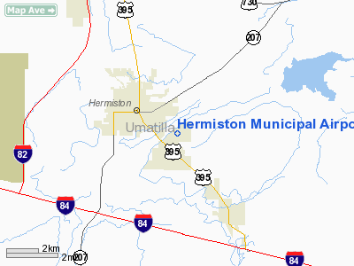
Hermiston Municipal Airport (IATA: HES, ICAO: KHRI, FAA LID: HRI, formerly S22) is a city-owned, public-use airport located two nautical miles (3.7 km) southeast of the central business district of Hermiston, in Umatilla County, Oregon, United States.
Although most U.S. airports use the same three-letter location identifier for the FAA and IATA, this airport is assigned HRI by the FAA and HES by the IATA.
Facilities and aircraft
Hermiston Municipal Airport covers an area of 267 acres (108 ha) at an elevation of 644 feet (196 m) above mean sea level. It has one runway designated 4/22 with an asphalt surface measuring 4,500 by 75 feet (1,372 x 23 m).
For the 12-month period ending May 1, 2004, the airport had 24,850 aircraft operations, an average of 68 per day: 98% general aviation, 2% air taxi, and <1% military. At that time there were 42 aircraft based at this airport: 81% single-engine, 9.5% multi-engine and 9.5% ultralight.
The above content comes from Wikipedia and is published under free licenses – click here to read more.
Location & QuickFacts
| FAA Information Effective: | 2008-09-25 |
| Airport Identifier: | HRI |
| Airport Status: | Operational |
| Longitude/Latitude: | 119-15-33.0000W/45-49-41.6000N
-119.259167/45.828222 (Estimated) |
| Elevation: | 644 ft / 196.29 m (Surveyed) |
| Land: | 267 acres |
| From nearest city: | 2 nautical miles SE of Hermiston, OR |
| Location: | Umatilla County, OR |
| Magnetic Variation: | 20E (1980) |
Owner & Manager
| Ownership: | Publicly owned |
| Owner: | City Of Hermiston |
| Address: | 180 N E 2nd St
Hermiston, OR 97838 |
| Phone number: | 541-567-5521 |
| Manager: | Larry Rawe |
| Address: | Po Box 1285
Hermiston, OR 97838 |
| Phone number: | 541-567-3694 |
Airport Operations and Facilities
| Airport Use: | Open to public |
| Wind indicator: | Yes |
| Segmented Circle: | Yes |
| Control Tower: | No |
| Lighting Schedule: | DUSK-DAWN
ACTVT MIRL RY 04/22, & REIL RY 22 - CTAF. PAPI RYS 04 & 22 OPER CONT. |
| Beacon Color: | Clear-Green (lighted land airport) |
| Landing fee charge: | No |
| Sectional chart: | Seattle |
| Region: | ANM - Northwest Mountain |
| Traffic Pattern Alt: | 800 ft |
| Boundary ARTCC: | ZSE - Seattle |
| Tie-in FSS: | MMV - Mc Minnville |
| FSS on Airport: | No |
| FSS Toll Free: | 1-800-WX-BRIEF |
| NOTAMs Facility: | HRI (NOTAM-d service avaliable) |
| Federal Agreements: | NGY |
Airport Communications
| CTAF: | 122.800 |
| Unicom: | 122.800 |
Airport Services
| Fuel available: | 100LLA |
| Airframe Repair: | MAJOR |
| Power Plant Repair: | MAJOR |
| Bottled Oxygen: | NONE |
| Bulk Oxygen: | NONE |
Runway Information
Runway 04/22
| Dimension: | 4500 x 75 ft / 1371.6 x 22.9 m |
| Surface: | ASPH, Fair Condition |
| Weight Limit: | Single wheel: 22000 lbs. |
| Edge Lights: | Medium |
| |
Runway 04 |
Runway 22 |
| Longitude: | 119-16-01.1270W | 119-15-04.8450W |
| Latitude: | 45-49-31.2680N | 45-49-51.8890N |
| Elevation: | 641.00 ft | 638.00 ft |
| Alignment: | 62 | 127 |
| Traffic Pattern: | Left | Left |
| Markings: | Basic, Good Condition | Basic, Good Condition |
| Crossing Height: | 36.00 ft | 37.00 ft |
| VASI: | 2-light PAPI on left side | 2-light PAPI on left side |
| Visual Glide Angle: | 3.00° | 3.50° |
| Runway End Identifier: | No | Yes |
| Obstruction: | 32 ft pole, 1250.0 ft from runway, 100 ft left of centerline, 32:1 slope to clear | 63 ft pline, 2350.0 ft from runway, 375 ft right of centerline, 34:1 slope to clear |
|
Radio Navigation Aids
| ID |
Type |
Name |
Ch |
Freq |
Var |
Dist |
| PD | NDB | Foris | | 230.00 | 20E | 23.6 nm |
| PSC | VOR/DME | Pasco | 021X | 108.40 | 20E | 26.8 nm |
| ALW | VOR/DME | Walla Walla | 111X | 116.40 | 20E | 43.3 nm |
| PDT | VORTAC | Pendleton | 094X | 114.70 | 20E | 15.5 nm |
Remarks
Images and information placed above are from
http://www.airport-data.com/airport/HRI/
We thank them for the data!
| General Info
|
| Country |
United States
|
| State |
OREGON
|
| FAA ID |
HRI
|
| Latitude |
45-49-41.600N
|
| Longitude |
119-15-33.000W
|
| Elevation |
644 feet
|
| Near City |
HERMISTON
|
We don't guarantee the information is fresh and accurate. The data may
be wrong or outdated.
For more up-to-date information please refer to other sources.
|
|