 |
|
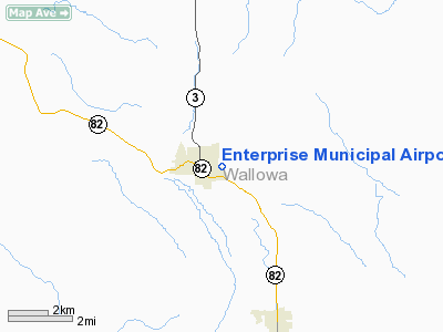
| Enterprise Municipal Airport |
| IATA: none – ICAO: none – FAA LID: 8S4 |
| Summary |
| Airport type |
Public |
| Operator |
City of Enterprise |
| Location |
Enterprise, Oregon |
| Elevation AMSL |
3957 ft / 1206 m |
| Coordinates |
45°25′29.5430″N 117°15′53.6080″W / 45.42487306°N 117.26489111°W / 45.42487306; -117.26489111Coordinates: 45°25′29.5430″N 117°15′53.6080″W / 45.42487306°N 117.26489111°W / 45.42487306; -117.26489111 |
| Runways |
| Direction |
Length |
Surface |
| ft |
m |
| 12/30 |
2850 |
869 |
asphalt |
| Runway and Taxiway have recently been resurfaced. Stripes numbers and other markings have been repainted and enlarged. |
Enterprise Municipal Airport (FAA LID: 8S4), is a public airport located in Enterprise in Wallowa County, Oregon, USA.
Aircraft based at Enterprise
Currently at Enterprise Municipal Airport there are 31 aircraft based there; 27 single engined planes and 4 ultralight aircraft.
The above content comes from Wikipedia and is published under free licenses – click here to read more.
Location & QuickFacts
| FAA Information Effective: | 2008-09-25 |
| Airport Identifier: | 8S4 |
| Airport Status: | Operational |
| Longitude/Latitude: | 117-15-53.6080W/45-25-29.5430N
-117.264891/45.424873 (Estimated) |
| Elevation: | 3957 ft / 1206.09 m (Estimated) |
| Land: | 10 acres |
| From nearest city: | 0 nautical miles E of Enterprise, OR |
| Location: | Wallowa County, OR |
| Magnetic Variation: | 18E (1985) |
Owner & Manager
| Ownership: | Publicly owned |
| Owner: | City Of Enterprise |
| Address: | 108 Ne 1st St
Enterprise, OR 97828 |
| Phone number: | 541-426-4196 |
| Manager: | Joe Spence |
| Address: | P O Box 217
Enterprise, OR 97828 |
| Phone number: | 541-426-3288 |
Airport Operations and Facilities
| Airport Use: | Open to public |
| Wind indicator: | Yes |
| Segmented Circle: | Yes |
| Control Tower: | No |
| Lighting Schedule: | DUSK-DAWN |
| Beacon Color: | Clear-Green (lighted land airport) |
| Landing fee charge: | No |
| Sectional chart: | Seattle |
| Region: | ANM - Northwest Mountain |
| Traffic Pattern Alt: | 1000 ft |
| Boundary ARTCC: | ZSE - Seattle |
| Tie-in FSS: | MMV - Mc Minnville |
| FSS on Airport: | No |
| FSS Toll Free: | 1-800-WX-BRIEF |
| NOTAMs Facility: | MMV (NOTAM-d service avaliable) |
Airport Communications
| CTAF: | 122.800 |
| Unicom: | 122.800
UNICOM MONITORED IRREGULARLY. |
Airport Services
| Fuel available: | 100LL
FOR FUEL CALL 541-426-3288. |
| Airframe Repair: | MINOR
MINOR AIRFRAME REPAIRS ON CALL 541-426-4984. |
| Power Plant Repair: | MINOR
MINOR POWER PLANT REPAIRS ON CALL 541-426-4984. |
| Bottled Oxygen: | NONE |
| Bulk Oxygen: | NONE |
Runway Information
Runway 12/30
| Dimension: | 2850 x 50 ft / 868.7 x 15.2 m |
| Surface: | ASPH, Fair Condition |
| Weight Limit: | Single wheel: 7000 lbs. |
| Edge Lights: | Low |
| |
Runway 12 |
Runway 30 |
| Traffic Pattern: | Left | Left |
| Markings: | Nonstandard, Fair Condition
RY 12/30 NSTD BSC MARKINGS; NUMBERS SMALL. | Nonstandard, Fair Condition |
|
Radio Navigation Aids
| ID |
Type |
Name |
Ch |
Freq |
Var |
Dist |
| LGD | NDB | La Grande | | 296.00 | 17E | 29.9 nm |
| BKE | VOR/DME | Baker City | 100X | 115.30 | 20E | 42.0 nm |
Remarks
-
- UNLIGHTED HELIPAD 150 FT SE OF ROTG BCN ADJ TO TWY.
- PARALLEL TWY 20 FT WIDE; LOOSE GRVL ON SURFACE.
- BE ALERT; SOFT EDGES AND STEEP SHOULDERS ALONG RY & TWY.
Images and information placed above are from
http://www.airport-data.com/airport/8S4/
We thank them for the data!
| General Info
|
| Country |
United States
|
| State |
OREGON
|
| FAA ID |
8S4
|
| Latitude |
45-25-29.543N
|
| Longitude |
117-15-53.608W
|
| Elevation |
3957 feet
|
| Near City |
ENTERPRISE
|
We don't guarantee the information is fresh and accurate. The data may
be wrong or outdated.
For more up-to-date information please refer to other sources.
|
|


