 |
|
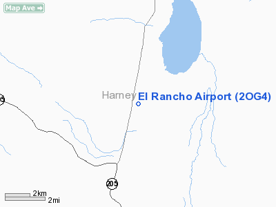
Location & QuickFacts
| FAA Information Effective: | 2008-09-25 |
| Airport Identifier: | 2OG4 |
| Airport Status: | Operational |
| Longitude/Latitude: | 118-38-50.0000W/42-19-49.0000N
-118.647222/42.330278 (Estimated) |
| Elevation: | 4130 ft / 1258.82 m (Estimated) |
| Land: | 110 acres |
| From nearest city: | 4 nautical miles NN of Fields, OR |
| Location: | Harney County, OR |
| Magnetic Variation: | () |
Owner & Manager
| Ownership: | Privately owned |
| Owner: | James Petersen & Larry Goodman |
| Address: | 4900 Nw O'neil Hwy
Prineville, OR 97754 |
| Phone number: | 541-420-4491 |
| Manager: | James Petersen & Larry Goodman |
| Address: | 4900 Nw O'neil Hwy
Prineville, OR 97754 |
| Phone number: | 541-420-4491 |
Airport Operations and Facilities
| Airport Use: | Private |
| Control Tower: | No |
| Sectional chart: | Klamath Falls |
| Region: | ANM - Northwest Mountain |
| Boundary ARTCC: | ZLC - Salt Lake City |
| Tie-in FSS: | MMV - Mc Minnville |
| FSS Toll Free: | 1-800-WX-BRIEF |
Runway Information
Runway 17/35
| Dimension: | 2500 x 50 ft / 762.0 x 15.2 m |
| Surface: | TURF, |
| |
Runway 17 |
Runway 35 |
| Traffic Pattern: | Left | Left |
|
Radio Navigation Aids
| ID |
Type |
Name |
Ch |
Freq |
Var |
Dist |
| RMD | NDB | Mc Dermitt State | | 204.00 | 17E | 45.5 nm |
| REO | VORTAC | Rome | 072X | 112.50 | 19E | 37.9 nm |
Images and information placed above are from
http://www.airport-data.com/airport/2OG4/
We thank them for the data!
|
|


