 |
|
Location & QuickFacts
| FAA Information Effective: | 2008-09-25 |
| Airport Identifier: | 69OR |
| Airport Status: | Operational |
| Longitude/Latitude: | 123-08-12.3850W/45-24-45.4130N
-123.136774/45.412615 (Estimated) |
| Elevation: | 300 ft / 91.44 m (Estimated) |
| Land: | 1 acres |
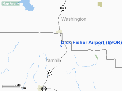
| From nearest city: | 1 nautical miles S of Gaston, OR |
| Location: | Yamhill County, OR |
| Magnetic Variation: | 20E (1980) |
Owner & Manager
| Ownership: | Privately owned |
| Owner: | Richard Arthur Fisher |
| Address: | 2115 N.w. Goodin Creek Rd.
Gaston, OR 97119 |
| Phone number: | 503-662-3947 |
| Manager: | Richard Arthur Fisher |
| Address: | 2115 N.w. Goodin Creek Rd.
Gaston, OR 97119 |
| Phone number: | 503-662-3947 |
Airport Operations and Facilities
| Airport Use: | Private |
| Segmented Circle: | No |
| Control Tower: | No |
| Sectional chart: | Seattle |
| Region: | ANM - Northwest Mountain |
| Boundary ARTCC: | ZSE - Seattle |
| Tie-in FSS: | MMV - Mc Minnville |
| FSS Toll Free: | 1-800-WX-BRIEF |
Runway Information
Runway 18/36
| Dimension: | 800 x 45 ft / 243.8 x 13.7 m |
| Surface: | TURF, |
| |
Runway 18 |
Runway 36 |
| Traffic Pattern: | Left | Left |
| Obstruction: | 25 ft pline, 750.0 ft from runway | |
|
Radio Navigation Aids
| ID |
Type |
Name |
Ch |
Freq |
Var |
Dist |
| PND | NDB | Banks | | 356.00 | 21E | 13.6 nm |
| LBH | NDB | Laker | | 332.00 | 20E | 29.5 nm |
| LSO | NDB | Kelso | | 256.00 | 21E | 45.6 nm |
| PEN | NDB | Karpen | | 201.00 | 20E | 47.6 nm |
| LWG | NDB | Lewisburg | | 225.00 | 18E | 48.4 nm |
| CBU | TACAN | Columbia | 029X | | 20E | 24.5 nm |
| UBG | VOR/DME | Newberg | 121X | 117.40 | 21E | 7.6 nm |
| PDX | VOR/DME | Portland | 055X | 111.80 | 20E | 24.9 nm |
| BTG | VORTAC | Battle Ground | 113X | 116.60 | 21E | 30.5 nm |
| HIO | VOT | Portland-hillsboro | | 115.20 | | 11.0 nm |
| PDX | VOT | Portland Intl | | 111.00 | | 25.2 nm |
Remarks
- MAY BE USED BY FEDERAL AND STATE FOR AERIAL SEARCH BASE FOR LOST ACFT OR PERSONS.
- LAND RWY 18-GRADIENT VARIES 10% TO 15%
Images and information placed above are from
http://www.airport-data.com/airport/69OR/
We thank them for the data!
| General Info
|
| Country |
United States
|
| State |
OREGON
|
| FAA ID |
69OR
|
| Latitude |
45-24-45.413N
|
| Longitude |
123-08-12.385W
|
| Elevation |
300 feet
|
| Near City |
GASTON
|
We don't guarantee the information is fresh and accurate. The data may
be wrong or outdated.
For more up-to-date information please refer to other sources.
|
|


