 |
|
| Davis Airport |
| IATA: none – ICAO: - FAA: 6S4 |
| Summary |
| Airport type |
Public |
| Operator |
Davis Airport, Inc |
| Location |
Gates, Oregon |
| Elevation AMSL |
1026 ft / 313 m |
| Coordinates |
44°44′44.4380″N 122°25′17.2940″W / 44.74567722°N 122.42147056°W / 44.74567722; -122.42147056Coordinates: 44°44′44.4380″N 122°25′17.2940″W / 44.74567722°N 122.42147056°W / 44.74567722; -122.42147056 |
| Runways |
| Direction |
Length |
Surface |
| ft |
m |
| 7/25 |
1940 |
591 |
Turf |
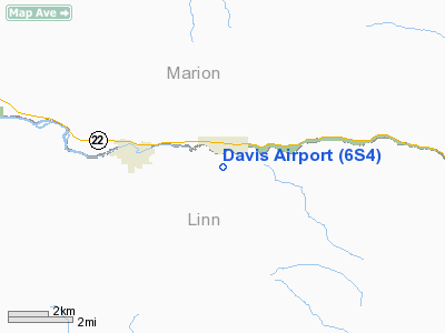
Davis Airport (FAA LID: 6S4), is a public airport located one mile (1.6 km) south of Gates in Linn County, Oregon, USA.
The above content comes from Wikipedia and is published under free licenses – click here to read more.
Location & QuickFacts
| FAA Information Effective: | 2008-09-25 |
| Airport Identifier: | 6S4 |
| Airport Status: | Operational |
| Longitude/Latitude: | 122-25-17.2940W/44-44-44.4380N
-122.421471/44.745677 (Estimated) |
| Elevation: | 1026 ft / 312.72 m (Estimated) |
| Land: | 10 acres |
| From nearest city: | 1 nautical miles S of Gates, OR |
| Location: | Linn County, OR |
| Magnetic Variation: | 19E (1985) |
Owner & Manager
| Ownership: | Privately owned |
| Owner: | Davis Arpt.inc. |
| Address: | 50287 Kingwood Ave.
Gates, OR 97358 |
| Phone number: | 503-897-2585 |
| Manager: | George A. Atiyeh |
| Address: | 32325 N Fork Road
Lyons, OR 97358 |
| Phone number: | 503-897-2585 |
Airport Operations and Facilities
| Airport Use: | Open to public |
| Wind indicator: | Yes |
| Segmented Circle: | No |
| Control Tower: | No |
| Landing fee charge: | No |
| Sectional chart: | Seattle |
| Region: | ANM - Northwest Mountain |
| Boundary ARTCC: | ZSE - Seattle |
| Tie-in FSS: | MMV - Mc Minnville |
| FSS on Airport: | No |
| FSS Toll Free: | 1-800-WX-BRIEF |
| NOTAMs Facility: | MMV (NOTAM-d service avaliable) |
Airport Communications
Airport Services
| Bottled Oxygen: | NONE |
| Bulk Oxygen: | NONE |
Runway Information
Runway 07/25
| Dimension: | 1940 x 50 ft / 591.3 x 15.2 m |
| Surface: | TURF, Good Condition |
| |
Runway 07 |
Runway 25 |
| Traffic Pattern: | Left | Left |
| Obstruction: | 150 ft trees, 1800.0 ft from runway, 12:1 slope to clear | 75 ft tree, 355.0 ft from runway, 100 ft left of centerline, 4:1 slope to clear |
|
Radio Navigation Aids
| ID |
Type |
Name |
Ch |
Freq |
Var |
Dist |
| LWG | NDB | Lewisburg | | 225.00 | 18E | 37.2 nm |
| EU | NDB | Frakk | | 260.00 | 19E | 46.9 nm |
| LBH | NDB | Laker | | 332.00 | 20E | 47.8 nm |
| CVO | VOR/DME | Corvallis | 101X | 115.40 | 18E | 40.1 nm |
| UBG | VOR/DME | Newberg | 121X | 117.40 | 21E | 43.5 nm |
Remarks
- MODEL AIRCRAFT FLYING AREA 300 FT SOUTH OF RY.
- EXISTED PRIOR TO 1959.
Images and information placed above are from
http://www.airport-data.com/airport/6S4/
We thank them for the data!
| General Info
|
| Country |
United States
|
| State |
OREGON
|
| FAA ID |
6S4
|
| Latitude |
44-44-44.438N
|
| Longitude |
122-25-17.294W
|
| Elevation |
1026 feet
|
| Near City |
GATES
|
We don't guarantee the information is fresh and accurate. The data may
be wrong or outdated.
For more up-to-date information please refer to other sources.
|
|


