 |
|
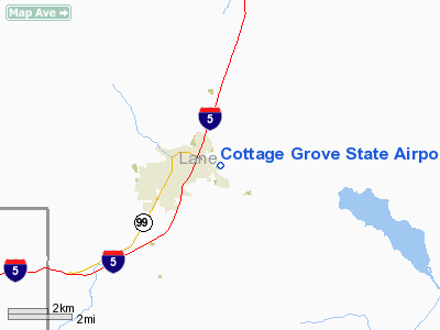
Cottage Grove State Airport |
Cottage Grove State Airport
Jim Wright Field |
| IATA: none – ICAO: - FAA: 61S |
| Summary |
| Airport type |
Public |
| Operator |
Oregon Department of Aviation |
| Location |
Cottage Grove, Oregon |
| Elevation AMSL |
641 ft / 195 m |
| Coordinates |
43°47′59.4430″N 123°01′44.2840″W / 43.79984528°N 123.02896778°W / 43.79984528; -123.02896778Coordinates: 43°47′59.4430″N 123°01′44.2840″W / 43.79984528°N 123.02896778°W / 43.79984528; -123.02896778 |
| Runways |
| Direction |
Length |
Surface |
| ft |
m |
| 15/33 |
3188 |
972 |
Asphalt |
Cottage Grove State Airport or Jim Wright Field (FAA LID: 61S), is a public airport serving small general aviation aircraft, located one mile (1.6 km) east of the city of Cottage Grove in Lane County, Oregon, USA.
On December 17, 2003 the airfield was named after Jim Wright, a local aviator and business man who painstakingly built a reproduction Hughes H-1 Racer. Wright perished in a tragic accident in the aircraft on August 4, 2003.
The above content comes from Wikipedia and is published under free licenses – click here to read more.
Location & QuickFacts
| FAA Information Effective: | 2008-09-25 |
| Airport Identifier: | 61S |
| Airport Status: | Operational |
| Longitude/Latitude: | 123-01-44.2840W/43-47-59.4430N
-123.028968/43.799845 (Estimated) |
| Elevation: | 641 ft / 195.38 m (Estimated) |
| Land: | 69 acres |
| From nearest city: | 1 nautical miles E of Cottage Grove, OR |
| Location: | Lane County, OR |
| Magnetic Variation: | 19E (1985) |
Owner & Manager
| Ownership: | Publicly owned |
| Owner: | Oregon Department Of Aviation |
| Address: | 3040 25th St S.e.
Salem, OR 97302-1125 |
| Phone number: | 503-378-4880 |
| Manager: | State Airports Manager |
| Address: | 3040 25th St Se
Salem, OR 97302-1125 |
| Phone number: | 503-378-4880 |
Airport Operations and Facilities
| Airport Use: | Open to public |
| Wind indicator: | Yes |
| Segmented Circle: | Yes |
| Control Tower: | No |
| Lighting Schedule: | DUSK-DAWN
ACTVT MIRL RY 15/33, PAPI RY 15 & RY 33 - CTAF. |
| Beacon Color: | Clear-Green (lighted land airport) |
| Landing fee charge: | No |
| Sectional chart: | Klamath Falls |
| Region: | ANM - Northwest Mountain |
| Traffic Pattern Alt: | 1000 ft |
| Boundary ARTCC: | ZSE - Seattle |
| Tie-in FSS: | MMV - Mc Minnville |
| FSS on Airport: | No |
| FSS Toll Free: | 1-800-WX-BRIEF |
| NOTAMs Facility: | MMV (NOTAM-d service avaliable) |
| Federal Agreements: | NGY |
Airport Communications
| CTAF: | 122.800 |
| Unicom: | 122.800
UNICOM UNMON. |
Airport Services
| Fuel available: | 100LL
FUEL AVBL 24 HR SELF SERVE CARDLOCK. |
| Airframe Repair: | NONE |
| Power Plant Repair: | NONE |
| Bottled Oxygen: | NONE |
Runway Information
Runway 15/33
| Dimension: | 3188 x 60 ft / 971.7 x 18.3 m |
| Surface: | ASPH, Fair Condition |
| Weight Limit: | Single wheel: 15000 lbs. |
| Edge Lights: | Medium |
| |
Runway 15 |
Runway 33 |
| Longitude: | 123-02-00.2000W | 123-01-50.5000W |
| Latitude: | 43-48-30.1000N | 43-47-59.4000N |
| Elevation: | 631.00 ft | 641.00 ft |
| Alignment: | 127 | 127 |
| Traffic Pattern: | Left | Right |
| Markings: | Basic, Good Condition | Basic, Good Condition |
| Crossing Height: | 45.00 ft | 45.00 ft |
| VASI: | 4-light PAPI on left side | 4-light PAPI on right side |
| Visual Glide Angle: | 3.00° | 4.20° |
| Obstruction: | 70 ft trees, 1100.0 ft from runway, 110 ft left of centerline, 13:1 slope to clear
RWY 15 +15 FT BRUSH, 130 FT FM THLD, 85 FT L. | 75 ft tree, 1338.0 ft from runway, 90 ft right of centerline, 15:1 slope to clear |
|
Radio Navigation Aids
| ID |
Type |
Name |
Ch |
Freq |
Var |
Dist |
| EU | NDB | Frakk | | 260.00 | 19E | 26.2 nm |
| RBG | NDB | Roseburg | | 400.00 | 20E | 36.8 nm |
| RBG | VOR/DME | Roseburg | 019X | 108.20 | 20E | 39.7 nm |
| CVO | VOR/DME | Corvallis | 101X | 115.40 | 18E | 43.6 nm |
| EUG | VORTAC | Eugene | 076X | 112.90 | 20E | 21.0 nm |
Remarks
- HIGH CONCENTRATION OF BIRDS ON & INVOF ARPT.
- DEER ON & INVOF ARPT ALL HRS.
- TWYS 25 FT WIDE, MKD WITH BLUE REFLECTORS.
Images and information placed above are from
http://www.airport-data.com/airport/61S/
We thank them for the data!
| General Info
|
| Country |
United States
|
| State |
OREGON
|
| FAA ID |
61S
|
| Latitude |
43-47-59.443N
|
| Longitude |
123-01-44.284W
|
| Elevation |
640 feet
|
| Near City |
COTTAGE GROVE
|
We don't guarantee the information is fresh and accurate. The data may
be wrong or outdated.
For more up-to-date information please refer to other sources.
|
|


