|
|
| Corvallis Municipal Airport |
 |
| IATA: CVO – ICAO: KCVO |
| Summary |
| Airport type |
Public |
| Operator |
City of Corvallis |
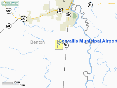
| Location |
Benton County, near Corvallis, Oregon |
| Elevation AMSL |
75 ft / m |
| Coordinates |
44°29′54″N 123°17′07″W / 44.498342°N 123.285377°W / 44.498342; -123.285377Coordinates: 44°29′54″N 123°17′07″W / 44.498342°N 123.285377°W / 44.498342; -123.285377 |
| Runways |
| Direction |
Length |
Surface |
| ft |
m |
| 17/35 |
5900 |
1798 |
Asphalt |
| 9/27 |
3335 |
1017 |
Asphalt |
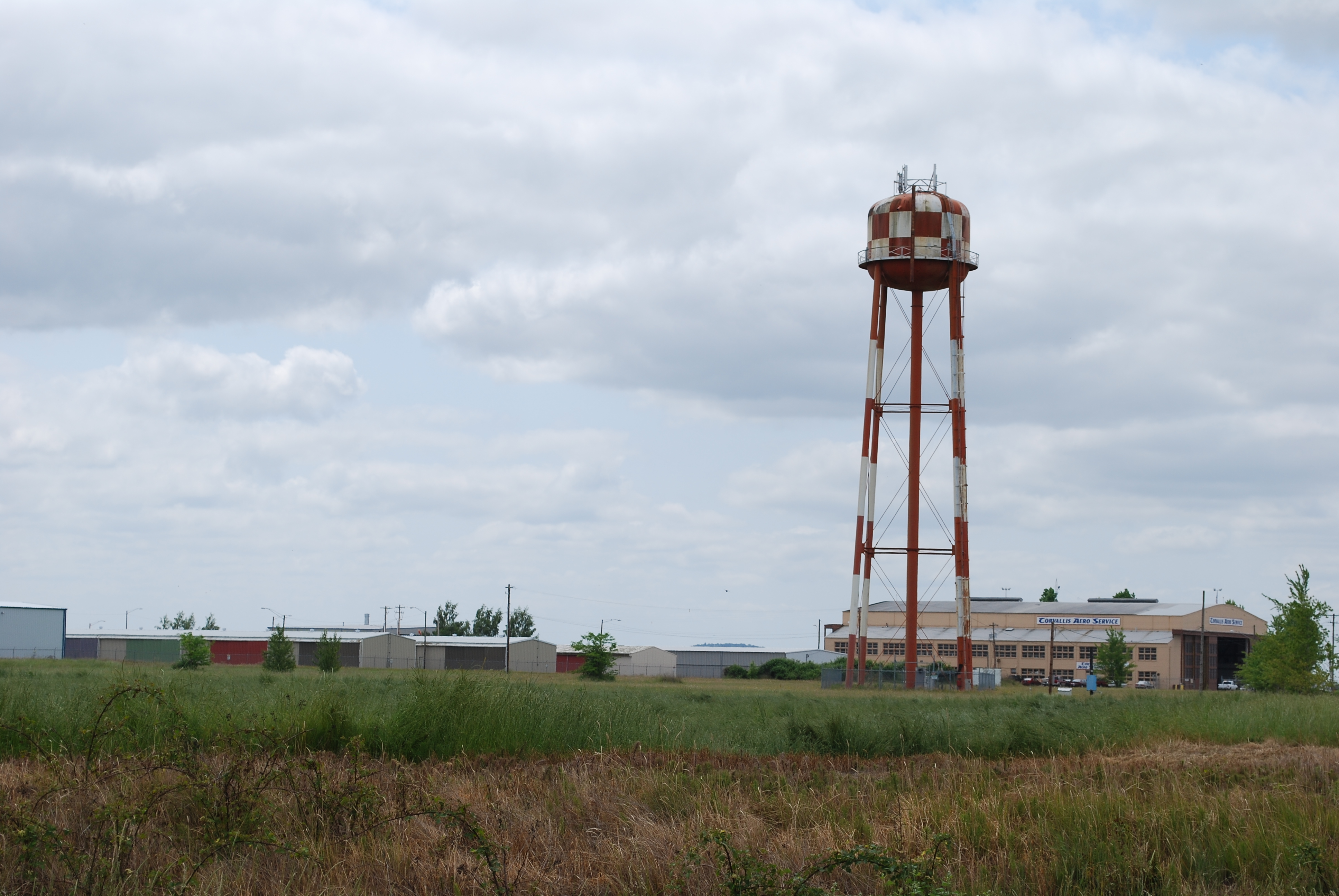
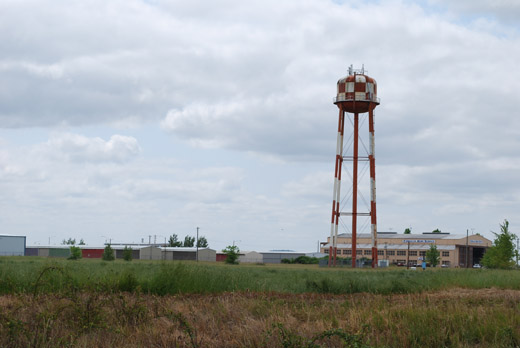
Corvallis Municipal Airport (IATA: CVO, ICAO: KCVO), is a public airport located four miles (6.4 km) south of the city of Corvallis in Benton County, Oregon, USA. The site was built during World War II for bomber training and the original hangar is still being used today. The airport offers full service and self serve fuel: 100LL and Jet A. Maintenance is also available on the ramp. Helicopter and fixed-wing flight instruction is also available through Corvallis Aero Service.
History
During World War II the airfield was used by the United States Army Air Force
The above content comes from Wikipedia and is published under free licenses – click here to read more.
Location & QuickFacts
| FAA Information Effective: | 2008-09-25 |
| Airport Identifier: | CVO |
| Airport Status: | Operational |
| Longitude/Latitude: | 123-17-22.3000W/44-29-49.6000N
-123.289528/44.497111 (Estimated) |
| Elevation: | 250 ft / 76.20 m (Surveyed) |
| Land: | 1490 acres |
| From nearest city: | 4 nautical miles SW of Corvallis, OR |
| Location: | Benton County, OR |
| Magnetic Variation: | 18E (1995) |
Owner & Manager
| Ownership: | Publicly owned |
| Owner: | City Of Corvallis |
| Address: | Public Works Dept
Corvallis, OR 97339 |
| Phone number: | 541-766-6916 |
| Manager: | Dan Mason |
| Address: | Po Box 1083
Corvallis, OR 97339 |
| Phone number: | 541-766-6916 |
Airport Operations and Facilities
| Airport Use: | Open to public |
| Wind indicator: | Yes |
| Segmented Circle: | Yes |
| Control Tower: | No |
| Lighting Schedule: | DUSK-DAWN
ACTVT MALSR RY 17 & MIRL RY 09/27 - CTAF. |
| Beacon Color: | Clear-Green (lighted land airport) |
| Landing fee charge: | No |
| Sectional chart: | Klamath Falls |
| Region: | ANM - Northwest Mountain |
| Traffic Pattern Alt: | 800 ft |
| Boundary ARTCC: | ZSE - Seattle |
| Tie-in FSS: | MMV - Mc Minnville |
| FSS on Airport: | No |
| FSS Toll Free: | 1-800-WX-BRIEF |
| NOTAMs Facility: | CVO (NOTAM-d service avaliable) |
| Federal Agreements: | NGPRY3 |
Airport Communications
| CTAF: | 123.000 |
| Unicom: | 123.000 |
Airport Services
| Fuel available: | 100LLA |
| Airframe Repair: | MAJOR |
| Power Plant Repair: | MAJOR |
| Bottled Oxygen: | HIGH |
| Bulk Oxygen: | HIGH/LOW |
Runway Information
Runway 09/27
| Dimension: | 3545 x 75 ft / 1080.5 x 22.9 m |
| Surface: | ASPH, Good Condition |
| Weight Limit: | Single wheel: 51000 lbs.
Dual wheel: 65000 lbs.
Dual tandem wheel: 100000 lbs. |
| Edge Lights: | Medium |
| |
Runway 09 |
Runway 27 |
| Longitude: | 123-17-27.5026W | 123-16-42.1383W |
| Latitude: | 44-30-06.1936N | 44-29-53.0971N |
| Elevation: | 245.00 ft | 246.00 ft |
| Alignment: | 112 | 127 |
| Traffic Pattern: | Left | Left |
| Markings: | Basic, Good Condition | Basic, Good Condition |
| Crossing Height: | 0.00 ft | 25.00 ft |
| Displaced threshold: | 0.00 ft | 199.00 ft |
| VASI: | | 4-light PAPI on left side |
| Visual Glide Angle: | 0.00° | 3.00° |
| Obstruction: | , 50:1 slope to clear | 21 ft rr, 380.0 ft from runway, 8:1 slope to clear
+44' TREE 850' FM THR 300' R; APCH RATIO 19:1 FM DSPLCD THR. |
|
Runway 17/35
| Dimension: | 5900 x 150 ft / 1798.3 x 45.7 m |
| Surface: | ASPH, Good Condition |
| Weight Limit: | Single wheel: 35000 lbs.
Dual wheel: 73000 lbs.
Dual tandem wheel: 100000 lbs. |
| Edge Lights: | Medium |
| |
Runway 17 |
Runway 35 |
| Longitude: | 123-17-27.8533W | 123-17-37.7204W |
| Latitude: | 44-30-12.4247N | 44-29-14.5951N |
| Elevation: | 244.00 ft | 250.00 ft |
| Alignment: | 127 | 7 |
| ILS Type: | ILS
| |
| Traffic Pattern: | Left | Left |
| Markings: | Precision instrument, Good Condition | Non-precision instrument, Good Condition |
| VASI: | 4-box on left side | 4-box on left side |
| Approach lights: | MALSR | |
| Runway End Identifier: | | Yes |
|
Radio Navigation Aids
| ID |
Type |
Name |
Ch |
Freq |
Var |
Dist |
| LWG | NDB | Lewisburg | | 225.00 | 18E | 7.0 nm |
| EU | NDB | Frakk | | 260.00 | 19E | 17.3 nm |
| CVO | VOR/DME | Corvallis | 101X | 115.40 | 18E | 0.2 nm |
| EUG | VORTAC | Eugene | 076X | 112.90 | 20E | 22.8 nm |
| ONP | VORTAC | Newport | 118X | 117.10 | 19E | 33.4 nm |
Remarks
- MIGRATORY WATERFOWL & OTR BIRDS ON & INVOF ARPT.
- HEAVY-LIFT HELICOPTER ACTIVITY ON & INVOF ARPT, BEAWARE OF POSSIBLE ROTOR TIP VORTICES.
- ESTABD PRIOR TO 1959.
Images and information placed above are from
http://www.airport-data.com/airport/CVO/
We thank them for the data!
| General Info
|
| Country |
United States
|
| State |
OREGON
|
| FAA ID |
CVO
|
| Latitude |
44-29-49.897N
|
| Longitude |
123-17-23.387W
|
| Elevation |
246 feet
|
| Near City |
CORVALLIS
|
We don't guarantee the information is fresh and accurate. The data may
be wrong or outdated.
For more up-to-date information please refer to other sources.
|
|