 |
|
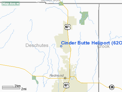
Location & QuickFacts
| FAA Information Effective: | 2008-09-25 |
| Airport Identifier: | 62OR |
| Airport Status: | Operational |
| Longitude/Latitude: | 121-11-36.0000W/44-19-18.0000N
-121.193333/44.321667 (Estimated) |
| Elevation: | 2950 ft / 899.16 m (Estimated) |
| Land: | 0 acres |
| From nearest city: | 3 nautical miles NW of Redmond, OR |
| Location: | Deschutes County, OR |
| Magnetic Variation: | 18E (1995) |
Owner & Manager
| Ownership: | Privately owned |
| Owner: | James Kanny |
| Address: | 2589 Nw Coyner
Redmond, OR 97756 |
| Phone number: | 503-548-8805 |
| Manager: | James Kanny |
| Address: | 2589 Nw Coyner
Redmond, OR 97756 |
| Phone number: | 503-548-8805 |
Airport Operations and Facilities
| Airport Use: | Private |
| Segmented Circle: | No |
| Control Tower: | No |
| Sectional chart: | Seattle |
| Region: | ANM - Northwest Mountain |
| Boundary ARTCC: | ZSE - Seattle |
| Tie-in FSS: | MMV - Mc Minnville |
| FSS on Airport: | No |
| FSS Toll Free: | 1-800-WX-BRIEF |
Runway Information
Helipad H1
| Dimension: | 110 x 110 ft / 33.5 x 33.5 m |
| Surface: | TURF, |
| |
Runway H1 |
Runway |
| Traffic Pattern: | Left | Left |
|
Radio Navigation Aids
| ID |
Type |
Name |
Ch |
Freq |
Var |
Dist |
| RD | NDB | Bodey | | 411.00 | 18E | 7.5 nm |
| DSD | VORTAC | Deschutes | 123X | 117.60 | 18E | 6.3 nm |
Images and information placed above are from
http://www.airport-data.com/airport/62OR/
We thank them for the data!
|
|


