 |
|
| Brookings Airport |
| IATA: BOK – ICAO: KBOK |
| Summary |
| Airport type |
Public |
| Operator |
Curry County, Oregon |
| Serves |
Brookings, OR |
| Location |
459 |
| Elevation AMSL |
139.9 ft / m |
| Coordinates |
42°04′28.4000″N 124°17′24.3380″W / 42.074556°N 124.29009389°W / 42.074556; -124.29009389Coordinates: 42°04′28.4000″N 124°17′24.3380″W / 42.074556°N 124.29009389°W / 42.074556; -124.29009389 |
| Runways |
| Direction |
Length |
Surface |
| ft |
m |
| 12/30 |
2900 |
884 |
Asphalt |
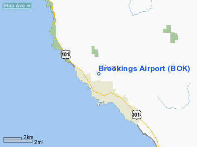
Brookings Airport (IATA: BOK, ICAO: KBOK), is a public airport located one mile (1.6 km) northeast of the city of Brookings in Curry County, Oregon, USA. Brookings is on the Chetco River, and is famed for Brookings Harbor.
Facilities Brookings Airport has Self Service fuel, hangars, a tie-down ramp, and a pilot lounge.
The above content comes from Wikipedia and is published under free licenses – click here to read more.
Location & QuickFacts
| FAA Information Effective: | 2008-09-25 |
| Airport Identifier: | BOK |
| Airport Status: | Operational |
| Longitude/Latitude: | 124-17-24.3380W/42-04-28.4000N
-124.290094/42.074556 (Estimated) |
| Elevation: | 459 ft / 139.90 m (Surveyed) |
| Land: | 90 acres |
| From nearest city: | 1 nautical miles NE of Brookings, OR |
| Location: | Curry County, OR |
| Magnetic Variation: | 18E (1985) |
Owner & Manager
| Ownership: | Publicly owned |
| Owner: | Curry County |
| Address: | Courthouse
Gold Beach, OR 97444 |
| Phone number: | 541-247-3296 |
| Manager: | Lucy La Bonte |
| Address: | Po Box 746
Gold Beach, OR 97444 |
| Phone number: | 541-247-3296 |
Airport Operations and Facilities
| Airport Use: | Open to public |
| Wind indicator: | Yes |
| Segmented Circle: | Yes |
| Control Tower: | No |
| Lighting Schedule: | DUSK-DAWN
ACTIVATE MIRL RY 12/30 AND PAPI RYS 12 & 30 - CTAF. |
| Beacon Color: | Clear-Green (lighted land airport) |
| Landing fee charge: | No |
| Sectional chart: | Klamath Falls |
| Region: | ANM - Northwest Mountain |
| Traffic Pattern Alt: | 1000 ft |
| Boundary ARTCC: | ZSE - Seattle |
| Tie-in FSS: | MMV - Mc Minnville |
| FSS on Airport: | No |
| FSS Toll Free: | 1-800-WX-BRIEF |
| NOTAMs Facility: | 4BK (NOTAM-d service avaliable) |
| Federal Agreements: | NGY |
Airport Communications
| CTAF: | 122.800 |
| Unicom: | 122.800 |
Airport Services
| Fuel available: | 100LLA |
| Airframe Repair: | NONE |
| Power Plant Repair: | NONE |
| Bottled Oxygen: | NONE |
| Bulk Oxygen: | NONE |
Runway Information
Runway 12/30
| Dimension: | 2900 x 60 ft / 883.9 x 18.3 m |
| Surface: | ASPH, Good Condition |
| Weight Limit: | Single wheel: 11000 lbs. |
| Edge Lights: | Medium |
| |
Runway 12 |
Runway 30 |
| Traffic Pattern: | Right | Left |
| Markings: | Basic, Good Condition | Basic, Good Condition |
| Crossing Height: | 40.00 ft | 40.00 ft |
| VASI: | 2-light PAPI on left side | 2-light PAPI on left side |
| Visual Glide Angle: | 4.00° | 3.00° |
| Obstruction: | 100 ft trees, 2600.0 ft from runway, 24:1 slope to clear | 15 ft tree, 550.0 ft from runway, 5 ft right of centerline, 23:1 slope to clear
RY 30 +20 FT TREE, 130 FT FM RY END, 90 FT L. |
|
Radio Navigation Aids
| ID |
Type |
Name |
Ch |
Freq |
Var |
Dist |
| CEC | VORTAC | Crescent City | 027X | 109.00 | 19E | 17.9 nm |
Images and information placed above are from
http://www.airport-data.com/airport/BOK/
We thank them for the data!
| General Info
|
| Country |
United States
|
| State |
OREGON
|
| FAA ID |
BOK
|
| Latitude |
42-04-28.400N
|
| Longitude |
124-17-24.338W
|
| Elevation |
459 feet
|
| Near City |
BROOKINGS
|
We don't guarantee the information is fresh and accurate. The data may
be wrong or outdated.
For more up-to-date information please refer to other sources.
|
|


