 |
|
Beaver Marsh State Airport |
| Beaver Marsh Airport |
| IATA: none – ICAO: none – FAA LID: 2S2 |
| Summary |
| Airport type |
Public |
| Owner |
E. Denton Talbert |
| Location |
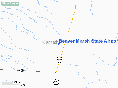
Beaver Marsh, Oregon |
| Elevation AMSL |
4,638 ft / 1,414 m |
| Coordinates |
43°07′44″N 121°49′04″W / 43.12889°N 121.81778°W / 43.12889; -121.81778 |
| Runways |
| Direction |
Length |
Surface |
| ft |
m |
| 18/36 |
4,500 |
1,372 |
Dirt |
| Statistics (2005) |
| Aircraft operations |
150 |
| Source: Federal Aviation Administration |
Beaver Marsh Airport (FAA LID: 2S2), formerly Beaver Marsh State Airport, is a public airport located one mile (1.6 km) southwest of the central business district of Beaver Marsh, in Klamath County, Oregon, United States. This airport is privately owned by E. Denton Talbert.
Facilities
Beaver Marsh Airport covers an area of 46 acres (19 ha) which contains one runway:
- Runway 18/36: 4,500 x 60 ft (1,372 x 18 m), Surface: Dirt
For 12-month period ending 16 August 2005 the airport had 150 aircraft operations:
- 100% general aviation: 150
The above content comes from Wikipedia and is published under free licenses – click here to read more.
Location & QuickFacts
| FAA Information Effective: | 2008-09-25 |
| Airport Identifier: | 2S2 |
| Airport Status: | Operational |
| Longitude/Latitude: | 121-49-04.0850W/43-07-44.4680N
-121.817801/43.129019 (Estimated) |
| Elevation: | 4638 ft / 1413.66 m (Estimated) |
| Land: | 46 acres |
| From nearest city: | 1 nautical miles SW of Beaver Marsh, OR |
| Location: | Klamath County, OR |
| Magnetic Variation: | 18E (1985) |
Owner & Manager
| Ownership: | Privately owned |
| Owner: | E. Denton Talbert |
| Address: | Hc 30 Box 124
Chemult, OR 97731 |
| Phone number: | (541) 365-2310 |
| Manager: | E. Denton Talbert |
| Address: | Hc 30 Box 124
Chemult, OR 97731 |
| Phone number: | (541) 365-2310 |
Airport Operations and Facilities
| Airport Use: | Open to public |
| Wind indicator: | No |
| Segmented Circle: | No |
| Control Tower: | No |
| Landing fee charge: | No |
| Sectional chart: | Klamath Falls |
| Region: | ANM - Northwest Mountain |
| Traffic Pattern Alt: | 1000 ft |
| Boundary ARTCC: | ZSE - Seattle |
| Tie-in FSS: | MMV - Mc Minnville |
| FSS on Airport: | No |
| FSS Toll Free: | 1-800-WX-BRIEF |
| NOTAMs Facility: | MMV (NOTAM-d service avaliable) |
| Federal Agreements: | 2 |
Airport Communications
Airport Services
| Airframe Repair: | NONE |
| Power Plant Repair: | NONE |
| Bottled Oxygen: | NONE |
| Bulk Oxygen: | NONE |
Runway Information
Runway 18/36
| Dimension: | 4500 x 60 ft / 1371.6 x 18.3 m
15 FT RY WIDTH USBL IN CENTER. |
| Surface: | DIRT, Poor Condition
RY IS BECOMING OVERGROWN WITH 2-4 FT PINE TREES.
DIRT SURFACE LOOSE & POWDERY, CREATES CLOUDS OF DUST; LOOSE ROCKS ON SFC, ROUGH. |
| |
Runway 18 |
Runway 36 |
| Traffic Pattern: | Left | Left |
| Obstruction: | 55 ft trees, 1150.0 ft from runway, 21:1 slope to clear | 65 ft trees, 522.0 ft from runway, 8:1 slope to clear |
|
Radio Navigation Aids
| ID |
Type |
Name |
Ch |
Freq |
Var |
Dist |
Remarks
- CLSD WINTER MONTHS.
- ESTABLISHED PRIOR TO 1959.
Images and information placed above are from
http://www.airport-data.com/airport/2S2/
We thank them for the data!
| General Info
|
| Country |
United States
|
| State |
OREGON
|
| FAA ID |
2S2
|
| Latitude |
43-07-44.468N
|
| Longitude |
121-49-04.085W
|
| Elevation |
4638 feet
|
| Near City |
BEAVER MARSH
|
We don't guarantee the information is fresh and accurate. The data may
be wrong or outdated.
For more up-to-date information please refer to other sources.
|
|


