|
|
| Astoria Regional Airport |
 |
| IATA: AST – ICAO: KAST |
| Summary |
| Airport type |
Public |
| Operator |
Port of Astoria |
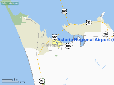
| Location |
Astoria, Oregon |
| Elevation AMSL |
15 ft / 4.6 m |
| Coordinates |
46°09′28.7000″N 123°52′43.3000″W / 46.157972°N 123.878694°W / 46.157972; -123.878694 |
| Website |
www.portofastoria.com |
| Runways |
| Direction |
Length |
Surface |
| ft |
m |
| 8/26 |
5796 |
1767 |
Asphalt |
| 13/31 |
4996 |
1523 |
Asphalt |
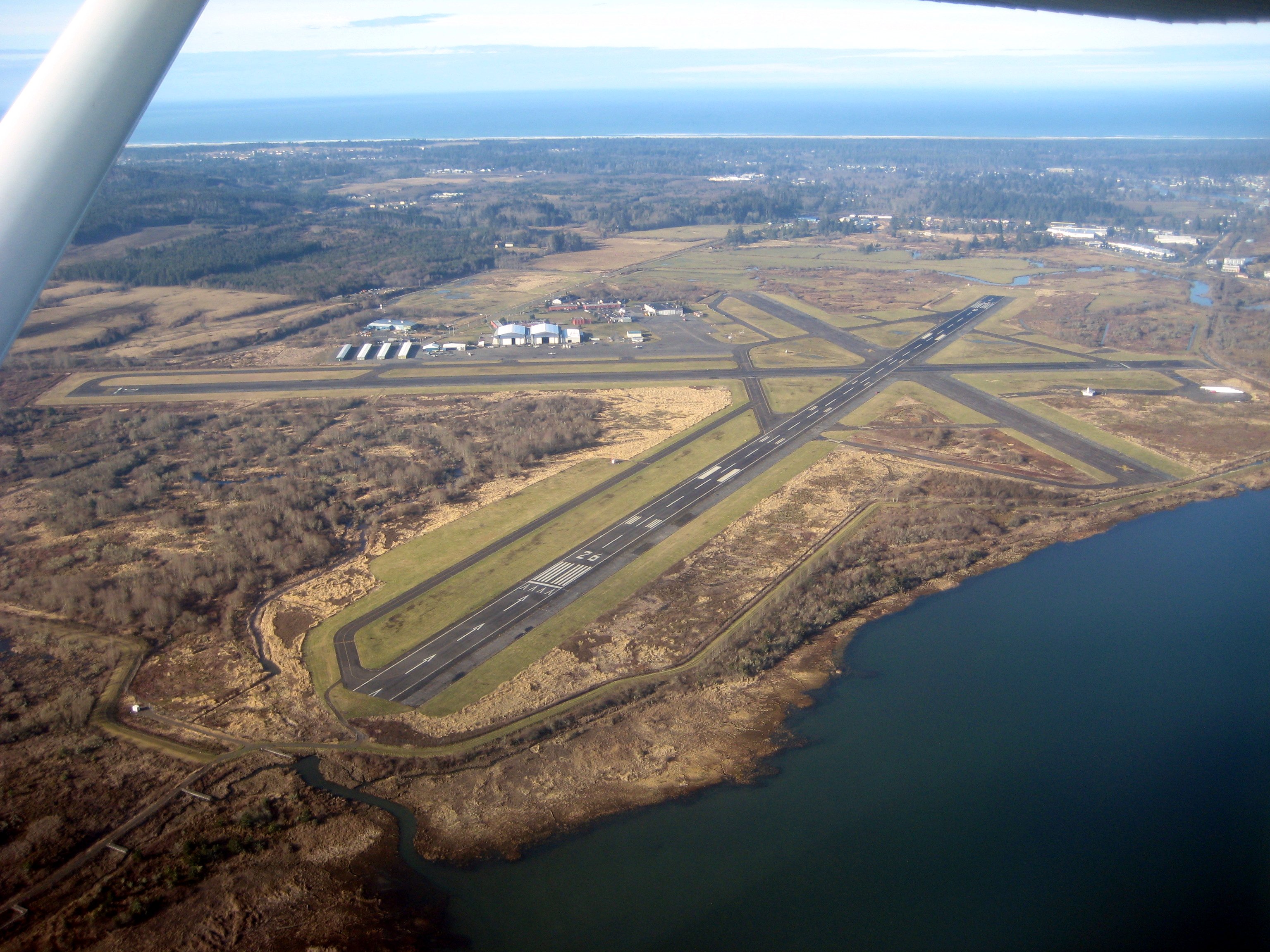
Astoria Regional Airport (IATA: AST, ICAO: KAST), is a public airport located three miles (4.8 km) southwest of the city of Astoria in Clatsop County, Oregon, United States. It is located in the adjacent city of Warrenton.
Airlines and destinations
| Airlines |
Destinations |
| SeaPort Airlines |
Portland International Airport |
The above content comes from Wikipedia and is published under free licenses – click here to read more.
 |
(Click on the photo to enlarge) |
Location & QuickFacts
| FAA Information Effective: | 2008-09-25 |
| Airport Identifier: | AST |
| Airport Status: | Operational |
| Longitude/Latitude: | 123-52-43.3000W/46-09-28.7000N
-123.878694/46.157972 (Estimated) |
| Elevation: | 15 ft / 4.57 m (Surveyed) |
| Land: | 870 acres |
| From nearest city: | 3 nautical miles SW of Astoria, OR |
| Location: | Clatsop County, OR |
| Magnetic Variation: | 19E (1990) |
Owner & Manager
| Ownership: | Publicly owned |
| Owner: | Port Of Astoria |
| Address: | 1 Portway
Astoria, OR 97103 |
| Phone number: | 503-325-4521 |
| Manager: | Ron Larsen |
| Address: | 422 Gateway, Suite 100
Astoria, OR 97103 |
| Phone number: | 503-325-4521 |
Airport Operations and Facilities
| Airport Use: | Open to public |
| Wind indicator: | Yes |
| Segmented Circle: | Yes |
| Control Tower: | No |
| Lighting Schedule: | DUSK-DAWN
ACTVT MIRL RY 08/26 & RY 13/31, MALSR RY 26 AND REIL RY 08 - CTAF. |
| Beacon Color: | Clear-Green (lighted land airport) |
| Landing fee charge: | No |
| Sectional chart: | Seattle |
| Region: | ANM - Northwest Mountain |
| Boundary ARTCC: | ZSE - Seattle |
| Tie-in FSS: | MMV - Mc Minnville |
| FSS on Airport: | No |
| FSS Toll Free: | 1-800-WX-BRIEF |
| NOTAMs Facility: | AST (NOTAM-d service avaliable) |
| Certification type/date: | I L U 06/1987 |
| Federal Agreements: | NGPY3 |
Airport Communications
| CTAF: | 122.800 |
| Unicom: | 122.800 |
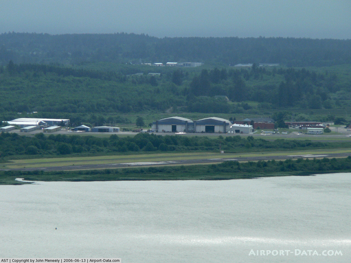
Airport Services
| Fuel available: | 100LLA |
| Airframe Repair: | MAJOR |
| Power Plant Repair: | MAJOR |
| Bottled Oxygen: | NONE |
| Bulk Oxygen: | NONE |
Runway Information
Runway 08/26
| Dimension: | 5796 x 100 ft / 1766.6 x 30.5 m |
| Surface: | ASPH, |
| Weight Limit: | Single wheel: 60000 lbs.
Dual wheel: 76000 lbs.
Dual tandem wheel: 119000 lbs. |
| Edge Lights: | Medium |
| |
Runway 08 |
Runway 26 |
| Longitude: | 123-53-23.0820W | 123-52-01.1430W |
| Latitude: | 46-09-35.3990N | 46-09-29.9260N |
| Elevation: | 12.00 ft | 11.00 ft |
| Alignment: | 95 | 127 |
| ILS Type: | | ILS
|
| Traffic Pattern: | Left | Left |
| Markings: | Non-precision instrument, Good Condition | Precision instrument, Good Condition |
| Crossing Height: | 51.00 ft | 0.00 ft |
| Displaced threshold: | 301.00 ft | 704.00 ft |
| VASI: | 4-box on left side | |
| Visual Glide Angle: | 3.00° | 0.00° |
| Approach lights: | | MALSR |
| Runway End Identifier: | Yes | |
| Obstruction: | 116 ft tree, 3100.0 ft from runway, 900 ft right of centerline, 25:1 slope to clear
+4 FT FENCE 0-200 FT FM RY END 315 FT R. | 5 ft dike, 200.0 ft from runway, 50 ft right of centerline
+4 FT LEVEE DIST 350 FT 500 FT R, +50:1 BASED ON DSPLCD THR.
+4 FT LEVEE 0-200 FT FM RY END 0-350 FT R. |
| Decleard distances: | Take off run available 5796.00 ft
Take off distance available 5796.00 ft
Actual stop distance available 5196.00 ft
Landing distance available 4896.00 ft
| Take off run available 5796.00 ft
Take off distance available 6096.00 ft
Actual stop distance available 5496.00 ft
Landing distance available 4782.00 ft
|
|
Runway 13/31
| Dimension: | 4996 x 100 ft / 1522.8 x 30.5 m |
| Surface: | ASPH, |
| Weight Limit: | Single wheel: 60000 lbs.
Dual wheel: 76000 lbs.
Dual tandem wheel: 119000 lbs. |
| Edge Lights: | Medium |
| |
Runway 13 |
Runway 31 |
| Longitude: | 123-53-00.4480W | 123-52-28.9200W |
| Latitude: | 46-09-46.2650N | 46-09-02.0790N |
| Elevation: | 11.00 ft | 15.00 ft |
| Alignment: | 127 | 127 |
| Traffic Pattern: | Left | Left |
| Markings: | Basic, Good Condition | Basic, Good Condition |
| Crossing Height: | 54.00 ft | 45.00 ft |
| Displaced threshold: | 329.00 ft | 0.00 ft |
| VASI: | 4-box on left side | 4-light PAPI on left side |
| Visual Glide Angle: | 3.00° | 4.00° |
| Runway End Identifier: | Yes | |
| Obstruction: | 5 ft berm, 200.0 ft from runway
APCH SLOPE 21:1 TO DSPLCD THR.
5 FT LEVEE 150 FT FROM RY END 250 FT L TO 250 FT R. | 80 ft trees, 1600.0 ft from runway, 15:1 slope to clear |
| Decleard distances: | Take off run available 4990.00 ft
Take off distance available 4990.00 ft
Actual stop distance available 4990.00 ft
Landing distance available 4990.00 ft
| Take off run available 4990.00 ft
Take off distance available 4990.00 ft
Actual stop distance available 4990.00 ft
Landing distance available 4990.00 ft
|
|
Radio Navigation Aids
| ID |
Type |
Name |
Ch |
Freq |
Var |
Dist |
| AST | FAN MARKER | Fort Stevens | | | 22E | 4.7 nm |
| PEN | NDB | Karpen | | 201.00 | 20E | 12.2 nm |
| LSO | NDB | Kelso | | 256.00 | 21E | 40.2 nm |
| PND | NDB | Banks | | 356.00 | 21E | 47.1 nm |
| TDO | NDB | Toledo | | 219.00 | 20E | 48.0 nm |
| AST | VOR/DME | Astoria | 087X | 114.00 | 19E | 0.2 nm |
| HQM | VORTAC | Hoquiam | 124X | 117.70 | 19E | 48.7 nm |
Remarks
- MIGRATORY FLOCKS OF WATERFOWL ON & INVOF ARPT.
- HIGH CONCENTRATION HEL OPNS IN AREA.
- HERDS OF ELK ON & INVOF ARPT OCNLY.
- ESTABD PRIOR TO 1959.
Images and information placed above are from
http://www.airport-data.com/airport/AST/
We thank them for the data!
| General Info
|
| Country |
United States
|
| State |
OREGON
|
| FAA ID |
AST
|
| Latitude |
46-09-28.700N
|
| Longitude |
123-52-43.300W
|
| Elevation |
15 feet
|
| Near City |
ASTORIA
|
We don't guarantee the information is fresh and accurate. The data may
be wrong or outdated.
For more up-to-date information please refer to other sources.
|
|