 |
|
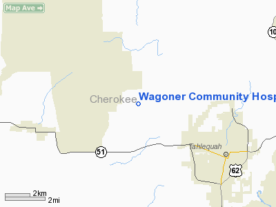
Wagoner Community Hospital Heliport |
Location & QuickFacts
| FAA Information Effective: | 2008-09-25 |
| Airport Identifier: | 87OK |
| Airport Status: | Operational |
| Longitude/Latitude: | 095-03-00.8480W/35-57-00.3380N
-95.050236/35.950094 (Estimated) |
| Elevation: | 650 ft / 198.12 m (Estimated) |
| Land: | 0 acres |
| From nearest city: | 1 nautical miles W of Wagoner, OK |
| Location: | Wagoner County, OK |
| Magnetic Variation: | 04E (2000) |
Owner & Manager
| Ownership: | Privately owned |
| Owner: | Wagoner Community Hospital |
| Address: | 1200 West Cherokee
Wagoner, OK 74467 |
| Phone number: | 918-485-5514 |
| Manager: | Raymond E Moore
PLANT OPERATIONS SUPERVISOR |
| Address: | 1200 West Cherokee
Wagoner, OK 74467 |
| Phone number: | 918-232-2252 |
Airport Operations and Facilities
| Airport Use: | Private
MEDICAL. |
| Wind indicator: | Yes |
| Segmented Circle: | No |
| Control Tower: | No |
| Lighting Schedule: | PHONE REQ
FOR PERIMETER LGTS CALL 918-485-5514. |
| Sectional chart: | Dallas-ft Worth |
| Region: | ASW - Southwest |
| Boundary ARTCC: | ZME - Memphis |
| Tie-in FSS: | MLC - Mc Alester |
| FSS Toll Free: | 1-800-WX-BRIEF |
Runway Information
Helipad H1
| Dimension: | 30 x 30 ft / 9.1 x 9.1 m |
| Surface: | CONC, |
| |
Runway H1 |
Runway |
| Traffic Pattern: | Left | Left |
|
Radio Navigation Aids
| ID |
Type |
Name |
Ch |
Freq |
Var |
Dist |
| TQH | NDB | Tahlequah | | 215.00 | 05E | 2.6 nm |
| MKO | NDB | Muskogee | | 306.00 | 06E | 24.3 nm |
| SLG | NDB | Siloam Springs | | 284.00 | 04E | 30.8 nm |
| IQS | NDB | Sallisaw | | 520.00 | 05E | 35.4 nm |
| DW | NDB | Owaso | | 375.00 | 06E | 45.4 nm |
| MEE | VOR | Davis | | 108.60 | 06E | 23.2 nm |
| DAK | VOR/DME | Drake | 025X | 108.80 | 07E | 41.8 nm |
| OKM | VOR/DME | Okmulgee | 096X | 114.90 | 08E | 42.7 nm |
| GNP | VOR/DME | Glenpool | 043X | 110.60 | 06E | 44.7 nm |
| TUL | VORTAC | Tulsa | 091X | 114.40 | 08E | 38.8 nm |
| RZC | VORTAC | Razorback | 111X | 116.40 | 04E | 48.5 nm |
| TUL | VOT | Tulsa Intl | | 109.00 | | 38.8 nm |
Images and information placed above are from
http://www.airport-data.com/airport/87OK/
We thank them for the data!
| General Info
|
| Country |
United States
|
| State |
OKLAHOMA
|
| FAA ID |
87OK
|
| Latitude |
35-57-00.338N
|
| Longitude |
095-03-00.848W
|
| Elevation |
650 feet
|
| Near City |
WAGONER
|
We don't guarantee the information is fresh and accurate. The data may
be wrong or outdated.
For more up-to-date information please refer to other sources.
|
|


