 |
|
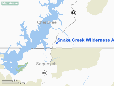
Snake Creek Wilderness Airport |
Location & QuickFacts
| FAA Information Effective: | 2008-09-25 |
| Airport Identifier: | OK06 |
| Airport Status: | Operational |
| Longitude/Latitude: | 094-57-00.0000W/35-38-52.0000N
-94.950000/35.647778 (Estimated) |
| Elevation: | 1130 ft / 344.42 m (Estimated) |
| Land: | 1500 acres |
| From nearest city: | 3 nautical miles S of Cookson, OK |
| Location: | Cherokee County, OK |
| Magnetic Variation: | () |
Owner & Manager
| Ownership: | Privately owned |
| Owner: | Veraman Davis |
| Address: | 19577 E. Wilderness
Cookson, OK 74427 |
| Phone number: | 918-457-5750 |
| Manager: | Wayne Thomas |
| Address: | 19757 E. Wilderness
Cookson, OK 74427 |
| Phone number: | 918-457-3444 |
Airport Operations and Facilities
| Airport Use: | Private |
| Wind indicator: | Yes |
| Control Tower: | No |
| Sectional chart: | Memphis |
| Region: | ASW - Southwest |
| Boundary ARTCC: | ZME - Memphis |
| Tie-in FSS: | MLC - Mc Alester |
| FSS Toll Free: | 1-800-WX-BRIEF |
Airport Communications
Runway Information
Runway 03/21
| Dimension: | 2840 x 50 ft / 865.6 x 15.2 m |
| Surface: | ASPH, |
| |
Runway 03 |
Runway 21 |
| Traffic Pattern: | Left | Left |
| Obstruction: | 50 ft trees, 500.0 ft from runway | 50 ft trees, 500.0 ft from runway |
|
Radio Navigation Aids
| ID |
Type |
Name |
Ch |
Freq |
Var |
Dist |
| MKO | NDB | Muskogee | | 306.00 | 06E | 16.8 nm |
| IQS | NDB | Sallisaw | | 520.00 | 05E | 16.8 nm |
| TQH | NDB | Tahlequah | | 215.00 | 05E | 17.0 nm |
| SLG | NDB | Siloam Springs | | 284.00 | 04E | 39.5 nm |
| MEE | VOR | Davis | | 108.60 | 06E | 20.4 nm |
| DAK | VOR/DME | Drake | 025X | 108.80 | 07E | 43.7 nm |
| OKM | VOR/DME | Okmulgee | 096X | 114.90 | 08E | 44.8 nm |
| FSM | VORTAC | Fort Smith | 041X | 110.40 | 07E | 36.7 nm |
Remarks
Images and information placed above are from
http://www.airport-data.com/airport/OK06/
We thank them for the data!
|
|


