 |
|
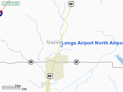
Longs Airport North Airport |
Location & QuickFacts
| FAA Information Effective: | 2008-09-25 |
| Airport Identifier: | OK21 |
| Airport Status: | Operational |
| Longitude/Latitude: | 095-18-15.8880W/36-20-00.3360N
-95.304413/36.333427 (Estimated) |
| Elevation: | 650 ft / 198.12 m (Estimated) |
| Land: | 70 acres |
| From nearest city: | 2 nautical miles NE of Pryor, OK |
| Location: | Mayes County, OK |
| Magnetic Variation: | 06E (1985) |
Owner & Manager
| Ownership: | Privately owned |
| Owner: | Purnell & Mitchell |
| Address: |
|
| Manager: | Imogene Long |
| Address: | Star Route 1, Box 114cc
Pryor, OK 74361 |
| Phone number: | 918-825-2051
OR 918-434-5571 |
Airport Operations and Facilities
| Airport Use: | Private |
| Wind indicator: | Yes |
| Segmented Circle: | No |
| Control Tower: | No |
| Landing fee charge: | No |
| Sectional chart: | Kansas City |
| Region: | ASW - Southwest |
| Boundary ARTCC: | ZKC - Kansas City |
| Tie-in FSS: | MLC - Mc Alester |
| FSS on Airport: | No |
| FSS Toll Free: | 1-800-WX-BRIEF |
Airport Services
| Airframe Repair: | NONE |
| Power Plant Repair: | NONE |
Runway Information
Runway 17/35
| Dimension: | 1900 x 200 ft / 579.1 x 61.0 m |
| Surface: | TURF, |
| |
Runway 17 |
Runway 35 |
| Traffic Pattern: | Right | Right |
| Runway End Identifier: | No | No |
| Centerline Lights: | No | No |
| Touchdown Lights: | No | No |
|
Radio Navigation Aids
| ID |
Type |
Name |
Ch |
Freq |
Var |
Dist |
| DW | NDB | Owaso | | 375.00 | 06E | 27.7 nm |
| TQH | NDB | Tahlequah | | 215.00 | 05E | 28.4 nm |
| SLG | NDB | Siloam Springs | | 284.00 | 04E | 40.5 nm |
| OWP | NDB | William Pogue | | 362.00 | 06E | 42.3 nm |
| MKO | NDB | Muskogee | | 306.00 | 06E | 44.4 nm |
| CFV | NDB | Coffeyville | | 212.00 | 05E | 47.4 nm |
| MEE | VOR | Davis | | 108.60 | 06E | 40.4 nm |
| GNP | VOR/DME | Glenpool | 043X | 110.60 | 06E | 40.7 nm |
| BVO | VOR/DME | Bartlesville | 126X | 117.90 | 08E | 45.8 nm |
| OKM | VOR/DME | Okmulgee | 096X | 114.90 | 08E | 47.2 nm |
| TUL | VORTAC | Tulsa | 091X | 114.40 | 08E | 24.8 nm |
| OSW | VORTAC | Oswego | 123X | 117.60 | 08E | 49.8 nm |
| TUL | VOT | Tulsa Intl | | 109.00 | | 24.8 nm |
Remarks
- AIRPORT EXISTED PRIOR TO 1959.
Images and information placed above are from
http://www.airport-data.com/airport/OK21/
We thank them for the data!
| General Info
|
| Country |
United States
|
| State |
OKLAHOMA
|
| FAA ID |
OK21
|
| Latitude |
36-20-00.336N
|
| Longitude |
095-18-15.888W
|
| Elevation |
650 feet
|
| Near City |
PRYOR
|
We don't guarantee the information is fresh and accurate. The data may
be wrong or outdated.
For more up-to-date information please refer to other sources.
|
|


