 |
|
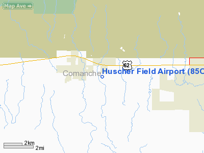
Location & QuickFacts
| FAA Information Effective: | 2008-09-25 |
| Airport Identifier: | 85OL |
| Airport Status: | Operational |
| Longitude/Latitude: | 098-35-44.2210W/34-37-10.2610N
-98.595617/34.619517 (Estimated) |
| Elevation: | 1242 ft / 378.56 m (Estimated) |
| Land: | 160 acres |
| From nearest city: | 2 nautical miles SE of Cache, OK |
| Location: | Comanche County, OK |
| Magnetic Variation: | 07E (1985) |
Owner & Manager
| Ownership: | Privately owned |
| Owner: | Duane L. Huscher |
| Address: | 572 N.w. Airport Rd
Cache, OK 73527 |
| Phone number: | 580-429-8714 |
| Manager: | Harvey G. Byrd |
| Address: | 572 N.w. Airport Rd
Cache, OK 73527 |
| Phone number: | 580-429-8714 |
Airport Operations and Facilities
| Airport Use: | Private |
| Wind indicator: | Yes |
| Segmented Circle: | No |
| Control Tower: | No |
| Landing fee charge: | No |
| Sectional chart: | Dallas-ft Worth |
| Region: | ASW - Southwest |
| Boundary ARTCC: | ZFW - Fort Worth |
| Tie-in FSS: | MLC - Mc Alester |
| FSS on Airport: | No |
| FSS Toll Free: | 1-800-WX-BRIEF |
Airport Services
Runway Information
Runway 08/26
| Dimension: | 1430 x 50 ft / 435.9 x 15.2 m |
| Surface: | TURF, Fair Condition
NORTH END RUTTED. |
| |
Runway 08 |
Runway 26 |
| Traffic Pattern: | Left | Left |
| Obstruction: | 15 ft road, 10.0 ft from runway | 4 ft fence, 0.0 ft from runway |
|
Runway 12/30
| Dimension: | 2000 x 55 ft / 609.6 x 16.8 m |
| Surface: | TURF, Fair Condition
NORTH END RUTTED. |
| |
Runway 12 |
Runway 30 |
| Traffic Pattern: | Left | Left |
| Obstruction: | 15 ft road, 10.0 ft from runway | 4 ft fence, 0.0 ft from runway |
|
Runway 17/35
| Dimension: | 2065 x 120 ft / 629.4 x 36.6 m |
| Surface: | TURF, Fair Condition
NORTH END RUTTED. |
| |
Runway 17 |
Runway 35 |
| Traffic Pattern: | Left | Left |
| Obstruction: | 4 ft fence | 10 ft road, 15.0 ft from runway, 1:1 slope to clear |
|
Radio Navigation Aids
| ID |
Type |
Name |
Ch |
Freq |
Var |
Dist |
| FSI | FAN MARKER | Trail | | | 09E | 13.6 nm |
| PFL | NDB | Post | | 308.00 | 08E | 9.5 nm |
| OFZ | NDB | Trail | | 388.00 | 09E | 13.6 nm |
| VRT | NDB | Wilbarger | | 230.00 | 08E | 41.3 nm |
| OLR | NDB | Chickasha | | 290.00 | 07E | 42.4 nm |
| SHP | TACAN | Sheppard | 045X | | 10E | 38.7 nm |
| LAW | VOR/DME | Lawton | 031X | 109.40 | 09E | 11.7 nm |
| DUC | VOR/DME | Duncan | 047X | 111.00 | 09E | 36.5 nm |
| HBR | VORTAC | Hobart | 055X | 111.80 | 10E | 27.5 nm |
| LTS | VORTAC | Altus | 035X | 109.80 | 08E | 33.5 nm |
| SPS | VORTAC | Wichita Falls | 074X | 112.70 | 10E | 38.0 nm |
| BFV | VORTAC | Burns Flat | 037X | 110.00 | 08E | 47.8 nm |
Remarks
- CTN: HIGH LINES NORTH OF AIRPORT.
- EXISTED PRIOR TO 1959.
Images and information placed above are from
http://www.airport-data.com/airport/85OL/
We thank them for the data!
| General Info
|
| Country |
United States
|
| State |
OKLAHOMA
|
| FAA ID |
85OL
|
| Latitude |
34-37-10.261N
|
| Longitude |
098-35-44.221W
|
| Elevation |
1242 feet
|
| Near City |
CACHE
|
We don't guarantee the information is fresh and accurate. The data may
be wrong or outdated.
For more up-to-date information please refer to other sources.
|
|


