|
|
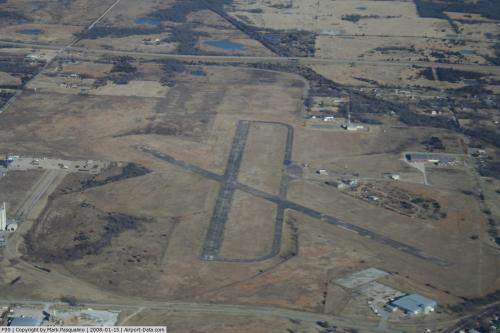 |
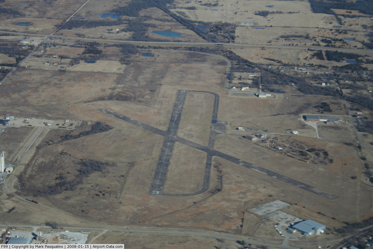
(Click on the photo to enlarge) |
Location & QuickFacts
| FAA Information Effective: | 2008-09-25 |
| Airport Identifier: | F99 |
| Airport Status: | Operational |
| Longitude/Latitude: | 096-25-00.0000W/35-05-09.1000N
-96.416667/35.085861 (Estimated) |
| Elevation: | 861 ft / 262.43 m (Surveyed) |
| Land: | 355 acres |
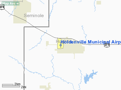
| From nearest city: | 1 nautical miles NW of Holdenville, OK |
| Location: | Hughes County, OK |
| Magnetic Variation: | 06E (1995) |
Owner & Manager
| Ownership: | Publicly owned |
| Owner: | City Of Holdenville |
| Address: | 100 N. Creek
Holdenville, OK 74848 |
| Phone number: | 405-379-3397 |
| Manager: | Clyde Byerly |
| Address: | Po Box 789, 100 N. Creek
Holdenville, OK 74848 |
| Phone number: | 405-379-9044 |
Airport Operations and Facilities
| Airport Use: | Open to public |
| Wind indicator: | Yes |
| Segmented Circle: | Yes |
| Control Tower: | No |
| Lighting Schedule: | DUSK-DAWN |
| Beacon Color: | Clear-Green (lighted land airport) |
| Landing fee charge: | No |
| Sectional chart: | Dallas-ft Worth |
| Region: | ASW - Southwest |
| Boundary ARTCC: | ZFW - Fort Worth |
| Tie-in FSS: | MLC - Mc Alester |
| FSS on Airport: | No |
| FSS Toll Free: | 1-800-WX-BRIEF |
| NOTAMs Facility: | MLC (NOTAM-d service avaliable) |
| Federal Agreements: | NGY3 |
Airport Communications
| CTAF: | 122.800 |
| Unicom: | 122.800 |
Airport Services
| Fuel available: | 100LL |
| Bottled Oxygen: | NONE |
| Bulk Oxygen: | NONE |
Runway Information
Runway 17/35
| Dimension: | 3251 x 100 ft / 990.9 x 30.5 m |
| Surface: | CONC, Poor Condition
RY SEVERE CRACKING AND DETERIORATION. |
| Weight Limit: | Single wheel: 30000 lbs.
Dual wheel: 42000 lbs. |
| Edge Lights: | Medium |
| |
Runway 17 |
Runway 35 |
| Longitude: | 096-24-59.9914W | 096-24-59.9753W |
| Latitude: | 35-05-25.1930N | 35-04-53.0409N |
| Elevation: | 861.00 ft | 856.00 ft |
| Alignment: | 127 | 127 |
| Traffic Pattern: | Left | Left |
| Markings: | Basic, Fair Condition | Basic, Fair Condition |
| Obstruction: | , 50:1 slope to clear | 40 ft pline, 712.0 ft from runway, 12:1 slope to clear |
|
Radio Navigation Aids
| ID |
Type |
Name |
Ch |
Freq |
Var |
Dist |
| HDL | NDB | Holdenville | | 411.00 | 06E | 0.2 nm |
| SRE | NDB | Seminole | | 278.00 | 06E | 16.9 nm |
| HET | NDB | Henryetta | | 267.00 | 04E | 27.5 nm |
| GGU | NDB | Prague | | 314.00 | 06E | 29.8 nm |
| TZO | NDB | Bristow | | 251.00 | 05E | 41.1 nm |
| CQB | NDB | Tilghman | | 396.00 | 06E | 43.0 nm |
| PVJ | NDB | Pauls Valley | | 384.00 | 06E | 45.8 nm |
| ADH | VOR/DME | Ada | 125X | 117.80 | 06E | 21.1 nm |
| OKM | VOR/DME | Okmulgee | 096X | 114.90 | 08E | 45.4 nm |
| MLC | VORTAC | Mc Alester | 057X | 112.00 | 08E | 34.3 nm |
Remarks
- 125 FT AGL SILO .3 NM W RY 35 THLD.
- ULTRALIGHTS ON & INVOF ARPT.
- ESTB.PRIOR TO 1959.
Images and information placed above are from
http://www.airport-data.com/airport/F99/
We thank them for the data!
| General Info
|
| Country |
United States
|
| State |
OKLAHOMA
|
| FAA ID |
F99
|
| Latitude |
35-05-09.150N
|
| Longitude |
096-25-00.000W
|
| Elevation |
860 feet
|
| Near City |
HOLDENVILLE
|
We don't guarantee the information is fresh and accurate. The data may
be wrong or outdated.
For more up-to-date information please refer to other sources.
|
|