|
 |
|
||||
|
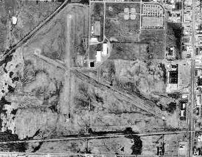
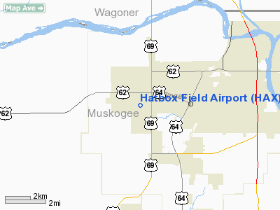
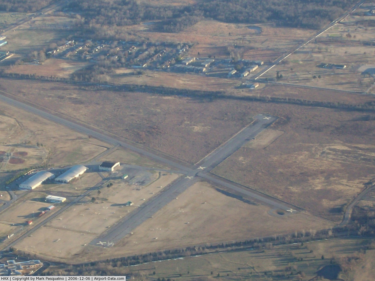
Hatbox Field (IATA: HAX, ICAO: KHAX, FAA LID: HAX) is a closed airfield located within city limits, two nautical miles (3.7 km) west of central Muskogee, a city in Muskogee County, Oklahoma, United States. It was opened sometime in the early 1920s and was closed in 2000. It is presently the location of the Love-Hatbox Sports Complex, a large recreation center and waterpark. The former airfield site includes 10 lighted baseball fields‚ eight lighted softball diamonds‚ two full-size football fields and a 30-acre‚ 19-field soccer area called the Georgia Pacific Soccer Complex. In addition‚ a 3.1-mile (5K) asphalt Centennial Trail walking/biking exercise pathway loops around the 120 acres‚ and a former airplane hangar houses three indoor batting cages. A local model airplane club hosts two annual events at Love-Hatbox that attract flying enthusiasts from around the country. HistoryHatbox Field was depicted on the 1929 Rand McNally "Standard Indexed Map with Air Trails of OK" as a public airport with a radio station. The airfield was Muskogee's original municipal airport, and is a very historic airfield. It is one of the airports that the Douglas aircraft of the Army's 1924 Around the World Flight stopped, and was a stop on the Army's mail route. In 1929, the airfield was described as a municipal airport, operated by the Army Air Corps, and having a beacon light. Charles Lindbergh was on hand for the dedication. The Spartan Aviation School opened at the field in 1940. They used the 2 large arch-roofed hangars at Hatbox. Renamed Muskogee Army Airfield during World War II, Spartan provided primary flight training to cadets as an Army Air Forces contract flying school until 1944. The USAAF 410th Bombardment Group trained at the airfield with Douglas A-20 Havocs in the fall of 1943 before being reassigned to the Ninth Air Force in England, where they flew Martin B-26 Marauders. Following the end of its military use, Hatbox was reused as a purely civil airfield. The operator was listed as the City of Muskogee. The city of Muskogee decided to close the field to the public following a two-fatality crash in 1998. Limited aviation use was allowed until 2000, however, by a private firm that refurbished military-surplus Beechcraft U-21 Utes. Hatbox was closed completely in 2000, and the refurbishing company moved to nearby Muskogee Davis Field. FacilitiesHatbox Field covered an area of 434 acres (176 ha) at an elevation of 627 feet (191 m) above mean sea level. It had one runway designated 11/29 with an asphalt surface measuring 3,800 by 50 feet (1,158 x 15 m). The above content comes from Wikipedia and is published under free licenses – click here to read more.
Location & QuickFacts
Owner & Manager
Airport Operations and Facilities
Airport Communications
Runway InformationRunway 11/29
Radio Navigation Aids
Remarks
Images and information placed above are from We thank them for the data!
We don't guarantee the information is fresh and accurate. The data may
be wrong or outdated.
|
|||||||||||||||||||||||||||||||||||||||||||||||||||||||||||||||||||||||||||||||||||||||||||||||||||||||||||||||||||||||||||||||||||||||||||||||||||||||||||||||||||||||||||||||||||||||||||||||||||||||||||||||||||||||||||||||||||||||||||||||||||||||||||||||||||||||||||||||||||||

 |
|
Copyright 2004-2026 © by Airports-Worldwide.com, Vyshenskoho st. 36, Lviv 79010, Ukraine Legal Disclaimer |