 |
|
Location & QuickFacts
| FAA Information Effective: | 2008-09-25 |
| Airport Identifier: | OK51 |
| Airport Status: | Operational |
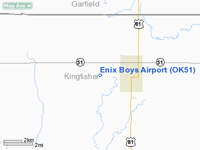
| Longitude/Latitude: | 097-56-13.2060W/36-06-15.1360N
-97.937002/36.104204 (Estimated) |
| Elevation: | 1100 ft / 335.28 m (Estimated) |
| Land: | 8 acres |
| From nearest city: | 2 nautical miles W of Hennessey, OK |
| Location: | Kingfisher County, OK |
| Magnetic Variation: | 07E (1985) |
Owner & Manager
| Ownership: | Privately owned |
| Owner: | Lee Enix |
| Address: | 107 S Main
Hennessey, OK 73742 |
| Phone number: | 405-853-4841 |
| Manager: | Lee Enix |
| Address: | Rt 1 Box 9e
Hennessey, OK 73742 |
| Phone number: | 405-853-4841 |
Airport Operations and Facilities
| Airport Use: | Private |
| Wind indicator: | Yes |
| Segmented Circle: | No |
| Control Tower: | No |
| Landing fee charge: | No |
| Sectional chart: | Wichita |
| Region: | ASW - Southwest |
| Boundary ARTCC: | ZKC - Kansas City |
| Tie-in FSS: | MLC - Mc Alester |
| FSS on Airport: | No |
| FSS Toll Free: | 1-800-WX-BRIEF |
Airport Services
Runway Information
Runway 18/36
| Dimension: | 2565 x 10 ft / 781.8 x 3.0 m |
| Surface: | ASPH, Poor Condition
RY CRACKING; LOOSE GRVL & GRASS ENCROACHMENT. RY EXTREMELY ROUGH. |
| |
Runway 18 |
Runway 36 |
| Traffic Pattern: | Left | Left |
| Obstruction: | , 50:1 slope to clear
MKD 4' FENCE 30' FROM RY END; 2' ELECTRIC FENCE ADJACENT TO RY THR. | 76 ft trees, 285.0 ft from runway, 100 ft right of centerline, 1:1 slope to clear
25' MKD PLINE 60' FM RY END. |
|
Radio Navigation Aids
| ID |
Type |
Name |
Ch |
Freq |
Var |
Dist |
| JWG | NDB | Watonga | | 359.00 | 07E | 27.9 nm |
| FAU | NDB | Fairview | | 246.00 | 07E | 28.4 nm |
| LCY | NDB | Logan County | | 326.00 | 07E | 29.7 nm |
| RQO | NDB | El Reno | | 335.00 | 07E | 37.8 nm |
| OK | NDB | Tuloo | | 406.00 | 07E | 41.3 nm |
| OJA | NDB | Weatherford | | 272.00 | 07E | 49.7 nm |
| TIK | TACAN | Tinker | 105X | | 07E | 48.5 nm |
| ODG | VOR/DME | Woodring | 027X | 109.00 | 08E | 17.7 nm |
| PWA | VOR/DME | Wiley Post | 081X | 113.40 | 08E | 37.1 nm |
| SWO | VOR/DME | Stillwater | 021X | 108.40 | 07E | 42.1 nm |
| END | VORTAC | Vance | 101X | 115.40 | 09E | 14.5 nm |
| IFI | VORTAC | Kingfisher | 094X | 114.70 | 09E | 18.3 nm |
| IRW | VORTAC | Will Rogers | 088X | 114.10 | 07E | 47.6 nm |
| OKC | VOT | Oklahoma Will Rgs W | | 108.80 | | 45.8 nm |
Images and information placed above are from
http://www.airport-data.com/airport/OK51/
We thank them for the data!
| General Info
|
| Country |
United States
|
| State |
OKLAHOMA
|
| FAA ID |
OK51
|
| Latitude |
36-06-15.136N
|
| Longitude |
097-56-13.206W
|
| Elevation |
1100 feet
|
| Near City |
HENNESSEY
|
We don't guarantee the information is fresh and accurate. The data may
be wrong or outdated.
For more up-to-date information please refer to other sources.
|
|


