 |
|
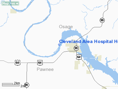
Cleveland Area Hospital Heliport |
Location & QuickFacts
| FAA Information Effective: | 2008-09-25 |
| Airport Identifier: | 8OK3 |
| Airport Status: | Operational |
| Longitude/Latitude: | 096-30-01.0860W/36-19-00.2400N
-96.500302/36.316733 (Estimated) |
| Elevation: | 960 ft / 292.61 m (Estimated) |
| Land: | 0 acres |
| From nearest city: | 0 nautical miles W of Cleveland, OK |
| Location: | Pawnee County, OK |
| Magnetic Variation: | 06E (1985) |
Owner & Manager
| Ownership: | Publicly owned |
| Owner: | Cleveland Area Hospital |
| Address: | 1401 W Pawnee
Cleveland, OK 74020 |
| Phone number: | 918-358-2501 |
| Manager: | Jim Clough |
| Address: | 1401 W Pawnee
Cleveland, OK 74020 |
| Phone number: | 918-358-2501
EXT: 106 |
Airport Operations and Facilities
| Airport Use: | Private
MEDICAL. |
| Wind indicator: | Yes |
| Segmented Circle: | No |
| Control Tower: | No |
| Lighting Schedule: | PHONE REQ
FOR FLOOD LGTS CALL 918-358-2501 |
| Landing fee charge: | No |
| Sectional chart: | Kansas City |
| Region: | ASW - Southwest |
| Boundary ARTCC: | ZKC - Kansas City |
| Tie-in FSS: | MLC - Mc Alester |
| FSS on Airport: | No |
| FSS Toll Free: | 1-800-WX-BRIEF |
Runway Information
Helipad H1
| Dimension: | 30 x 25 ft / 9.1 x 7.6 m |
| Surface: | CONC, |
| |
Runway H1 |
Runway |
| Traffic Pattern: | Left | Left |
|
Radio Navigation Aids
| ID |
Type |
Name |
Ch |
Freq |
Var |
Dist |
| OWP | NDB | William Pogue | | 362.00 | 06E | 18.9 nm |
| CUH | NDB | Cushing | | 242.00 | 05E | 28.9 nm |
| DW | NDB | Owaso | | 375.00 | 06E | 30.3 nm |
| TZO | NDB | Bristow | | 251.00 | 05E | 33.1 nm |
| CQB | NDB | Tilghman | | 396.00 | 06E | 38.9 nm |
| PN | NDB | Ponca | | 515.00 | 05E | 42.1 nm |
| GGU | NDB | Prague | | 314.00 | 06E | 49.2 nm |
| SWO | VOR/DME | Stillwater | 021X | 108.40 | 07E | 28.7 nm |
| GNP | VOR/DME | Glenpool | 043X | 110.60 | 06E | 35.1 nm |
| BVO | VOR/DME | Bartlesville | 126X | 117.90 | 08E | 38.8 nm |
| OKM | VOR/DME | Okmulgee | 096X | 114.90 | 08E | 48.5 nm |
| TUL | VORTAC | Tulsa | 091X | 114.40 | 08E | 35.3 nm |
| PER | VORTAC | Pioneer | 079X | 113.20 | 06E | 41.0 nm |
| TUL | VOT | Tulsa Intl | | 109.00 | | 35.3 nm |
Remarks
- PRVDD LNDG AREA LGTS ARE ILLUMINATED DURG ALL NIGHT OPNS.
Images and information placed above are from
http://www.airport-data.com/airport/8OK3/
We thank them for the data!
| General Info
|
| Country |
United States
|
| State |
OKLAHOMA
|
| FAA ID |
8OK3
|
| Latitude |
36-19-00.240N
|
| Longitude |
096-30-01.086W
|
| Elevation |
960 feet
|
| Near City |
CLEVELAND
|
We don't guarantee the information is fresh and accurate. The data may
be wrong or outdated.
For more up-to-date information please refer to other sources.
|
|


