 |
|
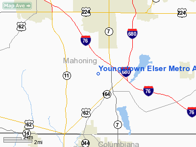
Youngstown Elser Metro Airport |
Location & QuickFacts
| FAA Information Effective: | 2008-09-25 |
| Airport Identifier: | 4G4 |
| Airport Status: | Operational |
| Longitude/Latitude: | 080-40-38.3750W/40-57-42.4630N
-80.677326/40.961795 (Estimated) |
| Elevation: | 1070 ft / 326.14 m (Surveyed) |
| Land: | 60 acres |
| From nearest city: | 7 nautical miles SW of Youngstown, OH |
| Location: | Mahoning County, OH |
| Magnetic Variation: | 08W (2000) |
Owner & Manager
| Ownership: | Privately owned |
| Owner: | Michael E. Stanko |
| Address: | 508 Robinson Road
Campbell, OH 44405 |
| Phone number: | 330-549-0337 |
| Manager: | Michael E. Stanko |
| Address: | 10800 Sharott Road
North Lima, OH 44452 |
| Phone number: | 330-549-0337 |
Airport Operations and Facilities
| Airport Use: | Open to public |
| Wind indicator: | Yes |
| Segmented Circle: | No |
| Control Tower: | No |
| Lighting Schedule: | DUSK-DAWN |
| Beacon Color: | Clear-Green (lighted land airport) |
| Landing fee charge: | No |
| Sectional chart: | Detroit |
| Region: | AGL - Great Lakes |
| Boundary ARTCC: | ZOB - Cleveland |
| Tie-in FSS: | CLE - Cleveland |
| FSS on Airport: | No |
| FSS Toll Free: | 1-800-WX-BRIEF |
| NOTAMs Facility: | CLE (NOTAM-d service avaliable) |
Airport Communications
| CTAF: | 123.050 |
| Unicom: | 123.050 |
Airport Services
| Fuel available: | 100LLA |
| Airframe Repair: | MAJOR |
| Power Plant Repair: | MAJOR |
| Bottled Oxygen: | NONE |
| Bulk Oxygen: | HIGH/LOW |
Runway Information
Runway 10/28
| Dimension: | 4012 x 50 ft / 1222.9 x 15.2 m |
| Surface: | ASPH, Good Condition |
| Edge Lights: | Medium |
| |
Runway 10 |
Runway 28 |
| Longitude: | 080-41-04.5920W | 080-40-12.3000W |
| Latitude: | 40-57-42.2090N | 40-57-41.9010N |
| Elevation: | 1012.00 ft | 1070.00 ft |
| Alignment: | 90 | 127 |
| Traffic Pattern: | Left | Left |
| Markings: | Non-precision instrument, Fair Condition | Non-precision instrument, Fair Condition |
| Displaced threshold: | 348.00 ft | 259.00 ft |
| VASI: | 2-light PAPI on left side | 2-light PAPI on left side
RY 28 PAPI OTS INDEFLY. |
| Visual Glide Angle: | 0.00° | 3.75° |
| Runway End Identifier: | Yes | Yes |
| Obstruction: | 59 ft trees, 273.0 ft from runway, 98 ft right of centerline, 1:1 slope to clear
RWY 10 APCH RATIO 0:1 TO DSPLCD THLD DUE TO +69 FT TREES 0 FT FM THLD 124 FT R.
RWY 10 +65' TREES 0'FR 125'L | 76 ft trees, 201.0 ft from runway, 231 ft left of centerline
APCH RATIO 0:1 TO DSPLCD THLD DUE TO +20 FT POWER LINE 0 FT FM DSPLCD THLD 177 FT R.
+18 FT ROAD 163 FT TO 200 FT FM RY END 125 FT L&R; +10 FT FENCE 140 FT FM RY END 125 FT R&L. |
|
Radio Navigation Aids
| ID |
Type |
Name |
Ch |
Freq |
Var |
Dist |
| UCP | NDB | Castle | | 272.00 | 09W | 12.4 nm |
| HBD | NDB | Hubbard | | 408.00 | 08W | 13.3 nm |
| TSO | NDB | Tolson | | 395.00 | 07W | 30.1 nm |
| AK | NDB | Akron | | 362.00 | 07W | 32.9 nm |
| CFX | NDB | Cadiz | | 239.00 | 07W | 46.2 nm |
| FKL | VOR | Franklin | | 109.60 | 06W | 46.9 nm |
| ACO | VOR/DME | Akron | 091X | 114.40 | 04W | 25.3 nm |
| BSV | VOR/DME | Briggs | 071X | 112.40 | 04W | 36.8 nm |
| CXR | VOR/DME | Chardon | 074X | 112.70 | 05W | 39.9 nm |
| HLG | VOR/DME | Wheeling | 059X | 112.20 | 07W | 42.5 nm |
| JFN | VOR/DME | Jefferson | 099X | 115.20 | 05W | 48.1 nm |
| YNG | VORTAC | Youngstown | 027X | 109.00 | 05W | 22.2 nm |
| EWC | VORTAC | Ellwood City | 105X | 115.80 | 08W | 22.7 nm |
| MMJ | VORTAC | Montour | 057X | 112.00 | 08W | 36.0 nm |
| CAK | VOT | Akron/canton Regional | | 110.60 | | 34.8 nm |
Remarks
- TWR 1085'AGL /2118'MSL/ LCTD 7-1/2 NM NNE.
- EXISTED PRIOR TO 1959.
Images and information placed above are from
http://www.airport-data.com/airport/4G4/
We thank them for the data!
| General Info
|
| Country |
United States
|
| State |
OHIO
|
| FAA ID |
4G4
|
| Latitude |
40-57-42.463N
|
| Longitude |
080-40-38.375W
|
| Elevation |
1070 feet
|
| Near City |
YOUNGSTOWN
|
We don't guarantee the information is fresh and accurate. The data may
be wrong or outdated.
For more up-to-date information please refer to other sources.
|
|


