 |
|
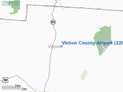
Location & QuickFacts
| FAA Information Effective: | 2008-09-25 |
| Airport Identifier: | 22I |
| Airport Status: | Operational |
| Longitude/Latitude: | 082-26-30.5580W/39-19-41.2500N
-82.441822/39.328125 (Estimated) |
| Elevation: | 958 ft / 292.00 m (Surveyed) |
| Land: | 55 acres |
| From nearest city: | 5 nautical miles NE of Mc Arthur, OH |
| Location: | Vinton County, OH |
| Magnetic Variation: | 05W (1985) |
Owner & Manager
| Ownership: | Publicly owned |
| Owner: | Vinton County |
| Address: | 100 E Main St
Mc Arthur, OH 45651 |
| Phone number: | 740-596-4571 |
| Manager: | Nick Rupert |
| Address: | Box 622
Welton, OH 45092 |
| Phone number: | 740-596-2588 |
Airport Operations and Facilities
| Airport Use: | Open to public |
| Wind indicator: | Yes |
| Segmented Circle: | No |
| Control Tower: | No |
| Lighting Schedule: | DUSK-DAWN
ACTVT MIRL RY 09/27 - 122.9. |
| Beacon Color: | Clear-Green (lighted land airport) |
| Landing fee charge: | No |
| Sectional chart: | Cincinnati |
| Region: | AGL - Great Lakes |
| Boundary ARTCC: | ZID - Indianapolis |
| Tie-in FSS: | DAY - Dayton |
| FSS on Airport: | No |
| FSS Toll Free: | 1-800-WX-BRIEF |
| NOTAMs Facility: | DAY (NOTAM-d service avaliable) |
| Federal Agreements: | N |
Airport Communications
| CTAF: | 122.800 |
| Unicom: | 122.800 |
Airport Services
| Fuel available: | 100LL
FOR FUEL CALL 740-357-0268 OR 740-596-0002. |
Runway Information
Runway 09/27
| Dimension: | 3725 x 75 ft / 1135.4 x 22.9 m |
| Surface: | ASPH, Good Condition |
| Edge Lights: | Medium |
| |
Runway 09 |
Runway 27 |
| Longitude: | 082-26-53.0285W | 082-26-06.5000W |
| Latitude: | 39-19-37.8458N | 39-19-44.8700N |
| Elevation: | 956.00 ft | 958.00 ft |
| Traffic Pattern: | Left | Left |
| Markings: | Basic, Fair Condition | Basic, Good Condition |
| VASI: | | 2-light PAPI on left side |
| Runway End Identifier: | No | No |
| Centerline Lights: | No | No |
| Touchdown Lights: | No | No |
| Obstruction: | 38 ft trees, 463.0 ft from runway, 97 ft left of centerline, 6:1 slope to clear | 80 ft trees, 1279.0 ft from runway, 231 ft right of centerline, 13:1 slope to clear
0-13 FT BRUSH 65 FT TO 200 FT FM RY 3ND 125 FT L/R. |
|
Radio Navigation Aids
| ID |
Type |
Name |
Ch |
Freq |
Var |
Dist |
| PKB | FAN MARKER | Marietta Ohio | | | 03W | 47.9 nm |
| AJY | FAN MARKER | Ashland | | | 03W | 49.2 nm |
| UGS | NDB | University | | 250.00 | 06W | 15.3 nm |
| EOP | NDB | Waverly | | 385.00 | 06W | 24.8 nm |
| CYO | NDB | Circleville | | 366.00 | 05W | 27.6 nm |
| RZT | NDB | Ross County | | 236.00 | 05W | 28.1 nm |
| GAS | NDB | Gallipolis | | 420.00 | 07W | 32.5 nm |
| PMH | NDB | Portsmouth | | 373.00 | 04W | 37.8 nm |
| HEH | NDB | Newark | | 524.00 | 06W | 42.0 nm |
| CM | NDB | Sumie | | 391.00 | 05W | 42.1 nm |
| HRA | NDB | Zanesville | | 204.00 | 06W | 42.3 nm |
| BU | NDB | Boutn | | 230.00 | 05W | 46.1 nm |
| CSS | NDB | Court House | | 414.00 | 05W | 47.0 nm |
| PZO | NDB | Peebles | | 329.00 | 02W | 48.0 nm |
| CHC | NDB | Grens | | 272.00 | 04W | 49.2 nm |
| LCK | TACAN | Rickenbacker | 069X | | 05W | 36.6 nm |
| XUB | VOR | Yellow Bud | | 112.50 | 05W | 27.6 nm |
| ZZV | VOR/DME | Zanesville | 051X | 111.40 | 06W | 44.8 nm |
| HNN | VORTAC | Henderson | 106X | 115.90 | 03W | 39.6 nm |
| YRK | VORTAC | York | 075X | 112.80 | 05W | 48.2 nm |
| APE | VORTAC | Appleton | 114X | 116.70 | 06W | 49.9 nm |
| CMH | VOT | Port Columbus | | 111.00 | | 45.0 nm |
Remarks
- OCNL DEER AND GEESE ON & INVOF ARPT.
- VFR USE ONLY
Images and information placed above are from
http://www.airport-data.com/airport/22I/
We thank them for the data!
| General Info
|
| Country |
United States
|
| State |
OHIO
|
| FAA ID |
22I
|
| Latitude |
39-19-41.250N
|
| Longitude |
082-26-30.558W
|
| Elevation |
958 feet
|
| Near City |
MC ARTHUR
|
We don't guarantee the information is fresh and accurate. The data may
be wrong or outdated.
For more up-to-date information please refer to other sources.
|
|


