 |
|
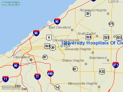
University Hospitals Of Cleveland Heliport |
Location & QuickFacts
| FAA Information Effective: | 2008-09-25 |
| Airport Identifier: | 77OI |
| Airport Status: | Operational |
| Longitude/Latitude: | 081-36-17.4550W/41-30-21.1860N
-81.604849/41.505885 (Estimated) |
| Elevation: | 761 ft / 231.95 m (Estimated) |
| Land: | 0 acres |
| From nearest city: | 4 nautical miles E of Cleveland, OH |
| Location: | Cuyahoga County, OH |
| Magnetic Variation: | 07W (1985) |
Owner & Manager
| Ownership: | Privately owned |
| Owner: | University Hospital-cleveland |
| Address: | 2074 Abington Road
Cleveland, OH 44106 |
| Phone number: | 216-844-7515 |
| Manager: | Daniel K Ellenberger |
| Address: | 2074 Abington Road
Cleveland, OH 44106 |
| Phone number: | 216-844-1111 |
Airport Operations and Facilities
| Airport Use: | Private
MEDICAL USE. |
| Wind indicator: | Yes |
| Segmented Circle: | No |
| Control Tower: | No |
| Lighting Schedule: | PHONE REQ
FOR ARPT BCN AND PERIMETER LGTS CALL 216-844-1111. |
| Beacon Color: | Clear-Green-Yellow (heliport) |
| Sectional chart: | Detroit |
| Region: | AGL - Great Lakes |
| Boundary ARTCC: | ZOB - Cleveland |
| Tie-in FSS: | CLE - Cleveland |
| FSS on Airport: | No |
| FSS Toll Free: | 1-800-WX-BRIEF |
Airport Communications
Runway Information
Helipad H1
| Dimension: | 80 x 80 ft / 24.4 x 24.4 m |
| Surface: | CONC,
AND H2 ROOFTOP. |
| |
Runway H1 |
Runway |
| Traffic Pattern: | Left | Left |
|
Helipad H2
| Dimension: | 128 x 62 ft / 39.0 x 18.9 m |
| Surface: | CONC,
AND H2 ROOFTOP. |
| |
Runway H2 |
Runway |
| Traffic Pattern: | Left | Left |
|
Radio Navigation Aids
| ID |
Type |
Name |
Ch |
Freq |
Var |
Dist |
| BKL | NDB | Burke Lakefront | | 416.00 | 07W | 3.0 nm |
| EZE | NDB | Engel | | 226.00 | 07W | 5.4 nm |
| LQL | NDB | Lakeland | | 263.00 | 08W | 14.7 nm |
| CL | NDB | Harri | | 344.00 | 07W | 19.1 nm |
| AK | NDB | Akron | | 362.00 | 07W | 28.0 nm |
| AAU | NDB | Ashland | | 329.00 | 07W | 43.8 nm |
| LNN | VOR/DME | Lost Nation | 039X | 110.20 | 08W | 14.4 nm |
| CXR | VOR/DME | Chardon | 074X | 112.70 | 05W | 19.9 nm |
| DJB | VOR/DME | Dryer | 083X | 113.60 | 05W | 26.6 nm |
| ACO | VOR/DME | Akron | 091X | 114.40 | 04W | 30.1 nm |
| JFN | VOR/DME | Jefferson | 099X | 115.20 | 05W | 41.4 nm |
| BSV | VOR/DME | Briggs | 071X | 112.40 | 04W | 46.7 nm |
| SKY | VOR/DME | Sandusky | 029X | 109.20 | 04W | 47.5 nm |
| YNG | VORTAC | Youngstown | 027X | 109.00 | 05W | 43.2 nm |
| CLE | VOT | Cleveland | | 110.40 | | 12.4 nm |
| CAK | VOT | Akron/canton Regional | | 110.60 | | 36.2 nm |
Remarks
- ALL APCH/DEP OPS FROM 010 DEG - 020 DEG AND FROM 075 DEG - 225 DEG 315 DEG - TO 345 DEG; TADEOFF/LDG AREA APPROPRIATELY MARKED; NON-OBSTRUCTING WIND INDICATOR MAINTAINED; OPERATIONAL LETTER OF AGREEMENT WITH UNIVERSITY HOSPITALS HELIPORT BETWEEN OWNER OF HELIPORT AND BKL ATCT.
Images and information placed above are from
http://www.airport-data.com/airport/77OI/
We thank them for the data!
| General Info
|
| Country |
United States
|
| State |
OHIO
|
| FAA ID |
77OI
|
| Latitude |
41-30-21.186N
|
| Longitude |
081-36-17.455W
|
| Elevation |
761 feet
|
| Near City |
CLEVELAND
|
We don't guarantee the information is fresh and accurate. The data may
be wrong or outdated.
For more up-to-date information please refer to other sources.
|
|


