|
|
Coordinates: 40°13′29″N 083°21′06″W / 40.22472°N 83.35167°W / 40.22472; -83.35167
| Union County Airport |
| IATA: none – ICAO: KMRT – FAA LID: MRT |
| Summary |
| Airport type |
Public |
| Owner |
Union County Airport Authority |
| Serves |
Marysville, Ohio |
| Elevation AMSL |
1,021 ft / 311 m |
| Runways |
| Direction |
Length |
Surface |
| ft |
m |
| 9/27 |
4,218 |
1,286 |
Asphalt |
| Statistics (2007) |
| Aircraft operations |
31,886 |
| Source: Federal Aviation Administration |
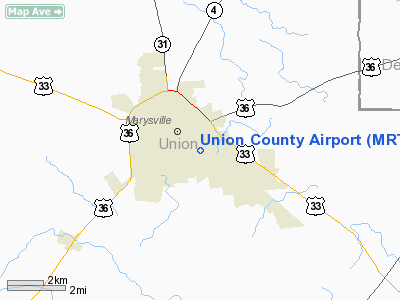
Union County Airport (ICAO: KMRT, FAA LID: MRT) is a public airport located one mile (2 km) southeast of the central business district of Marysville, a city in Union County, Ohio, United States. It is owned by the Union County Airport Authority.
Facilities and aircraft
Union County Airport covers an area of 54 acres (22 ha) which contains one runway designated 9/27 with a 4,218 x 75 ft (1,286 x 23 m) asphalt surface. For the 12-month period ending May 14, 2007, the airport had 31,886 aircraft operations, an average of 87 per day: 88% general aviation, 10% military and 2% air taxi.
The above content comes from Wikipedia and is published under free licenses – click here to read more.
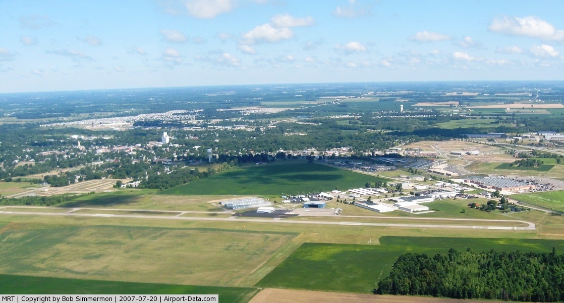
 |
(Click on the photo to enlarge) |
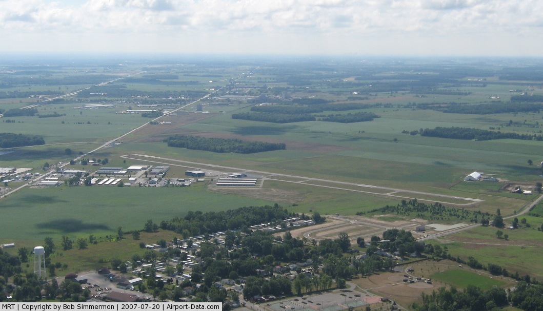
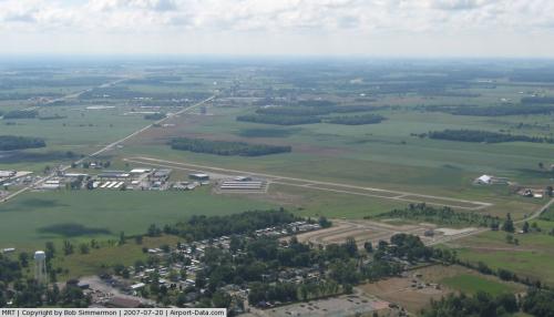 |
(Click on the photo to enlarge) |
Location & QuickFacts
| FAA Information Effective: | 2008-09-25 |
| Airport Identifier: | MRT |
| Airport Status: | Operational |
| Longitude/Latitude: | 083-21-05.8000W/40-13-28.9000N
-83.351611/40.224694 (Estimated) |
| Elevation: | 1021 ft / 311.20 m (Surveyed) |
| Land: | 54 acres |
| From nearest city: | 1 nautical miles SE of Marysville, OH |
| Location: | Union County, OH |
| Magnetic Variation: | 05W (1985) |
Owner & Manager
| Ownership: | Publicly owned |
| Owner: | Union County Arpt Auth |
| Address: | County Courthouse
Marysville, OH 43040 |
| Phone number: | 937-642-2055 |
| Manager: | Dennis Grossman |
| Address: | 760 Clymer Road
Marysville, OH 43040 |
| Phone number: | 937-644-2055 |
Airport Operations and Facilities
| Airport Use: | Open to public |
| Wind indicator: | Yes |
| Segmented Circle: | No |
| Control Tower: | No |
| Lighting Schedule: | DUSK-DAWN
ACTVT MIRL & REILS & PAPIS RY 09/27 - CTAF. |
| Beacon Color: | Clear-Green (lighted land airport) |
| Landing fee charge: | No
RAMP FEE FOR COMMERCIAL ACFT. |
| Sectional chart: | Detroit |
| Region: | AGL - Great Lakes |
| Boundary ARTCC: | ZID - Indianapolis |
| Tie-in FSS: | DAY - Dayton |
| FSS on Airport: | No |
| FSS Toll Free: | 1-800-WX-BRIEF |
| NOTAMs Facility: | DAY (NOTAM-d service avaliable) |
| Federal Agreements: | NGY |
Airport Communications
| CTAF: | 122.800 |
| Unicom: | 122.800 |
Airport Services
| Fuel available: | 100LLA1+ |
| Airframe Repair: | MAJOR |
| Power Plant Repair: | MAJOR |
| Bottled Oxygen: | HIGH/LOW |
| Bulk Oxygen: | HIGH/LOW |
Runway Information
Runway 09/27
| Dimension: | 4218 x 75 ft / 1285.6 x 22.9 m |
| Surface: | ASPH, Good Condition |
| Weight Limit: | Single wheel: 17000 lbs. |
| Edge Lights: | Medium |
| |
Runway 09 |
Runway 27 |
| Longitude: | 083-21-32.7622W | 083-20-38.7876W |
| Latitude: | 40-13-26.3082N | 40-13-31.3942N |
| Elevation: | 1021.00 ft | 997.00 ft |
| Alignment: | 83 | 127 |
| Traffic Pattern: | Left | Left |
| Markings: | Non-precision instrument, Good Condition | Non-precision instrument, Good Condition |
| Crossing Height: | 20.00 ft | 42.00 ft |
| Displaced threshold: | 0.00 ft | 124.00 ft |
| VASI: | 4-light PAPI on left side | 4-light PAPI on left side |
| Visual Glide Angle: | 4.00° | 4.00° |
| Runway End Identifier: | Yes | Yes |
| Obstruction: | 69 ft tree, 3600.0 ft from runway, 368 ft right of centerline, 49:1 slope to clear | 23 ft rr, 398.0 ft from runway, 276 ft right of centerline, 8:1 slope to clear
RWY 27 APCH RATIO 22:1 TO DSPLCD THLD. |
|
Radio Navigation Aids
| ID |
Type |
Name |
Ch |
Freq |
Var |
Dist |
| MRT | NDB | Marysville | | 403.00 | 05W | 0.2 nm |
| OS | NDB | Fuler | | 515.00 | 05W | 11.5 nm |
| DLZ | NDB | Delaware | | 215.00 | 06W | 11.8 nm |
| DKG | NDB | Don Scott | | 348.00 | 05W | 15.2 nm |
| UYF | NDB | London | | 263.00 | 06W | 18.2 nm |
| CHC | NDB | Grens | | 272.00 | 04W | 19.7 nm |
| RUV | NDB | Rushsylvania | | 326.00 | 05W | 20.2 nm |
| EDJ | NDB | Bellefontaine | | 242.00 | 05W | 22.9 nm |
| BU | NDB | Boutn | | 230.00 | 05W | 25.3 nm |
| MNN | NDB | Marion | | 201.00 | 05W | 26.9 nm |
| CCJ | NDB | Clark County | | 341.00 | 04W | 28.8 nm |
| CM | NDB | Sumie | | 391.00 | 05W | 31.0 nm |
| CSS | NDB | Court House | | 414.00 | 05W | 37.5 nm |
| XEN | NDB | Xenia | | 395.00 | 03W | 40.6 nm |
| LYL | NDB | Lima | | 362.00 | 04W | 42.1 nm |
| HEH | NDB | Newark | | 524.00 | 06W | 42.5 nm |
| CYO | NDB | Circleville | | 366.00 | 05W | 45.5 nm |
| IL | NDB | Airbo | | 407.00 | 04W | 47.5 nm |
| RZT | NDB | Ross County | | 236.00 | 05W | 49.6 nm |
| LCK | TACAN | Rickenbacker | 069X | | 05W | 31.7 nm |
| XSF | TACAN | Springfield | 065X | | 04W | 32.3 nm |
| FFO | TACAN | Patterson | 099X | | 04W | 40.6 nm |
| BUD | VOR | Buckeye | | 109.80 | 05W | 27.0 nm |
| AOH | VOR | Allen County | | 108.40 | 04W | 40.4 nm |
| XUB | VOR | Yellow Bud | | 112.50 | 05W | 45.3 nm |
| MAH | VOR | Marathon | | 114.90 | 05W | 49.6 nm |
| SGH | VOR/DME | Springfield | 079X | 113.20 | 04W | 32.6 nm |
| DQN | VOR/DME | Dayton | 092X | 114.50 | 01W | 49.6 nm |
| ROD | VORTAC | Rosewood | 122X | 117.50 | 05W | 31.9 nm |
| APE | VORTAC | Appleton | 114X | 116.70 | 06W | 35.3 nm |
| FDY | VORTAC | Findlay | 019X | 108.20 | 02W | 47.6 nm |
| CMH | VOT | Port Columbus | | 111.00 | | 25.5 nm |
| DAY | VOT | Dayton J M Cox-day | | 111.00 | | 44.4 nm |
Remarks
- DEER & BIRDS ON & INVOF ARPT.
- FOR SVC AFT HOURS CALL: 614-870-0533/270/4773.
Images and information placed above are from
http://www.airport-data.com/airport/MRT/
We thank them for the data!
| General Info
|
| Country |
United States
|
| State |
OHIO
|
| FAA ID |
MRT
|
| Latitude |
40-13-28.900N
|
| Longitude |
083-21-05.800W
|
| Elevation |
1021 feet
|
| Near City |
MARYSVILLE
|
We don't guarantee the information is fresh and accurate. The data may
be wrong or outdated.
For more up-to-date information please refer to other sources.
|
|