 |
|
Location & QuickFacts
| FAA Information Effective: | 2008-09-25 |
| Airport Identifier: | 34OI |
| Airport Status: | Operational |
| Longitude/Latitude: | 082-07-04.5500W/40-41-40.2120N
-82.117931/40.694503 (Estimated) |
| Elevation: | 1180 ft / 359.66 m (Estimated) |
| Land: | 0 acres |
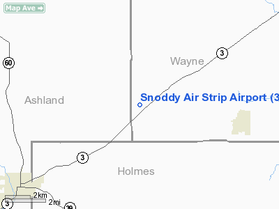
| From nearest city: | 4 nautical miles W of Shreve, OH |
| Location: | Wayne County, OH |
| Magnetic Variation: | 06W (1990) |
Owner & Manager
| Ownership: | Privately owned |
| Owner: | Walter F. Snoddy |
| Address: | 8388 Snoddy Road
Shreve, OH 44686 |
| Phone number: | 216-496-2331 |
| Manager: | Walter F. Snoddy |
| Address: | 8388 Snoddy Road
Shreve, OH 44686 |
| Phone number: | 216-496-2331 |
Airport Operations and Facilities
| Airport Use: | Private |
| Segmented Circle: | No |
| Control Tower: | No |
| Sectional chart: | Detroit |
| Region: | AGL - Great Lakes |
| Boundary ARTCC: | ZOB - Cleveland |
| Tie-in FSS: | CLE - Cleveland |
| FSS on Airport: | No |
| FSS Toll Free: | 1-800-WX-BRIEF |
Runway Information
Runway 09/27
| Dimension: | 2300 x 75 ft / 701.0 x 22.9 m |
| Surface: | TURF, |
| |
Runway 09 |
Runway 27 |
| Traffic Pattern: | Left | Left |
| Obstruction: | | 30 ft plines, 50.0 ft from runway |
|
Radio Navigation Aids
| ID |
Type |
Name |
Ch |
Freq |
Var |
Dist |
| MLR | NDB | Millersburg/dcmsnd | | 382.00 | 06W | 14.5 nm |
| MF | NDB | Manns | | 372.00 | 06W | 15.5 nm |
| AAU | NDB | Ashland | | 329.00 | 07W | 17.3 nm |
| CL | NDB | Harri | | 344.00 | 07W | 39.3 nm |
| AK | NDB | Akron | | 362.00 | 07W | 40.1 nm |
| HEH | NDB | Newark | | 524.00 | 06W | 43.2 nm |
| MNN | NDB | Marion | | 201.00 | 05W | 43.7 nm |
| TSO | NDB | Tolson | | 395.00 | 07W | 48.1 nm |
| HRA | NDB | Zanesville | | 204.00 | 06W | 48.2 nm |
| BUD | VOR | Buckeye | | 109.80 | 05W | 43.4 nm |
| TVT | VOR/DME | Tiverton | 112X | 116.50 | 03W | 14.2 nm |
| BSV | VOR/DME | Briggs | 071X | 112.40 | 04W | 31.4 nm |
| DJB | VOR/DME | Dryer | 083X | 113.60 | 05W | 39.9 nm |
| CTW | VOR/DME | Newcomerstown | 055X | 111.80 | 07W | 40.5 nm |
| ZZV | VOR/DME | Zanesville | 051X | 111.40 | 06W | 46.5 nm |
| ACO | VOR/DME | Akron | 091X | 114.40 | 04W | 48.5 nm |
| MFD | VORTAC | Mansfield | 025X | 108.80 | 03W | 23.9 nm |
| APE | VORTAC | Appleton | 114X | 116.70 | 06W | 39.1 nm |
| CAK | VOT | Akron/canton Regional | | 110.60 | | 33.5 nm |
| CLE | VOT | Cleveland | | 110.40 | | 44.7 nm |
Remarks
- PRVDD ANY OBSTN IN THE RY APCH SLOPE ARE REMOVED/LOWERED OR THE RY THR IS DSPLCD & MKD TO PRVD A 20:1 APCH SLOPE. THE AREA 125 FT EITHER SIDE OF THE RY CNTRLN & 200 FT OFF RY END BE CLEAR OF ANY OBSTN.
Images and information placed above are from
http://www.airport-data.com/airport/34OI/
We thank them for the data!
| General Info
|
| Country |
United States
|
| State |
OHIO
|
| FAA ID |
34OI
|
| Latitude |
40-41-40.212N
|
| Longitude |
082-07-04.550W
|
| Elevation |
1180 feet
|
| Near City |
SHREVE
|
We don't guarantee the information is fresh and accurate. The data may
be wrong or outdated.
For more up-to-date information please refer to other sources.
|
|


