 |
|
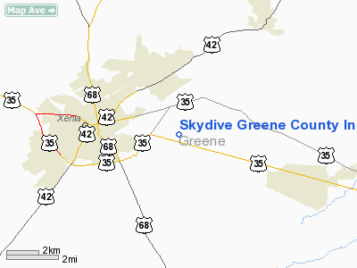
Skydive Greene County Inc Airport |
Location & QuickFacts
| FAA Information Effective: | 2008-09-25 |
| Airport Identifier: | 7OA7 |
| Airport Status: | Operational |
| Longitude/Latitude: | 083-52-14.7410W/39-40-45.2160N
-83.870761/39.679227 (Estimated) |
| Elevation: | 1055 ft / 321.56 m (Estimated) |
| Land: | 20 acres |
| From nearest city: | 3 nautical miles E of Xenia, OH |
| Location: | Greene County, OH |
| Magnetic Variation: | 04W (1985) |
Owner & Manager
| Ownership: | Privately owned |
| Owner: | Skydive Greene Co, Inc |
| Address: | 177 S Monroe-siding Rd
Xenia, OH 45385 |
| Phone number: | 513-372-0700 |
| Manager: | James R. West |
| Address: | 1790 Foust Rd
Xenia, OH 45385 |
| Phone number: | 513-372-6116 |
Airport Operations and Facilities
| Airport Use: | Private |
| Wind indicator: | Yes |
| Segmented Circle: | No |
| Control Tower: | No |
| Landing fee charge: | No |
| Sectional chart: | Cincinnati |
| Region: | AGL - Great Lakes |
| Boundary ARTCC: | ZID - Indianapolis |
| Tie-in FSS: | DAY - Dayton |
| FSS on Airport: | No |
| FSS Toll Free: | 1-800-WX-BRIEF |
Airport Services
| Fuel available: | 80 |
| Airframe Repair: | MINOR |
| Power Plant Repair: | MINOR |
Runway Information
Runway 09/27
| Dimension: | 2250 x 50 ft / 685.8 x 15.2 m |
| Surface: | TURF, |
| |
Runway 09 |
Runway 27 |
| Traffic Pattern: | Left | Left |
|
Runway 18/36
| Dimension: | 2615 x 150 ft / 797.1 x 45.7 m |
| Surface: | TURF, |
| |
Runway 18 |
Runway 36 |
| Traffic Pattern: | Left | Left |
|
Runway E/W
| Dimension: | 3500 x 75 ft / 1066.8 x 22.9 m |
| Surface: | TURF, |
| |
Runway E |
Runway W |
| Traffic Pattern: | Left | Left |
|
Radio Navigation Aids
| ID |
Type |
Name |
Ch |
Freq |
Var |
Dist |
| XEN | NDB | Xenia | | 395.00 | 03W | 3.5 nm |
| CCJ | NDB | Clark County | | 341.00 | 04W | 12.4 nm |
| IL | NDB | Airbo | | 407.00 | 04W | 12.9 nm |
| HW | NDB | Cubla | | 299.00 | 04W | 19.6 nm |
| CSS | NDB | Court House | | 414.00 | 05W | 22.7 nm |
| UYF | NDB | London | | 263.00 | 06W | 24.2 nm |
| HKF | NDB | Hook Field | | 239.00 | 04W | 28.8 nm |
| BU | NDB | Boutn | | 230.00 | 05W | 31.9 nm |
| HOC | NDB | Hillsboro | | 278.00 | 05W | 33.4 nm |
| ISZ | NDB | Cincinnati-blue Ash | | 388.00 | 04W | 35.3 nm |
| MDE | NDB | Madeira | | 379.00 | 04W | 35.5 nm |
| HAO | NDB | Hamilton | | 260.00 | 04W | 37.4 nm |
| LUK | NDB | Cincinnati | | 335.00 | 04W | 38.1 nm |
| OS | NDB | Fuler | | 515.00 | 05W | 39.1 nm |
| PWF | NDB | Sportys | | 245.00 | 04W | 39.6 nm |
| MRT | NDB | Marysville | | 403.00 | 05W | 40.7 nm |
| RZT | NDB | Ross County | | 236.00 | 05W | 41.6 nm |
| EDJ | NDB | Bellefontaine | | 242.00 | 05W | 41.7 nm |
| CYO | NDB | Circleville | | 366.00 | 05W | 42.3 nm |
| OXD | NDB | Oxford | | 282.00 | 04W | 43.4 nm |
| CHC | NDB | Grens | | 272.00 | 04W | 43.6 nm |
| VES | NDB | Versailles | | 356.00 | 04W | 43.7 nm |
| DKG | NDB | Don Scott | | 348.00 | 05W | 43.8 nm |
| RUV | NDB | Rushsylvania | | 326.00 | 05W | 47.8 nm |
| XSF | TACAN | Springfield | 065X | | 04W | 9.7 nm |
| FFO | TACAN | Patterson | 099X | | 04W | 12.0 nm |
| LCK | TACAN | Rickenbacker | 069X | | 05W | 44.2 nm |
| XUB | VOR | Yellow Bud | | 112.50 | 05W | 42.3 nm |
| SGH | VOR/DME | Springfield | 079X | 113.20 | 04W | 9.5 nm |
| MXQ | VOR/DME | Midwest | 076X | 112.90 | 04W | 15.3 nm |
| DQN | VOR/DME | Dayton | 092X | 114.50 | 01W | 31.6 nm |
| ROD | VORTAC | Rosewood | 122X | 117.50 | 05W | 37.4 nm |
| RID | VORTAC | Richmond | 043X | 110.60 | 03W | 45.0 nm |
| DAY | VOT | Dayton J M Cox-day | | 111.00 | | 21.0 nm |
| LUK | VOT | Cincinnati Muni/lunken | | 108.40 | | 41.8 nm |
| CMH | VOT | Port Columbus | | 111.00 | | 49.3 nm |
Remarks
- SKYDIVING ON AIRPORT.
- IN OPERN PRIOR TO 1959.
Images and information placed above are from
http://www.airport-data.com/airport/7OA7/
We thank them for the data!
| General Info
|
| Country |
United States
|
| State |
OHIO
|
| FAA ID |
7OA7
|
| Latitude |
39-40-45.216N
|
| Longitude |
083-52-14.741W
|
| Elevation |
1055 feet
|
| Near City |
XENIA
|
We don't guarantee the information is fresh and accurate. The data may
be wrong or outdated.
For more up-to-date information please refer to other sources.
|
|


