 |
|
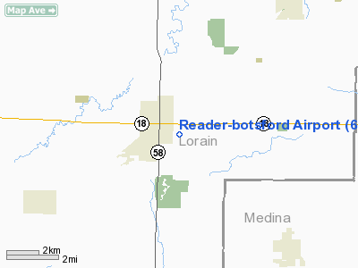
Location & QuickFacts
| FAA Information Effective: | 2008-09-25 |
| Airport Identifier: | 67D |
| Airport Status: | Operational |
| Longitude/Latitude: | 082-12-09.5630W/41-09-45.1920N
-82.202656/41.162553 (Estimated) |
| Elevation: | 864 ft / 263.35 m (Estimated) |
| Land: | 93 acres |
| From nearest city: | 0 nautical miles SE of Wellington, OH |
| Location: | Lorain County, OH |
| Magnetic Variation: | 06W (1985) |
Owner & Manager
| Ownership: | Privately owned |
| Owner: | John & Catherine K Power |
| Address: | 15181 Rt 18e
Wellington, OH 44090 |
| Phone number: | 440-647-1289 |
| Manager: | Air Wellington, Llc |
| Address: | 2253 Brigadoon Ctr
Westlake, OH 44145 |
| Phone number: | 440-835-1289 |
Airport Operations and Facilities
| Airport Use: | Open to public |
| Wind indicator: | Yes |
| Segmented Circle: | No |
| Control Tower: | No |
| Landing fee charge: | No |
| Sectional chart: | Detroit |
| Region: | AGL - Great Lakes |
| Traffic Pattern Alt: | 786 ft |
| Boundary ARTCC: | ZOB - Cleveland |
| Tie-in FSS: | CLE - Cleveland |
| FSS on Airport: | No |
| FSS Toll Free: | 1-800-WX-BRIEF |
| NOTAMs Facility: | CLE (NOTAM-d service avaliable) |
Airport Communications
Airport Services
| Bottled Oxygen: | NONE |
| Bulk Oxygen: | NONE |
Runway Information
Runway 18/36
| Dimension: | 2850 x 100 ft / 868.7 x 30.5 m |
| Surface: | TURF, Good Condition |
| |
Runway 18 |
Runway 36 |
| Longitude: | 082-12-06.0000W | 082-12-05.5000W |
| Latitude: | 41-09-44.0000N | 41-09-28.5000N |
| Elevation: | 864.00 ft | 864.00 ft |
| Traffic Pattern: | Left | Left |
| Runway End Identifier: | No | No |
| Centerline Lights: | No | No |
| Touchdown Lights: | No | No |
| Obstruction: | 73 ft trees, 120 ft left of centerline | 58 ft trees, 430.0 ft from runway, 122 ft left of centerline, 7:1 slope to clear |
|
Radio Navigation Aids
| ID |
Type |
Name |
Ch |
Freq |
Var |
Dist |
| AAU | NDB | Ashland | | 329.00 | 07W | 12.2 nm |
| CL | NDB | Harri | | 344.00 | 07W | 15.1 nm |
| MF | NDB | Manns | | 372.00 | 06W | 26.2 nm |
| EZE | NDB | Engel | | 226.00 | 07W | 29.2 nm |
| BKL | NDB | Burke Lakefront | | 416.00 | 07W | 32.8 nm |
| PCW | NDB | Port Clinton | | 423.00 | 06W | 36.9 nm |
| AK | NDB | Akron | | 362.00 | 07W | 37.3 nm |
| MLR | NDB | Millersburg/dcmsnd | | 382.00 | 06W | 40.2 nm |
| PT | NDB | Pelee Island | | 283.00 | 05W | 42.6 nm |
| TII | NDB | Tiffin | | 269.00 | 05W | 45.7 nm |
| LQL | NDB | Lakeland | | 263.00 | 08W | 48.5 nm |
| DJB | VOR/DME | Dryer | 083X | 113.60 | 05W | 11.9 nm |
| SKY | VOR/DME | Sandusky | 029X | 109.20 | 04W | 26.2 nm |
| TVT | VOR/DME | Tiverton | 112X | 116.50 | 03W | 42.5 nm |
| BSV | VOR/DME | Briggs | 071X | 112.40 | 04W | 43.2 nm |
| ACO | VOR/DME | Akron | 091X | 114.40 | 04W | 45.4 nm |
| LNN | VOR/DME | Lost Nation | 039X | 110.20 | 08W | 48.2 nm |
| MFD | VORTAC | Mansfield | 025X | 108.80 | 03W | 24.9 nm |
| CLE | VOT | Cleveland | | 110.40 | | 21.8 nm |
| CAK | VOT | Akron/canton Regional | | 110.60 | | 37.5 nm |
Remarks
- GLIDER & TOW PLANES LND/TKOF -- SOMETIMES OPPOSITE TO WIND INDCTNS.
- IN OPERATION PRIOR TO 1959
Images and information placed above are from
http://www.airport-data.com/airport/67D/
We thank them for the data!
| General Info
|
| Country |
United States
|
| State |
OHIO
|
| FAA ID |
67D
|
| Latitude |
41-09-45.192N
|
| Longitude |
082-12-09.563W
|
| Elevation |
864 feet
|
| Near City |
WELLINGTON
|
We don't guarantee the information is fresh and accurate. The data may
be wrong or outdated.
For more up-to-date information please refer to other sources.
|
|


