 |
|
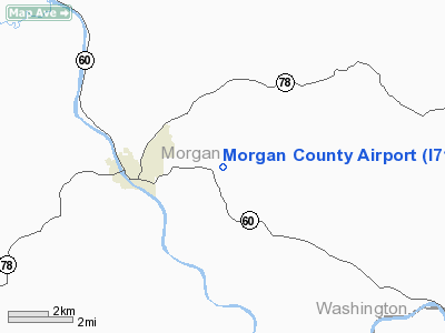
Location & QuickFacts
| FAA Information Effective: | 2008-09-25 |
| Airport Identifier: | I71 |
| Airport Status: | Operational |
| Longitude/Latitude: | 081-48-11.4810W/39-39-15.2580N
-81.803189/39.654238 (Estimated) |
| Elevation: | 1000 ft / 304.80 m (Estimated) |
| Land: | 123 acres |
| From nearest city: | 3 nautical miles E of Mc Connelsville, OH |
| Location: | Morgan County, OH |
| Magnetic Variation: | 06W (1985) |
Owner & Manager
| Ownership: | Publicly owned |
| Owner: | Morgan County Airport Auth |
| Address: | 1585 Main Street
Stockport, OH 43787 |
| Phone number: | 740-539-2950 |
| Manager: | Robert N. Richmond |
| Address: | 4455 W Ste Rt 37 Nw
Malta, OH 43758 |
| Phone number: | 740-962-3431
PHONE IN ADMIN BLDG. EMERGENCY PHONE 740-962-3333. |
Airport Operations and Facilities
| Airport Use: | Open to public |
| Wind indicator: | Yes |
| Segmented Circle: | No |
| Control Tower: | No |
| Lighting Schedule: | DUSK-DAWN
ACTVT MIRL RY 12/30 & REIL RY 30 - CTAF. |
| Beacon Color: | Clear-Green (lighted land airport)
OTS INDEFLY. |
| Landing fee charge: | No |
| Sectional chart: | Cincinnati |
| Region: | AGL - Great Lakes |
| Traffic Pattern Alt: | 800 ft |
| Boundary ARTCC: | ZID - Indianapolis |
| Tie-in FSS: | CLE - Cleveland |
| FSS on Airport: | No |
| FSS Toll Free: | 1-800-WX-BRIEF |
| NOTAMs Facility: | CLE (NOTAM-d service avaliable) |
Airport Communications
| CTAF: | 122.800 |
| Unicom: | 122.800 |
Airport Services
| Fuel available: | 100LL80
FOR FUEL USE PHONE IN ADMIN BLDG AND REFER TO LIST ABOVE PHONE. |
| Bottled Oxygen: | NONE |
| Bulk Oxygen: | NONE |
Runway Information
Runway 12/30
| Dimension: | 3500 x 65 ft / 1066.8 x 19.8 m |
| Surface: | ASPH, Good Condition
SURFACE HAS LOOSE AGGREGATE, LARGE CRACKS WITH GRASS GROWING THRU THEM. |
| Weight Limit: | Single wheel: 12000 lbs. |
| Edge Lights: | Medium |
| |
Runway 12 |
Runway 30 |
| Longitude: | 081-48-31.1400W | 081-47-51.8100W |
| Latitude: | 39-39-23.5000N | 39-39-06.9900N |
| Elevation: | 1000.00 ft | 1000.00 ft |
| Traffic Pattern: | Left | Left |
| Markings: | Basic, Good Condition | Basic, Good Condition |
| Displaced threshold: | 350.00 ft | 0.00 ft |
| Runway End Identifier: | No | Yes |
| Centerline Lights: | No | No |
| Touchdown Lights: | No | No |
| Obstruction: | 25 ft road, 252.0 ft from runway, 130 ft left of centerline, 2:1 slope to clear
RWY 12 RY 12 APCH SLOPE 19:1 TO DSPLCD THLD DUE TO 10 FT ROAD 0 FT FM RY END 58 FT R OF CNTRLN.
RWY 12 +12 FT TERRAIN 0 FT FROM RY END 125 FT LEFT. +10FT ROAD 0FT TO 200FT FROM RWY END 58FT RT | 65 ft tree, 1343.0 ft from runway, 172 ft left of centerline, 17:1 slope to clear
RWY 30 +7 FT TERRAIN 0 FT FM RY END 125 FT RIGHT |
|
Radio Navigation Aids
| ID |
Type |
Name |
Ch |
Freq |
Var |
Dist |
| PKB | FAN MARKER | Marietta Ohio | | | 03W | 24.2 nm |
| HRA | NDB | Zanesville | | 204.00 | 06W | 16.1 nm |
| UGS | NDB | University | | 250.00 | 06W | 28.2 nm |
| HEH | NDB | Newark | | 524.00 | 06W | 37.8 nm |
| CM | NDB | Sumie | | 391.00 | 05W | 48.2 nm |
| ZZV | VOR/DME | Zanesville | 051X | 111.40 | 06W | 17.7 nm |
| CTW | VOR/DME | Newcomerstown | 055X | 111.80 | 07W | 37.7 nm |
| JPU | VORTAC | Parkersburg | 023X | 108.60 | 03W | 23.6 nm |
| APE | VORTAC | Appleton | 114X | 116.70 | 06W | 46.9 nm |
Remarks
Images and information placed above are from
http://www.airport-data.com/airport/I71/
We thank them for the data!
| General Info
|
| Country |
United States
|
| State |
OHIO
|
| FAA ID |
I71
|
| Latitude |
39-39-15.258N
|
| Longitude |
081-48-11.481W
|
| Elevation |
1000 feet
|
| Near City |
MC CONNELSVILLE
|
We don't guarantee the information is fresh and accurate. The data may
be wrong or outdated.
For more up-to-date information please refer to other sources.
|
|


