 |
|
| Miller Airport |
| IATA: none – ICAO: none – FAA LID: 4G3 |
| Summary |
| Airport type |
Public |
| Owner |
Bill & Nancy Barrett |
| Serves |
Alliance, Ohio |
| Elevation AMSL |
1,070 ft / 326 m |
| Coordinates |
40°58′54″N 081°02′32″W / 40.98167°N 81.04222°W / 40.98167; -81.04222 |
| Runways |
| Direction |
Length |
Surface |
| ft |
m |
| 9/27 |
2,912 |
888 |
Asphalt |
| Statistics (2006) |
| Aircraft operations |
8,000 |
| Source: Federal Aviation Administration |
Miller Airport (FAA LID: 4G3) is a privately-owned public-use airport located five nautical miles (9 km) northeast of the central business district of Alliance, in Mahoning County, Ohio, United States.
Facilities and aircraft
Miller Airport covers an area of 225 acres (91 ha) at an elevation of 1,070 feet (326 m) above mean sea level. It has one asphalt paved runway designated 9/27 which measures 2,912 by 50 feet (888 x 15 m). For the 12-month period ending January 24, 2006, the airport had 8,000 aircraft operations, an average of 21 per day: 99% general aviation and 1% military.
The above content comes from Wikipedia and is published under free licenses – click here to read more.
Location & QuickFacts
| FAA Information Effective: | 2008-09-25 |
| Airport Identifier: | OI59 |
| Airport Status: | Operational |
| Longitude/Latitude: | 081-55-54.4950W/39-07-54.2770N
-81.931804/39.131744 (Estimated) |
| Elevation: | 690 ft / 210.31 m (Estimated) |
| Land: | 0 acres |
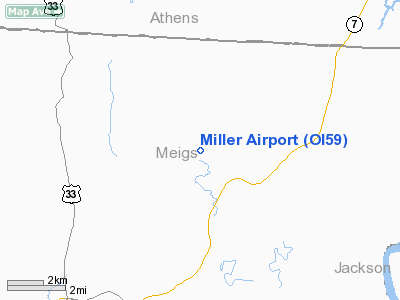
| From nearest city: | 3 nautical miles NW of Chester, OH |
| Location: | Meigs County, OH |
| Magnetic Variation: | 06W (1985) |
Owner & Manager
| Ownership: | Privately owned |
| Owner: | Roy E. Miller |
| Address: | 45610 Miller Rd., Rt 3
Pomeroy, OH 45769 |
| Phone number: | 614-985-3817 |
| Manager: | Roy E. Miller |
| Address: | 45610 Miller Rd., Rt 3
Pomeroy, OH 45769 |
| Phone number: | 614-985-3817 |
Airport Operations and Facilities
| Airport Use: | Private |
| Wind indicator: | Yes |
| Segmented Circle: | No |
| Control Tower: | No |
| Sectional chart: | Cincinnati |
| Region: | AGL - Great Lakes |
| Boundary ARTCC: | ZID - Indianapolis |
| Tie-in FSS: | DAY - Dayton |
| FSS on Airport: | No |
| FSS Toll Free: | 1-800-WX-BRIEF |
Runway Information
Runway 07/25
| Dimension: | 1500 x 100 ft / 457.2 x 30.5 m |
| Surface: | TURF, |
| |
Runway 07 |
Runway 25 |
| Traffic Pattern: | Left | Left |
|
Radio Navigation Aids
| ID |
Type |
Name |
Ch |
Freq |
Var |
Dist |
| PKB | FAN MARKER | Marietta Ohio | | | 03W | 28.5 nm |
| UGS | NDB | University | | 250.00 | 06W | 11.8 nm |
| GAS | NDB | Gallipolis | | 420.00 | 07W | 20.9 nm |
| HRA | NDB | Zanesville | | 204.00 | 06W | 46.6 nm |
| EOP | NDB | Waverly | | 385.00 | 06W | 46.7 nm |
| PMH | NDB | Portsmouth | | 373.00 | 04W | 47.6 nm |
| ZZV | VOR/DME | Zanesville | 051X | 111.40 | 06W | 48.7 nm |
| HNN | VORTAC | Henderson | 106X | 115.90 | 03W | 23.1 nm |
| JPU | VORTAC | Parkersburg | 023X | 108.60 | 03W | 31.9 nm |
| HVQ | VORTAC | Charleston | 121X | 117.40 | 03W | 47.6 nm |
| CRW | VOT | Charleston Kanawha | | 108.80 | | 48.3 nm |
Images and information placed above are from
http://www.airport-data.com/airport/OI59/
We thank them for the data!
| General Info
|
| Country |
United States
|
| State |
OHIO
|
| FAA ID |
4G3
|
| Latitude |
40-58-54.300N
|
| Longitude |
081-02-31.700W
|
| Elevation |
1070 feet
|
| Near City |
ALLIANCE
|
We don't guarantee the information is fresh and accurate. The data may
be wrong or outdated.
For more up-to-date information please refer to other sources.
|
|


