 |
|
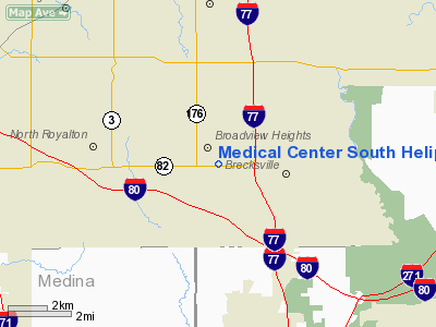
Medical Center South Heliport |
Location & QuickFacts
| FAA Information Effective: | 2008-09-25 |
| Airport Identifier: | 66OH |
| Airport Status: | Operational |
| Longitude/Latitude: | 081-40-15.0300W/41-18-53.5000N
-81.670842/41.314861 (Estimated) |
| Elevation: | 1205 ft / 367.28 m (Estimated) |
| Land: | 0 acres |
| From nearest city: | 1 nautical miles E of Broadview Heights, OH |
| Location: | Cuyahoga County, OH |
| Magnetic Variation: | 07W (1990) |
Owner & Manager
| Ownership: | Privately owned |
| Owner: | Medical Center South |
| Address: | 2001 E Royalton Road
Broadview Heights, OH 44147 |
| Phone number: | 440-717-5800 |
| Manager: | Joanne Socausky |
| Address: | 2001 E Royalton Road
Broadview Heights, OH 44147 |
| Phone number: | 440-717-5800 |
Airport Operations and Facilities
| Airport Use: | Private
MEDICAL USE. |
| Segmented Circle: | No |
| Control Tower: | No |
| Lighting Schedule: | PHONE REQ
FOR PERIMETER LGTS CALL 216-526-3333. |
| Sectional chart: | Detroit |
| Region: | AGL - Great Lakes |
| Boundary ARTCC: | ZOB - Cleveland |
| Tie-in FSS: | CLE - Cleveland |
| FSS on Airport: | No |
| FSS Toll Free: | 1-800-WX-BRIEF |
Runway Information
Helipad H1
| Dimension: | 45 x 45 ft / 13.7 x 13.7 m |
| Surface: | CONC, |
| |
Runway H1 |
Runway |
| Traffic Pattern: | Left | Left |
|
Radio Navigation Aids
| ID |
Type |
Name |
Ch |
Freq |
Var |
Dist |
| EZE | NDB | Engel | | 226.00 | 07W | 10.7 nm |
| BKL | NDB | Burke Lakefront | | 416.00 | 07W | 12.9 nm |
| CL | NDB | Harri | | 344.00 | 07W | 13.3 nm |
| AK | NDB | Akron | | 362.00 | 07W | 19.5 nm |
| LQL | NDB | Lakeland | | 263.00 | 08W | 25.7 nm |
| AAU | NDB | Ashland | | 329.00 | 07W | 33.8 nm |
| MLR | NDB | Millersburg/dcmsnd | | 382.00 | 06W | 47.4 nm |
| MF | NDB | Manns | | 372.00 | 06W | 48.2 nm |
| DJB | VOR/DME | Dryer | 083X | 113.60 | 05W | 22.3 nm |
| ACO | VOR/DME | Akron | 091X | 114.40 | 04W | 24.6 nm |
| LNN | VOR/DME | Lost Nation | 039X | 110.20 | 08W | 25.6 nm |
| CXR | VOR/DME | Chardon | 074X | 112.70 | 05W | 25.9 nm |
| BSV | VOR/DME | Briggs | 071X | 112.40 | 04W | 36.2 nm |
| SKY | VOR/DME | Sandusky | 029X | 109.20 | 04W | 45.0 nm |
| JFN | VOR/DME | Jefferson | 099X | 115.20 | 05W | 49.4 nm |
| YNG | VORTAC | Youngstown | 027X | 109.00 | 05W | 45.0 nm |
| MFD | VORTAC | Mansfield | 025X | 108.80 | 03W | 49.6 nm |
| CLE | VOT | Cleveland | | 110.40 | | 9.9 nm |
| CAK | VOT | Akron/canton Regional | | 110.60 | | 26.1 nm |
Remarks
- PRVDD APCH/DEP RTE OPNS FROM 290-080 DEG; TKOF/LNDG AREA MKD; AND WIND INDICATOR IS MNTND.
Images and information placed above are from
http://www.airport-data.com/airport/66OH/
We thank them for the data!
| General Info
|
| Country |
United States
|
| State |
OHIO
|
| FAA ID |
66OH
|
| Latitude |
41-18-52.194N
|
| Longitude |
081-40-15.455W
|
| Elevation |
1166 feet
|
| Near City |
BROADVIEW HEIGHTS
|
We don't guarantee the information is fresh and accurate. The data may
be wrong or outdated.
For more up-to-date information please refer to other sources.
|
|


