 |
|
Location & QuickFacts
| FAA Information Effective: | 2008-09-25 |
| Airport Identifier: | OI57 |
| Airport Status: | Operational |
| Longitude/Latitude: | 083-59-18.7510W/38-55-37.2430N
-83.988542/38.927012 (Estimated) |
| Elevation: | 970 ft / 295.66 m (Estimated) |
| Land: | 80 acres |
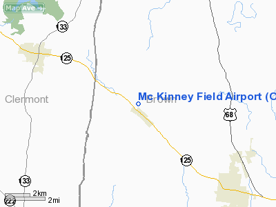
| From nearest city: | 0 nautical miles NW of Hamersville, OH |
| Location: | Brown County, OH |
| Magnetic Variation: | 04W (1990) |
Owner & Manager
| Ownership: | Privately owned |
| Owner: | Steve Mc Kinney |
| Address: | 1951 St Rt 125
Hamersville, OH 45130 |
| Phone number: | 513-379-1055 |
| Manager: | Steve Mc Kinney |
| Address: | 1951 St Rt 125
Hamersville, OH 45130 |
| Phone number: | 513-379-1634 |
Airport Operations and Facilities
| Airport Use: | Private |
| Wind indicator: | Yes |
| Segmented Circle: | No |
| Control Tower: | No |
| Sectional chart: | Cincinnati |
| Region: | AGL - Great Lakes |
| Boundary ARTCC: | ZID - Indianapolis |
| Tie-in FSS: | DAY - Dayton |
| FSS on Airport: | No |
| FSS Toll Free: | 1-800-WX-BRIEF |
Runway Information
Runway 09/27
| Dimension: | 2200 x 75 ft / 670.6 x 22.9 m |
| Surface: | TURF, |
| |
Runway 09 |
Runway 27 |
| Traffic Pattern: | Left | Right |
| Displaced threshold: | 0.00 ft | 400.00 ft |
| Obstruction: | | 20 ft plines, 20.0 ft from runway |
|
Radio Navigation Aids
| ID |
Type |
Name |
Ch |
Freq |
Var |
Dist |
| PWF | NDB | Sportys | | 245.00 | 04W | 13.9 nm |
| AMT | NDB | West Union | | 359.00 | 04W | 20.3 nm |
| LUK | NDB | Cincinnati | | 335.00 | 04W | 21.6 nm |
| MDE | NDB | Madeira | | 379.00 | 04W | 24.7 nm |
| HOC | NDB | Hillsboro | | 278.00 | 05W | 25.9 nm |
| HW | NDB | Cubla | | 299.00 | 04W | 26.2 nm |
| XW | NDB | Flmng | | 400.00 | 05W | 26.6 nm |
| ISZ | NDB | Cincinnati-blue Ash | | 388.00 | 04W | 26.9 nm |
| PZO | NDB | Peebles | | 329.00 | 02W | 30.9 nm |
| IL | NDB | Airbo | | 407.00 | 04W | 35.9 nm |
| UR | NDB | Burln | | 321.00 | 04W | 37.3 nm |
| HAO | NDB | Hamilton | | 260.00 | 04W | 38.2 nm |
| HKF | NDB | Hook Field | | 239.00 | 04W | 40.5 nm |
| XEN | NDB | Xenia | | 395.00 | 03W | 47.5 nm |
| CSS | NDB | Court House | | 414.00 | 05W | 49.1 nm |
| FLM | VOR/DME | Falmouth | 117X | 117.00 | 04W | 22.5 nm |
| MXQ | VOR/DME | Midwest | 076X | 112.90 | 04W | 31.5 nm |
| CVG | VORTAC | Cincinnati | 120X | 117.30 | 04W | 33.8 nm |
| LUK | VOT | Cincinnati Muni/lunken | | 108.40 | | 22.3 nm |
Remarks
- PROVIDED RY SLOPE OBSTRUCTIONS ARE REMOVED/LOWERED OR RY THR BE DSPLCD TO PROVIDE 20:1 APCH CLNC OVER OBSTNS. AREA 125 FT EITHER SIDE OF RY CNTRLN AND 200 FT OFF RY END BE CLEAR OF OBSTNS; AND ALL OPNS LNDG/DEPARTING RY 27 SHALL USE RT-HAND TFC PAT.
Images and information placed above are from
http://www.airport-data.com/airport/OI57/
We thank them for the data!
| General Info
|
| Country |
United States
|
| State |
OHIO
|
| FAA ID |
OI57
|
| Latitude |
38-55-37.243N
|
| Longitude |
083-59-18.751W
|
| Elevation |
970 feet
|
| Near City |
HAMERSVILLE
|
We don't guarantee the information is fresh and accurate. The data may
be wrong or outdated.
For more up-to-date information please refer to other sources.
|
|


