|
|
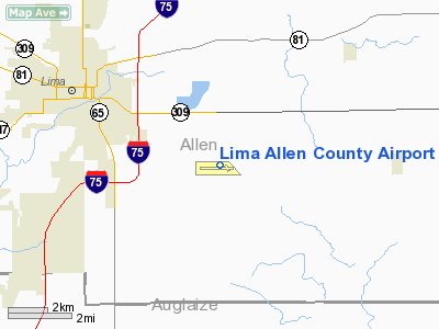
Lima Allen County Airport |
| Lima Allen County Airport |
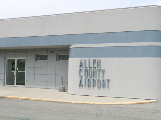 |
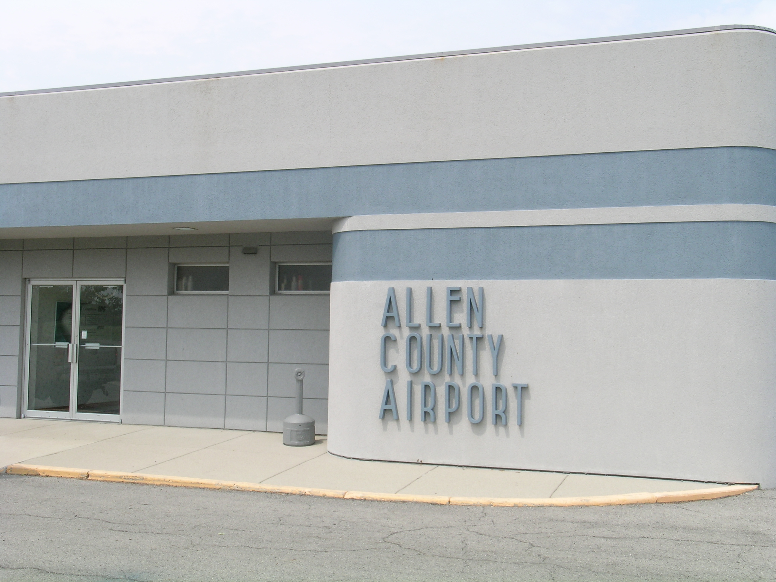
| The terminal building at KAOH. |
| IATA: AOH – ICAO: KAOH – FAA LID: AOH |
| Summary |
| Airport type |
Public |
| Owner |
Allen County Regional Airport Authority |
| Serves |
Lima, Ohio |
| Elevation AMSL |
975 ft / 297 m |
| Coordinates |
40°42′30″N 084°01′39″W / 40.70833°N 84.0275°W / 40.70833; -84.0275 |
| Runways |
| Direction |
Length |
Surface |
| ft |
m |
| 10/28 |
6,000 |
1,829 |
Asphalt |
| 14/32 |
3,994 |
1,217 |
Asphalt/Turf |
| Statistics (2007) |
| Aircraft operations |
32,500 |
| Based aircraft |
28 |
| Source: Federal Aviation Administration |
Lima Allen County Airport (IATA: AOH, ICAO: KAOH, FAA LID: AOH) is a public use airport located five nautical miles (9 km) southeast of the central business district of Lima, a city in Allen County, Ohio, United States. It is owned by the Allen County Regional Airport Authority. History
The current airport site is located near the corner of Hanthorn Road and SR 117 east of Lima. It moved to this site in 1963; prior to then, the airport was located northwest of Lima near the village of Elida.
Local television station WTLW has its studios located in a former hangar at the old airport site.
Facilities and aircraft
Lima Allen County Airport covers an area of 696 acres (282 ha) at an elevation of 975 feet (297 m) above mean sea level. It has two runways: 10/28 is 6,000 by 150 feet (1,829 x 46 m) with an asphalt surface; 14/32 is 3,994 by 150 feet (1,217 x 46 m) with an asphalt and turf surface. Runway 14/32 closed in the winter.
For the 12-month period ending June 1, 2007, the airport had 32,500 aircraft operations, an average of 89 per day: 80% general aviation, 18.5% air taxi, and 1.5% military. At that time there were 28 aircraft based at this airport: 71% single-engine, 25% multi-engine and 4% jet.
The above content comes from Wikipedia and is published under free licenses – click here to read more.
Location & QuickFacts
| FAA Information Effective: | 2008-09-25 |
| Airport Identifier: | AOH |
| Airport Status: | Operational |
| Longitude/Latitude: | 084-01-36.0000W/40-42-25.0000N
-84.026667/40.706944 (Estimated) |
| Elevation: | 975 ft / 297.18 m (Surveyed) |
| Land: | 696 acres |
| From nearest city: | 5 nautical miles SE of Lima, OH |
| Location: | Allen County, OH |
| Magnetic Variation: | 04W (1985) |
Owner & Manager
| Ownership: | Publicly owned |
| Owner: | Allen Cty Regional Arpt Auth |
| Address: | Po Box 1401
Lima, OH 45802 |
| Phone number: | 419-227-3225 |
| Manager: | John Galvin |
| Address: | 700 Airport Dr
Lima, OH 45804 |
| Phone number: | 419-227-3225 |
Airport Operations and Facilities
| Airport Use: | Open to public |
| Wind indicator: | Yes |
| Segmented Circle: | Yes |
| Control Tower: | No |
| Lighting Schedule: | DUSK-DAWN
ACTVT HIRL RY 09/27 & REIL RY 27 - CTAF. |
| Beacon Color: | Clear-Green (lighted land airport) |
| Landing fee charge: | No |
| Sectional chart: | Detroit |
| Region: | AGL - Great Lakes |
| Boundary ARTCC: | ZID - Indianapolis |
| Tie-in FSS: | DAY - Dayton |
| FSS on Airport: | No |
| FSS Toll Free: | 1-800-WX-BRIEF |
| NOTAMs Facility: | AOH (NOTAM-d service avaliable) |
| Federal Agreements: | NGY |
Airport Communications
| CTAF: | 122.700 |
| Unicom: | 122.700 |
Airport Services
| Fuel available: | 100LLA1+ |
| Airframe Repair: | MAJOR |
| Power Plant Repair: | MAJOR |
| Bottled Oxygen: | NONE |
| Bulk Oxygen: | HIGH |
Runway Information
Runway 09/27
| Dimension: | 5149 x 150 ft / 1569.4 x 45.7 m |
| Surface: | ASPH, Good Condition
FIRST 600 FT RY 32 PAVED 150 FT WIDE. |
| Weight Limit: | Dual wheel: 60000 lbs. |
| Edge Lights: | High |
| |
Runway 09 |
Runway 27 |
| Longitude: | 084-02-09.4166W | 084-01-02.5623W |
| Latitude: | 40-42-24.9894N | 40-42-24.9778N |
| Elevation: | 950.00 ft | 975.00 ft |
| Alignment: | 90 | 127 |
| ILS Type: | | ILS
|
| Traffic Pattern: | Left | Left |
| Markings: | Non-precision instrument, Fair Condition | Precision instrument, Fair Condition |
| Crossing Height: | 0.00 ft | 46.00 ft |
| Displaced threshold: | 138.00 ft | 0.00 ft |
| VASI: | | 4-light PAPI on right side |
| Visual Glide Angle: | 0.00° | 3.00° |
| Runway End Identifier: | No | Yes |
| Centerline Lights: | No | No |
| Touchdown Lights: | No | No |
| Obstruction: | 56 ft tree, 2454.0 ft from runway, 550 ft left of centerline, 40:1 slope to clear
RY 09 APCH RATIO 42:1 TO DSPLCD THLD. | , 50:1 slope to clear |
|
Runway 14/32
| Dimension: | 3994 x 150 ft / 1217.4 x 45.7 m |
| Surface: | ASPH-TURF, Fair Condition
FIRST 600 FT RY 32 PAVED 150 FT WIDE. |
| |
Runway 14 |
Runway 32 |
| Longitude: | 084-01-52.8150W | 084-01-16.4040W |
| Latitude: | 40-42-50.8730N | 40-42-22.7770N |
| Alignment: | 127 | 127 |
| Traffic Pattern: | Left | Left |
| Markings: | , | Basic, Fair Condition |
| Runway End Identifier: | No | No |
| Centerline Lights: | No | No |
| Touchdown Lights: | No | No |
| Obstruction: | 35 ft pole, 1300.0 ft from runway, 249 ft left of centerline, 37:1 slope to clear | 71 ft tree, 2660.0 ft from runway, 390 ft left of centerline, 37:1 slope to clear |
|
Radio Navigation Aids
| ID |
Type |
Name |
Ch |
Freq |
Var |
Dist |
| LYL | NDB | Lima | | 362.00 | 04W | 0.2 nm |
| PDR | NDB | Ottawa | | 233.00 | 05W | 19.6 nm |
| RUV | NDB | Rushsylvania | | 326.00 | 05W | 22.1 nm |
| EDJ | NDB | Bellefontaine | | 242.00 | 05W | 22.4 nm |
| BNR | NDB | Benton Ridge | | 334.00 | 05W | 24.9 nm |
| CQA | NDB | Lakefield | | 205.00 | 04W | 28.0 nm |
| VFU | NDB | Stanley | | 411.00 | 05W | 28.3 nm |
| VES | NDB | Versailles | | 356.00 | 04W | 37.7 nm |
| FZI | NDB | Fostoria | | 379.00 | 05W | 40.7 nm |
| DFI | NDB | Defiance | | 246.00 | 05W | 41.9 nm |
| MRT | NDB | Marysville | | 403.00 | 05W | 42.3 nm |
| MNN | NDB | Marion | | 201.00 | 05W | 43.9 nm |
| TII | NDB | Tiffin | | 269.00 | 05W | 44.0 nm |
| PLD | NDB | Portland | | 257.00 | 03W | 46.3 nm |
| DLZ | NDB | Delaware | | 215.00 | 06W | 49.5 nm |
| AOH | VOR | Allen County | | 108.40 | 04W | 2.7 nm |
| MAH | VOR | Marathon | | 114.90 | 05W | 24.8 nm |
| BUD | VOR | Buckeye | | 109.80 | 05W | 44.2 nm |
| DQN | VOR/DME | Dayton | 092X | 114.50 | 01W | 44.8 nm |
| VWV | VOR/DME | Waterville | 078X | 113.10 | 02W | 48.1 nm |
| FDY | VORTAC | Findlay | 019X | 108.20 | 02W | 19.3 nm |
| ROD | VORTAC | Rosewood | 122X | 117.50 | 05W | 25.2 nm |
| DAY | VOT | Dayton J M Cox-day | | 111.00 | | 49.2 nm |
Remarks
Images and information placed above are from
http://www.airport-data.com/airport/AOH/
We thank them for the data!
| General Info
|
| Country |
United States
|
| State |
OHIO
|
| FAA ID |
AOH
|
| Latitude |
40-42-25.000N
|
| Longitude |
084-01-36.000W
|
| Elevation |
975 feet
|
| Near City |
LIMA
|
We don't guarantee the information is fresh and accurate. The data may
be wrong or outdated.
For more up-to-date information please refer to other sources.
|
|