 |
|
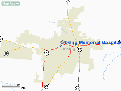
Licking Memorial Hospital Heliport |
Location & QuickFacts
| FAA Information Effective: | 2008-09-25 |
| Airport Identifier: | 74OI |
| Airport Status: | Operational |
| Longitude/Latitude: | 082-26-35.5580W/40-03-39.2310N
-82.443211/40.060898 (Estimated) |
| Elevation: | 880 ft / 268.22 m (Estimated) |
| Land: | 0 acres |
| From nearest city: | 0 nautical miles N of Newark, OH |
| Location: | Licking County, OH |
| Magnetic Variation: | 05W (1985) |
Owner & Manager
| Ownership: | Privately owned |
| Owner: | Licking Memorial Hospital |
| Address: | 1320 W Main St
Newark, OH 43055 |
| Phone number: | 614-344-0331 |
| Manager: | John R. Tolliver |
| Address: | 1320 W Main St
Newark, OH 43055 |
| Phone number: | 614-344-0331 |
Airport Operations and Facilities
| Airport Use: | Private
MEDICAL USE. |
| Wind indicator: | Yes |
| Segmented Circle: | No |
| Control Tower: | No |
| Sectional chart: | Detroit |
| Region: | AGL - Great Lakes |
| Boundary ARTCC: | ZID - Indianapolis |
| Tie-in FSS: | DAY - Dayton |
| FSS Toll Free: | 1-800-WX-BRIEF |
Runway Information
Helipad H1
| Dimension: | 45 x 32 ft / 13.7 x 9.8 m |
| Surface: | ASPH, |
| |
Runway H1 |
Runway |
| Traffic Pattern: | Left | Left |
|
Radio Navigation Aids
| ID |
Type |
Name |
Ch |
Freq |
Var |
Dist |
| HEH | NDB | Newark | | 524.00 | 06W | 2.3 nm |
| CM | NDB | Sumie | | 391.00 | 05W | 15.0 nm |
| HRA | NDB | Zanesville | | 204.00 | 06W | 25.9 nm |
| CHC | NDB | Grens | | 272.00 | 04W | 27.1 nm |
| DKG | NDB | Don Scott | | 348.00 | 05W | 29.3 nm |
| DLZ | NDB | Delaware | | 215.00 | 06W | 33.0 nm |
| OS | NDB | Fuler | | 515.00 | 05W | 34.7 nm |
| BU | NDB | Boutn | | 230.00 | 05W | 38.0 nm |
| MLR | NDB | Millersburg/dcmsnd | | 382.00 | 06W | 39.0 nm |
| CYO | NDB | Circleville | | 366.00 | 05W | 40.7 nm |
| MF | NDB | Manns | | 372.00 | 06W | 42.4 nm |
| MRT | NDB | Marysville | | 403.00 | 05W | 42.8 nm |
| MNN | NDB | Marion | | 201.00 | 05W | 44.1 nm |
| RZT | NDB | Ross County | | 236.00 | 05W | 46.2 nm |
| UYF | NDB | London | | 263.00 | 06W | 47.7 nm |
| LCK | TACAN | Rickenbacker | 069X | | 05W | 27.0 nm |
| XUB | VOR | Yellow Bud | | 112.50 | 05W | 40.5 nm |
| BUD | VOR | Buckeye | | 109.80 | 05W | 43.9 nm |
| ZZV | VOR/DME | Zanesville | 051X | 111.40 | 06W | 26.4 nm |
| TVT | VOR/DME | Tiverton | 112X | 116.50 | 03W | 27.9 nm |
| CTW | VOR/DME | Newcomerstown | 055X | 111.80 | 07W | 45.6 nm |
| APE | VORTAC | Appleton | 114X | 116.70 | 06W | 8.6 nm |
| MFD | VORTAC | Mansfield | 025X | 108.80 | 03W | 49.0 nm |
| CMH | VOT | Port Columbus | | 111.00 | | 20.7 nm |
Remarks
- PRVDD OPNS ARE CONDUCTED FM 260 TO 060 DEGS; AREA IS MKD; WIND INDICATOR IS MAINTAINED.
Images and information placed above are from
http://www.airport-data.com/airport/74OI/
We thank them for the data!
| General Info
|
| Country |
United States
|
| State |
OHIO
|
| FAA ID |
74OI
|
| Latitude |
40-03-39.231N
|
| Longitude |
082-26-35.558W
|
| Elevation |
880 feet
|
| Near City |
NEWARK
|
We don't guarantee the information is fresh and accurate. The data may
be wrong or outdated.
For more up-to-date information please refer to other sources.
|
|


