 |
|
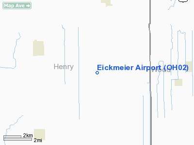
Location & QuickFacts
| FAA Information Effective: | 2008-09-25 |
| Airport Identifier: | OH02 |
| Airport Status: | Operational |
| Longitude/Latitude: | 083-57-16.7930W/41-17-40.1810N
-83.954665/41.294495 (Estimated) |
| Elevation: | 694 ft / 211.53 m (Estimated) |
| Land: | 2 acres |
| From nearest city: | 4 nautical miles S of Mc Clure, OH |
| Location: | Henry County, OH |
| Magnetic Variation: | 05W (1985) |
Owner & Manager
| Ownership: | Privately owned |
| Owner: | Alvah L. Eickmeier |
| Address: | 4-783 Co Road J
Mc Clure, OH 43534 |
| Phone number: | 419-278-0163 |
| Manager: | Alvah L. Eickmeier |
| Address: | Rr 1. 4-783 Co.rd. J.
Mc Clure, OH 43534 |
| Phone number: | 4-783 CO RD* |
Airport Operations and Facilities
| Airport Use: | Private |
| Wind indicator: | Yes |
| Segmented Circle: | No |
| Control Tower: | No |
| Lighting Schedule: | RDO-CTL
ACTVT LIRL RY 18/36 - 123.5. |
| Landing fee charge: | No |
| Sectional chart: | Detroit |
| Region: | AGL - Great Lakes |
| Boundary ARTCC: | ZOB - Cleveland |
| Tie-in FSS: | CLE - Cleveland |
| FSS on Airport: | No |
| FSS Toll Free: | 1-800-WX-BRIEF |
Airport Services
| Airframe Repair: | MAJOR |
| Power Plant Repair: | MAJOR |
| Bottled Oxygen: | NONE |
| Bulk Oxygen: | NONE |
Runway Information
Runway 09/27
| Dimension: | 1200 x 70 ft / 365.8 x 21.3 m |
| Surface: | TURF, Good Condition |
| |
Runway 09 |
Runway 27 |
| Traffic Pattern: | Left | Left |
|
Runway 18/36
| Dimension: | 2305 x 48 ft / 702.6 x 14.6 m |
| Surface: | TURF, Good Condition |
| Edge Lights: | Low |
| |
Runway 18 |
Runway 36 |
| Traffic Pattern: | Left | Left |
| Markings: | Nonstandard,
MKD WITH RED RWY LGTS BOTH SIDES. | Nonstandard, |
| Obstruction: | 45 ft silo, 65.0 ft from runway, 24 ft left of centerline, 2:1 slope to clear | , 50:1 slope to clear |
|
Radio Navigation Aids
| ID |
Type |
Name |
Ch |
Freq |
Var |
Dist |
| PDR | NDB | Ottawa | | 233.00 | 05W | 15.9 nm |
| USE | NDB | Fulton | | 375.00 | 05W | 20.5 nm |
| BNR | NDB | Benton Ridge | | 334.00 | 05W | 20.9 nm |
| DFI | NDB | Defiance | | 246.00 | 05W | 21.5 nm |
| BYN | NDB | Bryan | | 260.00 | 04W | 25.6 nm |
| FZI | NDB | Fostoria | | 379.00 | 05W | 26.0 nm |
| ADG | NDB | Adrian | | 278.00 | 06W | 35.0 nm |
| LYL | NDB | Lima | | 362.00 | 04W | 35.6 nm |
| TII | NDB | Tiffin | | 269.00 | 05W | 35.8 nm |
| VFU | NDB | Stanley | | 411.00 | 05W | 39.6 nm |
| TCU | NDB | Tecumseh | | 239.00 | 04W | 44.7 nm |
| TOL | TACAN | Toledo | 072X | | 05W | 19.3 nm |
| MAH | VOR | Marathon | | 114.90 | 05W | 21.3 nm |
| AOH | VOR | Allen County | | 108.40 | 04W | 35.3 nm |
| VWV | VOR/DME | Waterville | 078X | 113.10 | 02W | 17.1 nm |
| FDY | VORTAC | Findlay | 019X | 108.20 | 02W | 22.3 nm |
Remarks
Images and information placed above are from
http://www.airport-data.com/airport/OH02/
We thank them for the data!
| General Info
|
| Country |
United States
|
| State |
OHIO
|
| FAA ID |
OH02
|
| Latitude |
41-17-40.181N
|
| Longitude |
083-57-16.793W
|
| Elevation |
694 feet
|
| Near City |
MC CLURE
|
We don't guarantee the information is fresh and accurate. The data may
be wrong or outdated.
For more up-to-date information please refer to other sources.
|
|


