 |
|
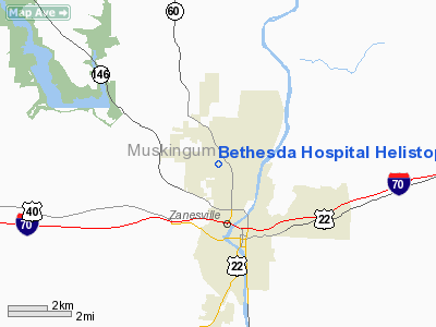
Bethesda Hospital Helistop Heliport |
Location & QuickFacts
| FAA Information Effective: | 2008-09-25 |
| Airport Identifier: | 4OH2 |
| Airport Status: | Operational |
| Longitude/Latitude: | 082-01-05.4910W/39-58-27.2420N
-82.018192/39.974234 (Estimated) |
| Elevation: | 783 ft / 238.66 m (Estimated) |
| Land: | 0 acres |
| From nearest city: | 2 nautical miles SE of Zanesville, OH |
| Location: | Muskingum County, OH |
| Magnetic Variation: | 06W (1985) |
Owner & Manager
| Ownership: | Privately owned |
| Owner: | Bethesda Hospital |
| Address: | 2951 N. Maple Avenue
Zanesville, OH 43701 |
| Phone number: | 614-454-4600 |
| Manager: | Karen Neal |
| Address: | 2951 N. Maple Ave
Zanesville, OH 43701 |
| Phone number: | 614-454-4704 |
Airport Operations and Facilities
| Airport Use: | Private
MEDICAL USE. |
| Wind indicator: | Yes |
| Segmented Circle: | No |
| Control Tower: | No |
| Landing fee charge: | No |
| Sectional chart: | Cincinnati |
| Region: | AGL - Great Lakes |
| Boundary ARTCC: | ZID - Indianapolis |
| Tie-in FSS: | CLE - Cleveland |
| FSS on Airport: | No |
| FSS Toll Free: | 1-800-WX-BRIEF |
Airport Services
| Airframe Repair: | NONE |
| Power Plant Repair: | NONE |
Runway Information
Helipad H1
| Dimension: | 40 x 40 ft / 12.2 x 12.2 m |
| Surface: | ASPH-CONC, |
| |
Runway H1 |
Runway |
| Traffic Pattern: | Left | Left |
| Markings: | Basic, | , |
|
Radio Navigation Aids
| ID |
Type |
Name |
Ch |
Freq |
Var |
Dist |
| PKB | FAN MARKER | Marietta Ohio | | | 03W | 45.1 nm |
| HRA | NDB | Zanesville | | 204.00 | 06W | 6.1 nm |
| HEH | NDB | Newark | | 524.00 | 06W | 20.7 nm |
| CM | NDB | Sumie | | 391.00 | 05W | 33.9 nm |
| MLR | NDB | Millersburg/dcmsnd | | 382.00 | 06W | 34.8 nm |
| UGS | NDB | University | | 250.00 | 06W | 43.4 nm |
| CHC | NDB | Grens | | 272.00 | 04W | 46.6 nm |
| CFX | NDB | Cadiz | | 239.00 | 07W | 48.8 nm |
| DKG | NDB | Don Scott | | 348.00 | 05W | 49.2 nm |
| LCK | TACAN | Rickenbacker | 069X | | 05W | 43.2 nm |
| ZZV | VOR/DME | Zanesville | 051X | 111.40 | 06W | 6.1 nm |
| CTW | VOR/DME | Newcomerstown | 055X | 111.80 | 07W | 29.2 nm |
| TVT | VOR/DME | Tiverton | 112X | 116.50 | 03W | 29.5 nm |
| APE | VORTAC | Appleton | 114X | 116.70 | 06W | 28.3 nm |
| JPU | VORTAC | Parkersburg | 023X | 108.60 | 03W | 43.7 nm |
| CMH | VOT | Port Columbus | | 111.00 | | 40.0 nm |
Remarks
Images and information placed above are from
http://www.airport-data.com/airport/4OH2/
We thank them for the data!
| General Info
|
| Country |
United States
|
| State |
OHIO
|
| FAA ID |
4OH2
|
| Latitude |
39-58-27.242N
|
| Longitude |
082-01-05.491W
|
| Elevation |
783 feet
|
| Near City |
ZANESVILLE
|
We don't guarantee the information is fresh and accurate. The data may
be wrong or outdated.
For more up-to-date information please refer to other sources.
|
|


