|
|
Bellefontaine Rgnl Airport |
| Bellefontaine Regional Airport |
 |
| IATA: none – ICAO: KEDJ – FAA LID: EDJ |
| Summary |
| Airport type |
Public |
| Owner |
City of Bellefontaine |
| Location |
Bellefontaine, Ohio |
| Elevation AMSL |
1,123 ft / 342 m |
| Coordinates |
40°22′20″N 083°49′08″W / 40.37222°N 83.81889°W / 40.37222; -83.81889 |
| Runways |
| Direction |
Length |
Surface |
| ft |
m |
| 7/25 |
5,000 |
1,524 |
Asphalt |
| Statistics (2007) |
| Aircraft operations |
8,325 |
| Based aircraft |
31 |
| Source: Federal Aviation Administration |
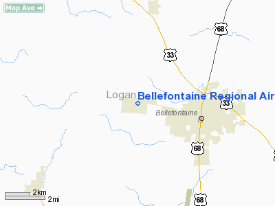
Bellefontaine Regional Airport (ICAO: KEDJ, FAA LID: EDJ) is a public airport located three miles (5 km) west of the central business district of Bellefontaine, a city in Logan County, Ohio, United States. It is owned by the City of Bellefontaine. It is a corporate and general aviation airport operated by Midwest Corporate Air under the auspices of the City of Bellefontaine. The airport is accessible by road from State Route 47.
Although most U.S. airports use the same three-letter location identifier for the FAA and IATA, Bellefontaine Regional Airport is assigned EDJ by the FAA but has no designation from the IATA.
The airport replaced an earlier airport, Bellefontaine Municipal Airport, which was located four miles (6 km) northeast of the current airport (to the north of the city, near U.S. Route 68). According to the AOPA, Bellefontaine Regional was, at its opening in 2002, only the second new airport to open in Ohio in the last 30 years.
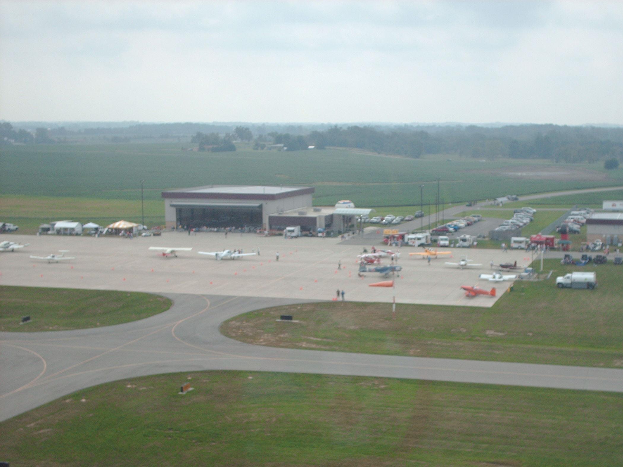
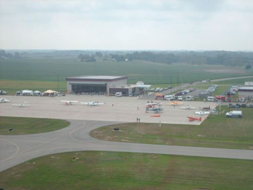
For the last several years, Bellefontaine Regional has hosted an annual "Airfest" in late summer. The most recent of these airshows took place on July 3rd, 2010.
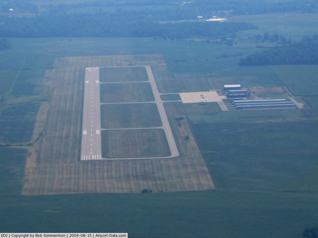
Facilities and aircraft
Bellefontaine Regional Airport covers an area of 300 acres (121 ha) which contains one asphalt paved runway (7/25) measuring 5,000 x 100 ft (1,524 x 30 m).
The airport has fuel services available. Planes can use tiedowns or hangars for parking.
For the 12-month period ending April 24, 2007, the airport had 8,325 aircraft operations, an average of 22 per day: 89% general aviation (7,425) and 11% air taxi (900). There are 31 aircraft based at this airport: 87% single-engine, 10% multi-engine and 3% helicopter.
The above content comes from Wikipedia and is published under free licenses – click here to read more.
 |
(Click on the photo to enlarge) |
Location & QuickFacts
| FAA Information Effective: | 2008-09-25 |
| Airport Identifier: | EDJ |
| Airport Status: | Operational |
| Longitude/Latitude: | 083-49-09.3000W/40-22-20.2000N
-83.819250/40.372278 (Estimated) |
| Elevation: | 1122 ft / 341.99 m (Surveyed) |
| Land: | 300 acres |
| From nearest city: | 3 nautical miles W of Bellefontaine, OH |
| Location: | Logan County, OH |
| Magnetic Variation: | 05W (1985) |
Owner & Manager
| Ownership: | Publicly owned |
| Owner: | City Of Bellefontaine |
| Address: | City Hall, 135 N Detroit St
Bellefontaine, OH 43311 |
| Phone number: | 937-592-4376 |
| Manager: | Steve Buchenroth |
| Address: | 3100 W St Rt 47, P.o. Box 87
Bellefonraine, OH 43311 |
| Phone number: | 937-593-8210 |
Airport Operations and Facilities
| Airport Use: | Open to public |
| Wind indicator: | Yes |
| Segmented Circle: | No |
| Control Tower: | No |
| Lighting Schedule: | DUSK-DAWN
ACTVT MIRL, PAPI & REIL RY 07/25 - CTAF. |
| Beacon Color: | Clear-Green (lighted land airport) |
| Sectional chart: | Detroit |
| Region: | AGL - Great Lakes |
| Boundary ARTCC: | ZID - Indianapolis |
| Tie-in FSS: | DAY - Dayton |
| FSS Toll Free: | 1-800-WX-BRIEF |
| NOTAMs Facility: | DAY (NOTAM-d service avaliable) |
Airport Communications
| CTAF: | 122.800 |
| Unicom: | 122.800 |
Airport Services
| Fuel available: | 100LLA1+ |
| Airframe Repair: | MINOR |
| Power Plant Repair: | MINOR |
Runway Information
Runway 07/25
| Dimension: | 4999 x 100 ft / 1523.7 x 30.5 m |
| Surface: | ASPH, Good Condition |
| Edge Lights: | Medium |
| |
Runway 07 |
Runway 25 |
| Longitude: | 083-49-39.4674W | 083-48-39.0401W |
| Latitude: | 40-22-11.5032N | 40-22-28.9455N |
| Elevation: | 1104.00 ft | 1122.00 ft |
| Alignment: | 70 | 127 |
| Traffic Pattern: | Left | Left |
| Markings: | Non-precision instrument, Good Condition | Non-precision instrument, Good Condition |
| Crossing Height: | 40.00 ft | 57.00 ft |
| VASI: | 4-light PAPI on left side | 4-light PAPI on left side |
| Visual Glide Angle: | 3.00° | 4.00° |
| Runway End Identifier: | Yes | Yes |
| Obstruction: | 42 ft pline, 1906.0 ft from runway, 468 ft left of centerline, 40:1 slope to clear | 20 ft fence, 1005.0 ft from runway, 370 ft right of centerline, 40:1 slope to clear |
|
Radio Navigation Aids
| ID |
Type |
Name |
Ch |
Freq |
Var |
Dist |
| EDJ | NDB | Bellefontaine | | 242.00 | 05W | 0.3 nm |
| RUV | NDB | Rushsylvania | | 326.00 | 05W | 8.7 nm |
| LYL | NDB | Lima | | 362.00 | 04W | 22.0 nm |
| MRT | NDB | Marysville | | 403.00 | 05W | 23.2 nm |
| CCJ | NDB | Clark County | | 341.00 | 04W | 30.0 nm |
| UYF | NDB | London | | 263.00 | 06W | 30.9 nm |
| DLZ | NDB | Delaware | | 215.00 | 06W | 33.3 nm |
| OS | NDB | Fuler | | 515.00 | 05W | 33.7 nm |
| VES | NDB | Versailles | | 356.00 | 04W | 33.8 nm |
| CQA | NDB | Lakefield | | 205.00 | 04W | 34.7 nm |
| MNN | NDB | Marion | | 201.00 | 05W | 37.3 nm |
| DKG | NDB | Don Scott | | 348.00 | 05W | 38.2 nm |
| BNR | NDB | Benton Ridge | | 334.00 | 05W | 39.6 nm |
| XEN | NDB | Xenia | | 395.00 | 03W | 39.8 nm |
| PDR | NDB | Ottawa | | 233.00 | 05W | 40.2 nm |
| CHC | NDB | Grens | | 272.00 | 04W | 42.3 nm |
| BU | NDB | Boutn | | 230.00 | 05W | 43.6 nm |
| VFU | NDB | Stanley | | 411.00 | 05W | 46.7 nm |
| XSF | TACAN | Springfield | 065X | | 04W | 32.1 nm |
| FFO | TACAN | Patterson | 099X | | 04W | 35.0 nm |
| AOH | VOR | Allen County | | 108.40 | 04W | 21.2 nm |
| BUD | VOR | Buckeye | | 109.80 | 05W | 37.5 nm |
| MAH | VOR | Marathon | | 114.90 | 05W | 39.3 nm |
| SGH | VOR/DME | Springfield | 079X | 113.20 | 04W | 32.2 nm |
| DQN | VOR/DME | Dayton | 092X | 114.50 | 01W | 34.1 nm |
| ROD | VORTAC | Rosewood | 122X | 117.50 | 05W | 11.4 nm |
| FDY | VORTAC | Findlay | 019X | 108.20 | 02W | 35.2 nm |
| DAY | VOT | Dayton J M Cox-day | | 111.00 | | 33.8 nm |
| CMH | VOT | Port Columbus | | 111.00 | | 48.5 nm |
Remarks
- SEE AIRSPACE CASE 02-AGL-0501-NRA.
Images and information placed above are from
http://www.airport-data.com/airport/EDJ/
We thank them for the data!
| General Info
|
| Country |
United States
|
| State |
OHIO
|
| FAA ID |
EDJ
|
| Latitude |
40.372314
40° 22' 20.33" N
|
| Longitude |
-83.819017
083° 49' 08.46" W
|
| Elevation |
1123 feet
342 meters
|
| Magnetic Variation |
006° W (01/06)
|
| Beacon |
Yes
|
| Operating Agency |
U.S.CIVIL AIRPORT WHEREIN PERMIT COVERS USE BY TRANSIT MILITARY AIRCRAFT
|
We don't guarantee the information is fresh and accurate. The data may
be wrong or outdated.
For more up-to-date information please refer to other sources.
|
|