 |
|
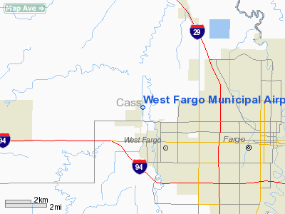
Location & QuickFacts
| FAA Information Effective: | 2008-09-25 |
| Airport Identifier: | D54 |
| Airport Status: | Operational |
| Longitude/Latitude: | 096-55-07.3030W/46-54-02.8830N
-96.918695/46.900801 (Estimated) |
| Elevation: | 896 ft / 273.10 m (Estimated) |
| Land: | 34 acres |
| From nearest city: | 6 nautical miles NW of Fargo, ND |
| Location: | Cass County, ND |
| Magnetic Variation: | 06E (1985) |
Owner & Manager
| Ownership: | Publicly owned |
| Owner: | West Fargo Arpt Authority
DAVE GLATT CHRMN ARPT AUTH. |
| Address: | 800 4th Ave East
West Fargo, ND 58078 |
| Phone number: | 701-433-5166 |
| Manager: | Keith Schonert |
| Address: | 1040 19th Ave Nw
West Fargo, ND 58078 |
| Phone number: | 701-281-9394
ADDITIONAL PHONE 701-866-4970 CELL |
Airport Operations and Facilities
| Airport Use: | Open to public |
| Wind indicator: | Yes |
| Segmented Circle: | No |
| Control Tower: | No |
| Lighting Schedule: | DUSK-DAWN
ACTVT LIRL RY 18/36 - CTAF. |
| Beacon Color: | Clear-Green (lighted land airport) |
| Landing fee charge: | No |
| Sectional chart: | Twin Cities |
| Region: | AGL - Great Lakes |
| Traffic Pattern Alt: | 800 ft |
| Boundary ARTCC: | ZMP - Minneapolis |
| Tie-in FSS: | GFK - Grand Forks |
| FSS on Airport: | No |
| FSS Toll Free: | 1-800-WX-BRIEF |
| NOTAMs Facility: | GFK (NOTAM-d service avaliable) |
Airport Communications
Airport Services
| Airframe Repair: | MAJOR |
| Power Plant Repair: | MAJOR |
| Bottled Oxygen: | HIGH/LOW |
| Bulk Oxygen: | NONE |
Runway Information
Runway 18/36
| Dimension: | 3300 x 50 ft / 1005.8 x 15.2 m
RWY 17/35 HAD 900' ASPHALT EXTENSION CONSTRUCTED ON SOUTH END OF RUNWAY |
| Surface: | ASPH, Good Condition |
| Weight Limit: | Single wheel: 12500 lbs. |
| Edge Lights: | Low |
| |
Runway 18 |
Runway 36 |
| Longitude: | 096-55-06.3000W | 096-55-06.3000W |
| Latitude: | 46-54-17.0000N | 46-53-53.3100N |
| Elevation: | 896.00 ft | 895.00 ft |
| Traffic Pattern: | Right | Left |
| Markings: | Basic, Good Condition | Basic, Good Condition |
| Runway End Identifier: | No | No |
| Centerline Lights: | No | No |
| Touchdown Lights: | No | No |
| Obstruction: | 17 ft road, 360.0 ft from runway, 9:1 slope to clear | 334 ft tower, 11100.0 ft from runway, 200 ft left of centerline, 33:1 slope to clear |
|
Radio Navigation Aids
| ID |
Type |
Name |
Ch |
Freq |
Var |
Dist |
| AA | NDB | Kenie | | 365.00 | 06E | 7.8 nm |
| VCY | NDB | Valley City | | 382.00 | 07E | 40.9 nm |
| BWP | NDB | Breckenridge-wahpeton | | 233.00 | 05E | 41.5 nm |
| DTL | VOR/DME | Detroit Lakes | 049X | 111.20 | 05E | 42.6 nm |
| FFM | VOR/DME | Fergus Falls | 041X | 110.40 | 05E | 48.4 nm |
| FAR | VORTAC | Fargo | 109X | 116.20 | 09E | 9.3 nm |
Remarks
- CFM WINTER CONDS AFTER MAJOR STORM - CALL 701-281-9394 OR CELL 701-866-4970
- BIRDS ON & INVOF ARPT.
- PARACHUTE JUMPING ON & INVOF ARPT.
Images and information placed above are from
http://www.airport-data.com/airport/D54/
We thank them for the data!
|
|


