 |
|
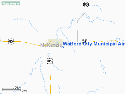
Watford City Muni Airport |
Location & QuickFacts
| FAA Information Effective: | 2008-09-25 |
| Airport Identifier: | S25 |
| Airport Status: | Operational |
| Longitude/Latitude: | 103-15-13.3170W/47-47-44.5190N
-103.253699/47.795700 (Estimated) |
| Elevation: | 2109 ft / 642.82 m (Estimated) |
| Land: | 440 acres |
| From nearest city: | 1 nautical miles SE of Watford City, ND |
| Location: | Mc Kenzie County, ND |
| Magnetic Variation: | 11E (2000) |
Owner & Manager
| Ownership: | Publicly owned |
| Owner: | Watford City Arpt Auth
TIM TAYLOR CHRMN OF ARPT AUTH. |
| Address: | Box 541
Watford City, ND 58854 |
| Phone number: | 701-444-6411 |
| Manager: | Wally Johnson |
| Address: | Box 562
Watford City, ND 58854 |
| Phone number: | 701-570-0530
ASDDITIONAL PHONE NR 701-444-2523. |
Airport Operations and Facilities
| Airport Use: | Open to public |
| Wind indicator: | Yes |
| Segmented Circle: | Yes |
| Control Tower: | No |
| Lighting Schedule: | DUSK-2200
MIRL RY 12/30 PRESET ON LOW INTST DUSK-2200; TO INCR INTST - CTAF; AFT 2200 ACTVT ROTG BCN & PAPI RYS 12 & 30 - CTAF. |
| Beacon Color: | Clear-Green (lighted land airport) |
| Landing fee charge: | No |
| Sectional chart: | Billings |
| Region: | AGL - Great Lakes |
| Boundary ARTCC: | ZLC - Salt Lake City |
| Tie-in FSS: | GFK - Grand Forks |
| FSS on Airport: | No |
| FSS Toll Free: | 1-800-WX-BRIEF |
| NOTAMs Facility: | GFK (NOTAM-d service avaliable) |
| Federal Agreements: | NGY |
Airport Communications
| CTAF: | 122.800 |
| Unicom: | 122.800
UNICOM LCTD AT SHERIFF'S OFFICE. |
Airport Services
| Fuel available: | 100LL
SELF SERVICE 24 HR CREDIT CARD FUEL AVBL. |
| Airframe Repair: | NONE |
| Power Plant Repair: | NONE |
| Bottled Oxygen: | NONE |
| Bulk Oxygen: | NONE |
Runway Information
Runway 12/30
| Dimension: | 4401 x 75 ft / 1341.4 x 22.9 m |
| Surface: | ASPH, Good Condition |
| Weight Limit: | Single wheel: 12500 lbs. |
| Edge Lights: | Medium |
| |
Runway 12 |
Runway 30 |
| Longitude: | 103-15-36.2140W | 103-14-50.4210W |
| Latitude: | 47-47-59.7990N | 47-47-29.2360N |
| Elevation: | 2056.00 ft | 2108.00 ft |
| Alignment: | 127 | 127 |
| Traffic Pattern: | Left | Left |
| Markings: | Non-precision instrument, Fair Condition | Non-precision instrument, Fair Condition |
| Crossing Height: | 27.00 ft | 29.00 ft |
| VASI: | 2-light PAPI on left side | 2-light PAPI on left side |
| Visual Glide Angle: | 3.00° | 3.00° |
| Obstruction: | 17 ft road, 540.0 ft from runway, 150 ft right of centerline, 20:1 slope to clear | 167 ft hill, 3800.0 ft from runway, 240 ft left of centerline, 21:1 slope to clear |
|
Runway 18/36
| Dimension: | 2320 x 150 ft / 707.1 x 45.7 m |
| Surface: | TURF, Fair Condition |
| |
Runway 18 |
Runway 36 |
| Traffic Pattern: | Left | Left |
| Obstruction: | , 50:1 slope to clear | 50 ft pline, 1800.0 ft from runway, 36:1 slope to clear |
|
Radio Navigation Aids
| ID |
Type |
Name |
Ch |
Freq |
Var |
Dist |
| ISN | NDB | Williston | | 275.00 | 15E | 24.9 nm |
| SDY | NDB | Sidney | | 359.00 | 12E | 37.8 nm |
| PSH | NDB | Parshall | | 379.00 | 11E | 45.8 nm |
| ISN | VORTAC | Williston | 110X | 116.30 | 12E | 34.0 nm |
Remarks
- AFT WINTER STORMS CFM ARPT CONDS WITH AMGR OR CITY HALL; CALL 701-444-2523 OR 570-0530.
Images and information placed above are from
http://www.airport-data.com/airport/S25/
We thank them for the data!
|
|


