 |
|
Location & QuickFacts
| FAA Information Effective: | 2008-09-25 |
| Airport Identifier: | Y27 |
| Airport Status: | Operational |
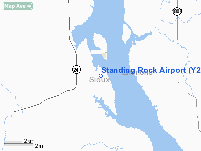
| Longitude/Latitude: | 100-38-05.4570W/46-03-58.9880N
-100.634849/46.066386 (Estimated) |
| Elevation: | 1633 ft / 497.74 m (Estimated) |
| Land: | 230 acres |
| From nearest city: | 1 nautical miles S of Fort Yates, ND |
| Location: | Sioux County, ND |
| Magnetic Variation: | 09E (1985) |
Owner & Manager
| Ownership: | Publicly owned |
| Owner: | Standing Rock Sioux Tribe |
| Address: | Po Box D
Fort Yates, ND 58538 |
| Phone number: | 701-854-7202 |
| Manager: | Charles Murry
TRIBAL CHRMN. |
| Address: | Po Box D
Fort Yates, ND 58538 |
| Phone number: | 701-854-7202
ADDNL PHONE 701-854-7432/7342 - BIA ROADS DEPT. |
Airport Operations and Facilities
| Airport Use: | Open to public |
| Wind indicator: | Yes |
| Segmented Circle: | Yes |
| Control Tower: | No |
| Landing fee charge: | No |
| Sectional chart: | Twin Cities |
| Region: | AGL - Great Lakes |
| Boundary ARTCC: | ZMP - Minneapolis |
| Tie-in FSS: | GFK - Grand Forks |
| FSS on Airport: | No |
| FSS Toll Free: | 1-800-WX-BRIEF |
| NOTAMs Facility: | GFK (NOTAM-d service avaliable) |
| Federal Agreements: | NGY |
Airport Communications
Airport Services
| Airframe Repair: | NONE |
| Power Plant Repair: | NONE |
| Bottled Oxygen: | NONE |
| Bulk Oxygen: | NONE |
Runway Information
Runway 05/23
| Dimension: | 3400 x 120 ft / 1036.3 x 36.6 m |
| Surface: | TURF, Fair Condition |
| |
Runway 05 |
Runway 23 |
| Longitude: | 100-38-31.0300W | 100-37-49.8700W |
| Latitude: | 46-03-48.4100N | 46-04-01.7300N |
| Elevation: | 1630.00 ft | 1629.00 ft |
| Traffic Pattern: | Left | Left |
| Runway End Identifier: | No | No |
| Centerline Lights: | No | No |
| Touchdown Lights: | No | No |
| Obstruction: | 35 ft pline, 1700.0 ft from runway, 250 ft left of centerline, 48:1 slope to clear | 15 ft road, 200.0 ft from runway, 150 ft left of centerline, 13:1 slope to clear |
|
Runway 14/32
| Dimension: | 3700 x 60 ft / 1127.8 x 18.3 m |
| Surface: | ASPH, Poor Condition |
| Surface Treatment: | Aggregate Friction Seal Coat |
| Weight Limit: | Single wheel: 11500 lbs. |
| |
Runway 14 |
Runway 32 |
| Longitude: | 100-38-12.5400W | 100-37-47.4300W |
| Latitude: | 46-04-21.6100N | 46-03-44.0100N |
| Elevation: | 1630.00 ft | 1629.00 ft |
| Traffic Pattern: | Left | Left |
| Markings: | Basic, Fair Condition | Basic, Fair Condition |
| Runway End Identifier: | No | No |
| Centerline Lights: | No | No |
| Touchdown Lights: | No | No |
| Obstruction: | 20 ft tree, 550.0 ft from runway, 20 ft right of centerline, 17:1 slope to clear
+15 FT DIRT TRAIL EXTDD OUTBOUND FM THLD ON RY CNTRLN. | 40 ft pline, 1050.0 ft from runway, 21:1 slope to clear |
|
Radio Navigation Aids
| ID |
Type |
Name |
Ch |
Freq |
Var |
Dist |
| RVB | NDB | Riverbend | | 407.00 | 09E | 32.4 nm |
| BI | NDB | Jadan | | 230.00 | 11E | 38.0 nm |
| BIS | VOR/DME | Bismarck | 112X | 116.50 | 12E | 41.8 nm |
Remarks
- CFM SNOW REMOVAL OCT-APR; CALL 701-854-7438/7202.
- +18 FT IRRIGATORS LCTD 130 FT L/R OF CNTRLN NEAR S HALF RY 14/32 & W HALF RY 05/23 VIOLATE 7:1 TRANSITION ZONE.
- BE ALERT FOR PSBL HOLES ON RY 05/23 & LOOSE GLASS PIECES ON RY TURNAROUNDS.
- BIRDS ON & INVOF ARPT.
- BE ALERT BY 05/23 GRASS MOWING IRREGULAR; CONFIRM PRIOR TO USE 701-854-7438.
- +15 FT DIRT TRAIL ON TWY ACROSS RY SFC EAST TO GRVL PIT.
Images and information placed above are from
http://www.airport-data.com/airport/Y27/
We thank them for the data!
| General Info
|
| Country |
United States
|
| State |
NORTH DAKOTA
|
| FAA ID |
Y27
|
| Latitude |
46-03-58.988N
|
| Longitude |
100-38-05.457W
|
| Elevation |
1633 feet
|
| Near City |
FORT YATES
|
We don't guarantee the information is fresh and accurate. The data may
be wrong or outdated.
For more up-to-date information please refer to other sources.
|
|


