 |
|
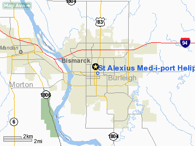
St Alexius Med-i-port Heliport |
Location & QuickFacts
| FAA Information Effective: | 2008-09-25 |
| Airport Identifier: | ND46 |
| Airport Status: | Operational |
| Longitude/Latitude: | 100-46-36.4600W/46-48-26.9760N
-100.776794/46.807493 (Estimated) |
| Elevation: | 1697 ft / 517.25 m (Estimated) |
| Land: | 0 acres |
| From nearest city: | 0 nautical miles N of Bismarck, ND |
| Location: | Burleigh County, ND |
| Magnetic Variation: | 10E (1990) |
Owner & Manager
| Ownership: | Privately owned |
| Owner: | St Alexius Hospital |
| Address: | 900 East Broadway
Bismarck, ND 58501 |
| Phone number: | 701-224-7010 |
| Manager: | Richard Tschider |
| Address: | 900 East Broadway
Bismarck, ND 58501 |
| Phone number: | 701-224-7010 |
Airport Operations and Facilities
| Airport Use: | Private
MEDICAL USE. |
| Wind indicator: | Yes |
| Segmented Circle: | No |
| Control Tower: | No |
| Lighting Schedule: | PHONE REQ
FOR PERIMETER & FLOOD LGTS CALL 701-224-7001. |
| Sectional chart: | Twin Cities |
| Region: | AGL - Great Lakes |
| Boundary ARTCC: | ZMP - Minneapolis |
| Tie-in FSS: | GFK - Grand Forks |
| FSS Toll Free: | 1-800-WX-BRIEF |
Runway Information
Helipad H1
| Dimension: | 30 x 30 ft / 9.1 x 9.1 m |
| Surface: | CONC,
ROOFTOP. |
| |
Runway H1 |
Runway |
| Traffic Pattern: | Left | Left |
|
Radio Navigation Aids
| ID |
Type |
Name |
Ch |
Freq |
Var |
Dist |
| BI | NDB | Jadan | | 230.00 | 11E | 8.5 nm |
| BIS | VOR/DME | Bismarck | 112X | 116.50 | 12E | 5.3 nm |
Remarks
- PRVDD 2ND EVAL IS CONDUCTED PRIOR TO FINAL APVL; APCH/DEP RTE OPS FM 330 TO 340 & FM 110 TO 170; TKOF/LDG AREA MKD; WIND IND IS MAINT; 2 TREES N & THE TREES S & THE LGT STANDARD TO THE E BE LOWERED OR REMOVED; & RDO COMM ARE ESTABLISHED WITH BIS ATCT PRIOR TO ENTERING THE CZ.
Images and information placed above are from
http://www.airport-data.com/airport/ND46/
We thank them for the data!
| General Info
|
| Country |
United States
|
| State |
NORTH DAKOTA
|
| FAA ID |
ND46
|
| Latitude |
46-48-26.976N
|
| Longitude |
100-46-36.460W
|
| Elevation |
1697 feet
|
| Near City |
BISMARCK
|
We don't guarantee the information is fresh and accurate. The data may
be wrong or outdated.
For more up-to-date information please refer to other sources.
|
|


