 |
|
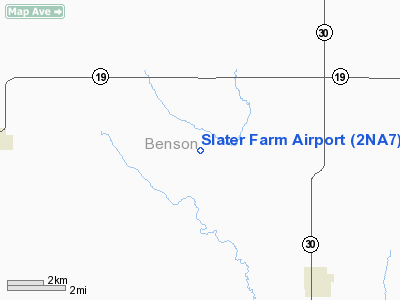
Location & QuickFacts
| FAA Information Effective: | 2008-09-25 |
| Airport Identifier: | 2NA7 |
| Airport Status: | Operational |
| Longitude/Latitude: | 099-36-59.4770W/48-01-42.0280N
-99.616521/48.028341 (Estimated) |
| Elevation: | 1600 ft / 487.68 m (Estimated) |
| Land: | 2 acres |
| From nearest city: | 6 nautical miles E of Esmond, ND |
| Location: | Benson County, ND |
| Magnetic Variation: | 09E (1985) |
Owner & Manager
| Ownership: | Privately owned |
| Owner: | Richard Slater |
| Address: |
Esmond, ND 58332 |
| Phone number: | 701-438-2444 |
| Manager: | Richard Slater |
| Address: |
Esmond, ND 58332 |
| Phone number: | 701-438-2444 |
Airport Operations and Facilities
| Airport Use: | Private
PERSONAL USE. |
| Segmented Circle: | No |
| Control Tower: | No |
| Sectional chart: | Twin Cities |
| Region: | AGL - Great Lakes |
| Boundary ARTCC: | ZMP - Minneapolis |
| Tie-in FSS: | GFK - Grand Forks |
| FSS on Airport: | No |
| FSS Toll Free: | 1-800-WX-BRIEF |
Runway Information
Runway 08/26
| Dimension: | 1200 x 30 ft / 365.8 x 9.1 m |
| Surface: | DIRT, |
| |
Runway 08 |
Runway 26 |
| Traffic Pattern: | Left | Left |
|
Radio Navigation Aids
| ID |
Type |
Name |
Ch |
Freq |
Var |
Dist |
| RUG | NDB | Rugby | | 212.00 | 08E | 27.2 nm |
| DVL | VOR/DME | Devils Lake | 047X | 111.00 | 07E | 28.8 nm |
Remarks
- PRVDD ADQT RWY LENGTH EXISTS FOR TYPE OF OPNS ENTENDED.
Images and information placed above are from
http://www.airport-data.com/airport/2NA7/
We thank them for the data!
| General Info
|
| Country |
United States
|
| State |
NORTH DAKOTA
|
| FAA ID |
2NA7
|
| Latitude |
48-01-42.028N
|
| Longitude |
099-36-59.477W
|
| Elevation |
1600 feet
|
| Near City |
ESMOND
|
We don't guarantee the information is fresh and accurate. The data may
be wrong or outdated.
For more up-to-date information please refer to other sources.
|
|


