 |
|
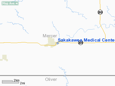
Sakakawea Medical Center Heliport |
Location & QuickFacts
| FAA Information Effective: | 2008-09-25 |
| Airport Identifier: | ND50 |
| Airport Status: | Operational |
| Longitude/Latitude: | 101-36-46.5930W/47-17-54.0120N
-101.612943/47.298337 (Estimated) |
| Elevation: | 1756 ft / 535.23 m (Estimated) |
| Land: | 0 acres |
| From nearest city: | 0 nautical miles N of Hazen, ND |
| Location: | Mercer County, ND |
| Magnetic Variation: | 10E (1990) |
Owner & Manager
| Ownership: | Publicly owned |
| Owner: | Hazen Memorial Hospital Assoc |
| Address: | 510 Eighth Ave. Ne
Hazen, ND 58545 |
| Phone number: | 701-748-2225 |
| Manager: | Dan Howell Administrator |
| Address: | 510 Eighth Ave. Ne
Hazen, ND 58545 |
| Phone number: | 701-748-2225 |
Airport Operations and Facilities
| Airport Use: | Private
MEDICAL USE. |
| Segmented Circle: | No |
| Control Tower: | No |
| Sectional chart: | Billings |
| Region: | AGL - Great Lakes |
| Boundary ARTCC: | ZMP - Minneapolis |
| Tie-in FSS: | GFK - Grand Forks |
| FSS Toll Free: | 1-800-WX-BRIEF |
Runway Information
Helipad H1
| Dimension: | 50 x 50 ft / 15.2 x 15.2 m |
| Surface: | CONC, |
| |
Runway H1 |
Runway |
| Traffic Pattern: | Left | Left |
|
Radio Navigation Aids
| ID |
Type |
Name |
Ch |
Freq |
Var |
Dist |
| PSH | NDB | Parshall | | 379.00 | 11E | 43.8 nm |
Remarks
- (E111-1) TWO SMALL BUSHES/TREES AT THE SE & SW CORNERS OF HELIPAD BE REMOVED/REPLACED WITH LOWER SHRUBBERY & YIELD SIGN AT THE NW CORNER OF PAD BE LOWERED TO CLEAR THE APCH SFC (8:1) & TRANSITION SFC (2:1).
- PRVDD APCH/DEP RTE OPS TO/FM 170 & TO/FM 340; TKOF/LDG AREA MKD; WIND IND MAINT; PLINE OVER THE STREET AT THE ROUGH RIDER MOTEL IS MKD.
Images and information placed above are from
http://www.airport-data.com/airport/ND50/
We thank them for the data!
| General Info
|
| Country |
United States
|
| State |
NORTH DAKOTA
|
| FAA ID |
ND50
|
| Latitude |
47-17-54.012N
|
| Longitude |
101-36-46.593W
|
| Elevation |
1756 feet
|
| Near City |
HAZEN
|
We don't guarantee the information is fresh and accurate. The data may
be wrong or outdated.
For more up-to-date information please refer to other sources.
|
|


