 |
|
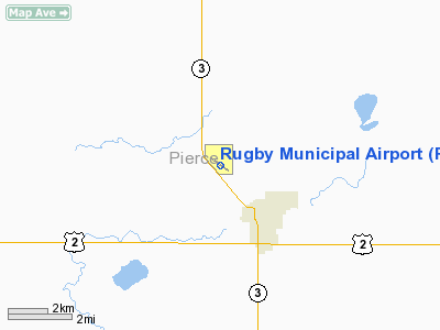
Location & QuickFacts
| FAA Information Effective: | 2008-09-25 |
| Airport Identifier: | RUG |
| Airport Status: | Operational |
| Longitude/Latitude: | 100-01-27.3860W/48-23-25.2930N
-100.024274/48.390359 (Estimated) |
| Elevation: | 1548 ft / 471.83 m (Surveyed) |
| Land: | 280 acres |
| From nearest city: | 2 nautical miles NW of Rugby, ND |
| Location: | Pierce County, ND |
| Magnetic Variation: | 08E (2000) |
Owner & Manager
| Ownership: | Publicly owned |
| Owner: | Rugby Arpt Auth
HARTLEY HAGNESS - CHRMN ARPT AUTH. (701) 776-6715. |
| Address: | 2830 Hwy 2 West
Rugby, ND 58368 |
| Phone number: | 701-776-5746 |
| Manager: | Steve Schneider |
| Address: | 516 Se 6th St
Rugby, ND 58368 |
| Phone number: | 701-776-5171
AMGR HOME PHONE 701-776-5176 OR CELL 208-1630 |
Airport Operations and Facilities
| Airport Use: | Open to public |
| Wind indicator: | Yes |
| Segmented Circle: | Yes |
| Control Tower: | No |
| Lighting Schedule: | DUSK-DAWN
ACTVT MIRL RY 12/30 & PAPI RYS 12 & 30 - CTAF. |
| Beacon Color: | Clear-Green (lighted land airport) |
| Landing fee charge: | No |
| Sectional chart: | Twin Cities |
| Region: | AGL - Great Lakes |
| Boundary ARTCC: | ZMP - Minneapolis |
| Tie-in FSS: | GFK - Grand Forks |
| FSS on Airport: | No |
| FSS Toll Free: | 1-800-WX-BRIEF |
| NOTAMs Facility: | GFK (NOTAM-d service avaliable) |
| Federal Agreements: | NGY |
Airport Communications
| CTAF: | 122.800 |
| Unicom: | 122.800 |
Airport Services
| Fuel available: | 100LL
SELF SERVICE 24 HOUR CREDIT CARD FUEL SYSTEM AVBL. |
| Bottled Oxygen: | NONE |
| Bulk Oxygen: | NONE |
Runway Information
Runway 12/30
| Dimension: | 3604 x 60 ft / 1098.5 x 18.3 m |
| Surface: | ASPH, Good Condition |
| Weight Limit: | Single wheel: 12500 lbs. |
| Edge Lights: | Medium |
| |
Runway 12 |
Runway 30 |
| Longitude: | 100-01-48.3060W | 100-01-06.5570W |
| Latitude: | 48-23-36.4190N | 48-23-14.2530N |
| Elevation: | 1532.00 ft | 1548.00 ft |
| Alignment: | 127 | 127 |
| Traffic Pattern: | Left | Left |
| Markings: | Non-precision instrument, Good Condition | Non-precision instrument, Good Condition |
| Crossing Height: | 27.00 ft | 20.00 ft |
| VASI: | 2-light PAPI on left side | 2-light PAPI on left side |
| Visual Glide Angle: | 3.00° | 3.00° |
| Obstruction: | 40 ft pline, 1800.0 ft from runway, 400 ft right of centerline, 40:1 slope to clear | 18 ft road, 560.0 ft from runway, 300 ft left of centerline, 20:1 slope to clear |
|
Radio Navigation Aids
| ID |
Type |
Name |
Ch |
Freq |
Var |
Dist |
| RUG | NDB | Rugby | | 212.00 | 08E | 0.2 nm |
| RLL | NDB | Rolla | | 263.00 | 09E | 33.7 nm |
| DVL | VOR/DME | Devils Lake | 047X | 111.00 | 07E | 47.5 nm |
Remarks
- APRON SFC ROLLING - NO HIGH SPEED TAXI.
- WATERFOWL IN WETLANDS APR-MAY & SEP-NOV LCTD 3000 FT OUTBOUND RY 30.
Images and information placed above are from
http://www.airport-data.com/airport/RUG/
We thank them for the data!
| General Info
|
| Country |
United States
|
| State |
NORTH DAKOTA
|
| FAA ID |
RUG
|
| Latitude |
48-23-25.293N
|
| Longitude |
100-01-27.386W
|
| Elevation |
1548 feet
|
| Near City |
RUGBY
|
We don't guarantee the information is fresh and accurate. The data may
be wrong or outdated.
For more up-to-date information please refer to other sources.
|
|


